GDEM_V2 30米数字高程模型产品(V2)
收藏地球大数据科学工程2024-03-04 收录
下载链接:
https://data.casearth.cn/sdo/detail/653faac4819aec161b6dbce6
下载链接
链接失效反馈官方服务:
资源简介:
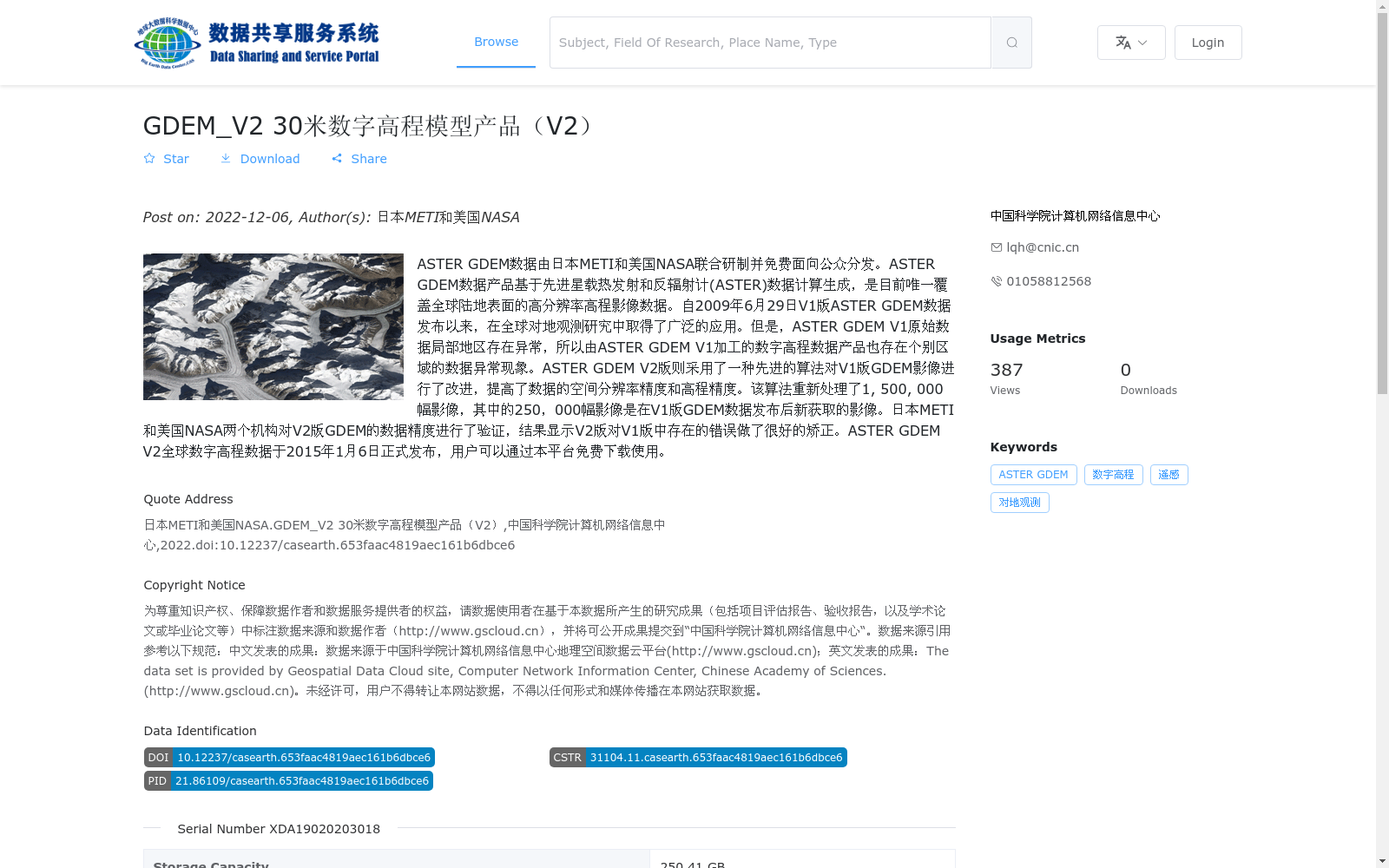
ASTER GDEM数据由日本METI和美国NASA联合研制并免费面向公众分发。ASTER GDEM数据产品基于先进星载热发射和反辐射计(ASTER)数据计算生成,是目前唯一覆盖全球陆地表面的高分辨率高程影像数据。自2009年6月29日V1版ASTER GDEM数据发布以来,在全球对地观测研究中取得了广泛的应用。但是,ASTER GDEM V1原始数据局部地区存在异常,所以由ASTER GDEM V1加工的数字高程数据产品也存在个别区域的数据异常现象。ASTER GDEM V2版则采用了一种先进的算法对V1版GDEM影像进行了改进,提高了数据的空间分辨率精度和高程精度。该算法重新处理了1, 500, 000幅影像,其中的250,000幅影像是在V1版GDEM数据发布后新获取的影像。日本METI和美国NASA两个机构对V2版GDEM的数据精度进行了验证,结果显示V2版对V1版中存在的错误做了很好的矫正。ASTER GDEM V2全球数字高程数据于2015年1月6日正式发布,用户可以通过本平台免费下载使用。
ASTER GDEM data was jointly developed by Japan’s METI and NASA of the United States, and is freely distributed to the public. The ASTER GDEM product is generated based on Advanced Spaceborne Thermal Emission and Reflection Radiometer (ASTER) data, and it is currently the only high-resolution elevation image dataset covering the global land surface. Since the release of ASTER GDEM Version 1 (V1) data on June 29, 2009, it has been widely applied in global Earth observation research. However, the original ASTER GDEM V1 data contained anomalies in some local areas, so the digital elevation data products processed from ASTER GDEM V1 also exhibited data anomalies in individual regions. ASTER GDEM Version 2 (V2) adopted an advanced algorithm to improve the V1 GDEM imagery, enhancing both the spatial resolution accuracy and elevation accuracy of the dataset. This algorithm reprocessed 1,500,000 images, of which 250,000 were newly acquired after the release of the V1 GDEM data. Both Japan’s METI and NASA verified the data accuracy of the V2 GDEM, and the results showed that V2 had well corrected the errors existing in the V1 version. The ASTER GDEM V2 global digital elevation data was officially released on January 6, 2015, and users can download and use it for free through this platform.
提供机构:
中国科学院计算机网络信息中心
搜集汇总
数据集介绍
背景与挑战
背景概述
该数据集是日本METI和美国NASA联合发布的ASTER GDEM V2全球30米数字高程模型产品,基于V1版本通过先进算法改进,提高了空间分辨率和高程精度,覆盖全球陆地表面,是免费公开的高分辨率高程数据,适用于对地观测研究。数据以GeoTiff格式提供,存储容量为250.41 GB,包含22624个文件。
以上内容由遇见数据集搜集并总结生成


