三江源GIMMS NDVI3g数据集(1982-2015)
收藏国家青藏高原科学数据中心2021-03-28 更新2024-03-06 收录
下载链接:
https://data.tpdc.ac.cn/zh-hans/data/22068d23-8233-419b-a241-af3db96603c4
下载链接
链接失效反馈官方服务:
资源简介:
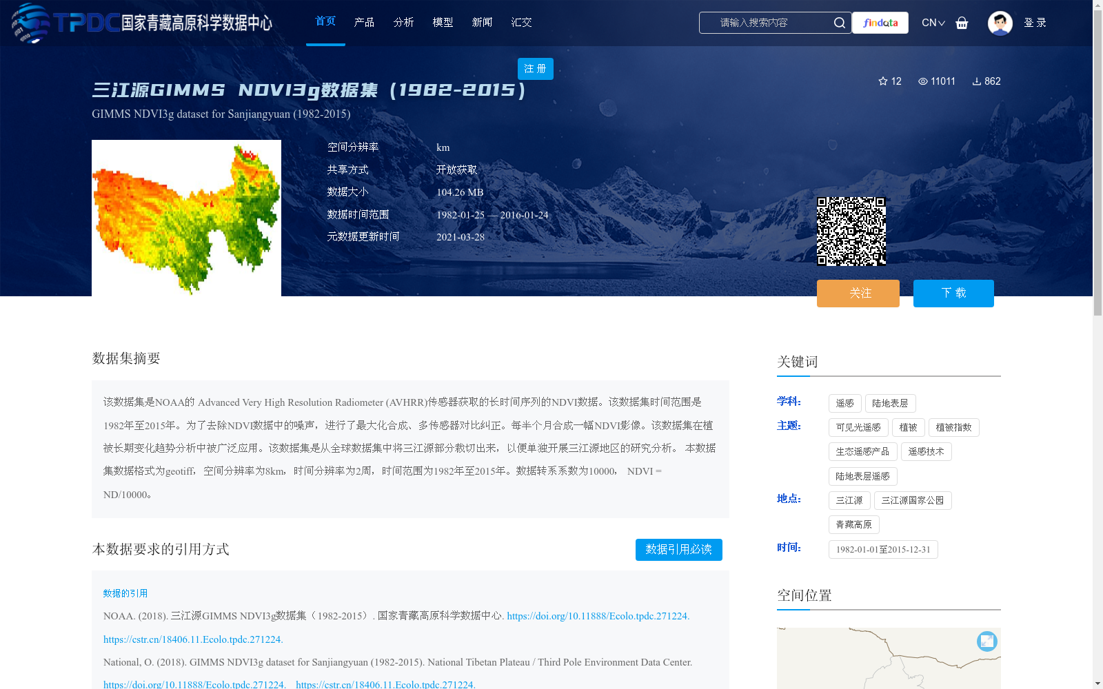
该数据集是NOAA的 Advanced Very High Resolution Radiometer (AVHRR)传感器获取的长时间序列的NDVI数据。该数据集时间范围是1982年至2015年。为了去除NDVI数据中的噪声,进行了最大化合成、多传感器对比纠正。每半个月合成一幅NDVI影像。该数据集在植被长期变化趋势分析中被广泛应用。该数据集是从全球数据集中将三江源部分裁切出来,以便单独开展三江源地区的研究分析。
本数据集数据格式为geotiff,空间分辨率为8km,时间分辨率为2周,时间范围为1982年至2015年。数据转系系数为10000, NDVI = ND/10000。
This dataset is a long-time-series Normalized Difference Vegetation Index (NDVI) dataset acquired by NOAA's Advanced Very High Resolution Radiometer (AVHRR) sensors. The temporal coverage of the dataset spans from 1982 to 2015. To remove noise from the NDVI data, maximum value compositing and inter-sensor cross-calibration were performed. One NDVI composite image is generated every two weeks. This dataset has been widely used in the analysis of long-term vegetation change trends. It was cropped from the global dataset to isolate the Three-River Source Region for independent research and analysis of this area.
The dataset uses GeoTIFF format, with a spatial resolution of 8 km, a temporal resolution of two weeks, and covers the period from 1982 to 2015. The data conversion factor is 10000, and NDVI = ND / 10000.
提供机构:
NOAA
创建时间:
2018-12-04
搜集汇总
数据集介绍
背景与挑战
背景概述
三江源GIMMS NDVI3g数据集(1982-2015)是NOAA AVHRR传感器获取的长时间序列NDVI数据,经过噪声去除处理,空间分辨率8km,时间分辨率2周,专门用于三江源地区植被变化研究。
以上内容由遇见数据集搜集并总结生成


