青藏高原10m土地覆被、地上生物量、植被覆盖度(2020)
收藏国家青藏高原科学数据中心2025-02-17 更新2025-02-22 收录
下载链接:
https://data.tpdc.ac.cn/zh-hans/data/07515052-c159-4c53-a848-97d2be364da6
下载链接
链接失效反馈官方服务:
资源简介:
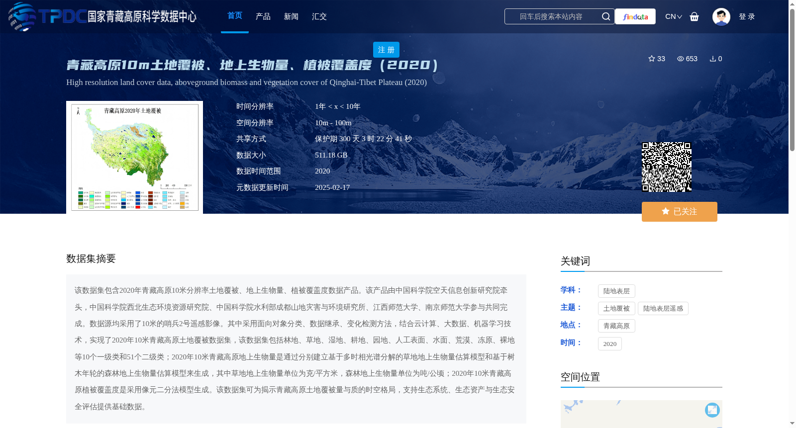
该数据集包含2020年青藏高原10米分辨率土地覆被、地上生物量、植被覆盖度数据产品。该产品由中国科学院空天信息创新研究院牵头,中国科学院西北生态环境资源研究院、中国科学院水利部成都山地灾害与环境研究所、江西师范大学、南京师范大学参与共同完成。数据源均采用了10米的哨兵2号遥感影像。其中采用面向对象分类、数据继承、变化检测方法,结合云计算、大数据、机器学习技术,实现了2020年10米青藏高原土地覆被数据集,该数据集包括林地、草地、湿地、耕地、园地、人工表面、水面、荒漠、冻原、裸地等10个一级类和51个二级类;2020年10米青藏高原地上生物量是通过分别建立基于多时相光谱分解的草地地上生物量估算模型和基于树木年轮的森林地上生物量估算模型来生成,其中草地地上生物量单位为克/平方米,森林地上生物量单位为吨/公顷;2020年10米青藏高原植被覆盖度是采用像元二分法模型生成。该数据集可为揭示青藏高原土地覆被量与质的时空格局,支持生态系统、生态资产与生态安全评估提供基础数据。
This dataset includes three 10-meter-resolution data products for the Qinghai-Tibet Plateau in 2020: land cover, aboveground biomass, and vegetation coverage. It was co-developed by the Aerospace Information Research Institute, Chinese Academy of Sciences (CAS) as the leading institution, in collaboration with the Northwest Institute of Eco-Environment and Resources, CAS, the Institute of Mountain Hazards and Environment (CAS & Ministry of Water Resources), Jiangxi Normal University, and Nanjing Normal University. All datasets were developed using 10-meter-resolution Sentinel-2 remote sensing imagery. For the 2020 10-meter-resolution land cover dataset of the Qinghai-Tibet Plateau, object-oriented classification, data inheritance, and change detection methods were employed, combined with cloud computing, big data, and machine learning technologies. This land cover dataset includes 10 first-level categories and 51 second-level categories, namely forestland, grassland, wetland, cultivated land, horticultural land, artificial surfaces, water bodies, desert, tundra, and bare land. The 2020 10-meter-resolution aboveground biomass dataset for the Qinghai-Tibet Plateau was generated by establishing two separate estimation models: one for grassland aboveground biomass based on multi-temporal spectral decomposition, and another for forest aboveground biomass based on tree ring analysis. The unit of grassland aboveground biomass is grams per square meter (g/m²), while that of forest aboveground biomass is tons per hectare (t/ha). The 2020 10-meter-resolution vegetation coverage dataset for the Qinghai-Tibet Plateau was generated using the pixel dichotomy model. This dataset provides fundamental data for revealing the spatio-temporal patterns of both quantity and quality of land cover on the Qinghai-Tibet Plateau, and supporting ecosystem, ecological asset, and ecological security assessments.
提供机构:
吴炳方
创建时间:
2025-01-13
搜集汇总
数据集介绍
背景与挑战
背景概述
该数据集包含2020年青藏高原10米分辨率的土地覆被、地上生物量和植被覆盖度数据,由多机构合作利用哨兵2号影像和多种技术方法生成,适用于生态系统评估等研究。
以上内容由遇见数据集搜集并总结生成


