黑龙江省30m分辨率城镇化占用耕地空间数据集(2015-2020年)
收藏国家地球系统科学数据中心2024-11-27 更新2024-11-16 收录
下载链接:
https://www.geodata.cn/data/datadetails.html?dataguid=162258360791017&docId=2161
下载链接
链接失效反馈官方服务:
资源简介:
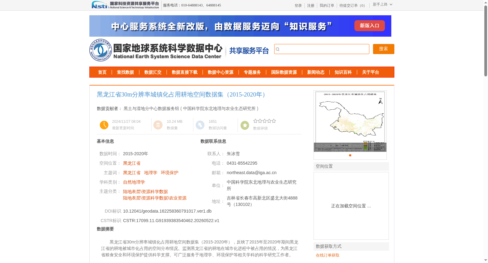
黑龙江省30m分辨率城镇化占用耕地空间数据集(2015-2020年),反映了2015年至2020年期间黑龙江省的耕地被城市化占用的空间分布情况。监测黑龙江省的耕地在城市化进程中被占用的情况,为黑龙江省粮食安全和环境保护提供科学支撑。可广泛服务于地理学、环境保护等相关学科的科学研究工作者。
30m-resolution Spatial Dataset of Cultivated Land Occupied by Urbanization in Heilongjiang Province (2015–2020)
This dataset documents the spatial distribution of cultivated land occupied by urbanization in Heilongjiang Province from 2015 to 2020. It serves to monitor the status of cultivated land occupation during urbanization in Heilongjiang Province, offering scientific support for the province’s food security and environmental protection efforts. The dataset can be widely utilized by scientific researchers in relevant disciplines including geography and environmental protection.
提供机构:
中国科学院东北地理与农业生态研究所
创建时间:
2024-10-23
搜集汇总
数据集介绍
背景与挑战
背景概述
该数据集是黑龙江省2015年至2020年期间30米分辨率的城镇化占用耕地空间分布数据,基于Landsat遥感影像通过面向对象分类方法生成,精度超过90%,旨在监测城市化进程中的耕地占用情况,为粮食安全和环境保护研究提供科学依据。数据集采用Krasovsky_1940_Albers投影坐标系,以栅格格式存储,适用于地理学和环境保护等领域的分析应用。
以上内容由遇见数据集搜集并总结生成


