洞庭湖50米分辨率湖泊沉积物量数据集(1950s-2010s)
收藏国家地球系统科学数据中心2024-07-09 更新2024-07-13 收录
下载链接:
https://www.geodata.cn/data/datadetails.html?dataguid=280996358734053&docId=2990
下载链接
链接失效反馈官方服务:
资源简介:
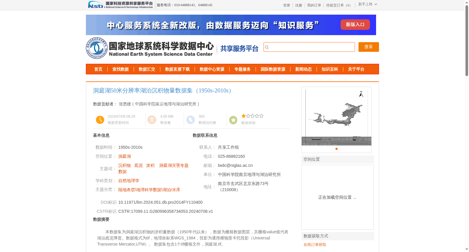
本数据集为洞庭湖沉积物的淤积量数据(1950年代以来),数据为栅格数据图层,其栅格value值代表湖泊底泥厚度。数据格式为tif,地理坐标系WGS_1984,投影为通用横轴墨卡托投影(Universal Transverse Mercator,UTM)。
数据集包含1个tif栅格文件,洞庭湖.tif。
This dataset contains sediment accumulation data of Dongting Lake since the 1950s. It is a raster data layer, where the pixel values of the raster represent the thickness of lake bottom sediment. The data is stored in TIFF format, with the geographic coordinate system set as WGS_1984 and the projection being Universal Transverse Mercator (UTM). The dataset includes one TIFF raster file: Dongting Lake.tif.
提供机构:
中国科学院南京地理与湖泊研究所
创建时间:
2024-07-08
搜集汇总
数据集介绍
背景与挑战
背景概述
该数据集为1950s至2010s期间洞庭湖50米分辨率的湖泊沉积物量数据,包含栅格格式的底泥厚度信息,采用WGS_1984地理坐标系和UTM投影。数据通过地形图对比、仪器测量和样品采集分析构建,并经过质量验证。
以上内容由遇见数据集搜集并总结生成


