BIFOLD-BigEarthNetv2-0/BigEarthNet.txt
收藏资源简介:
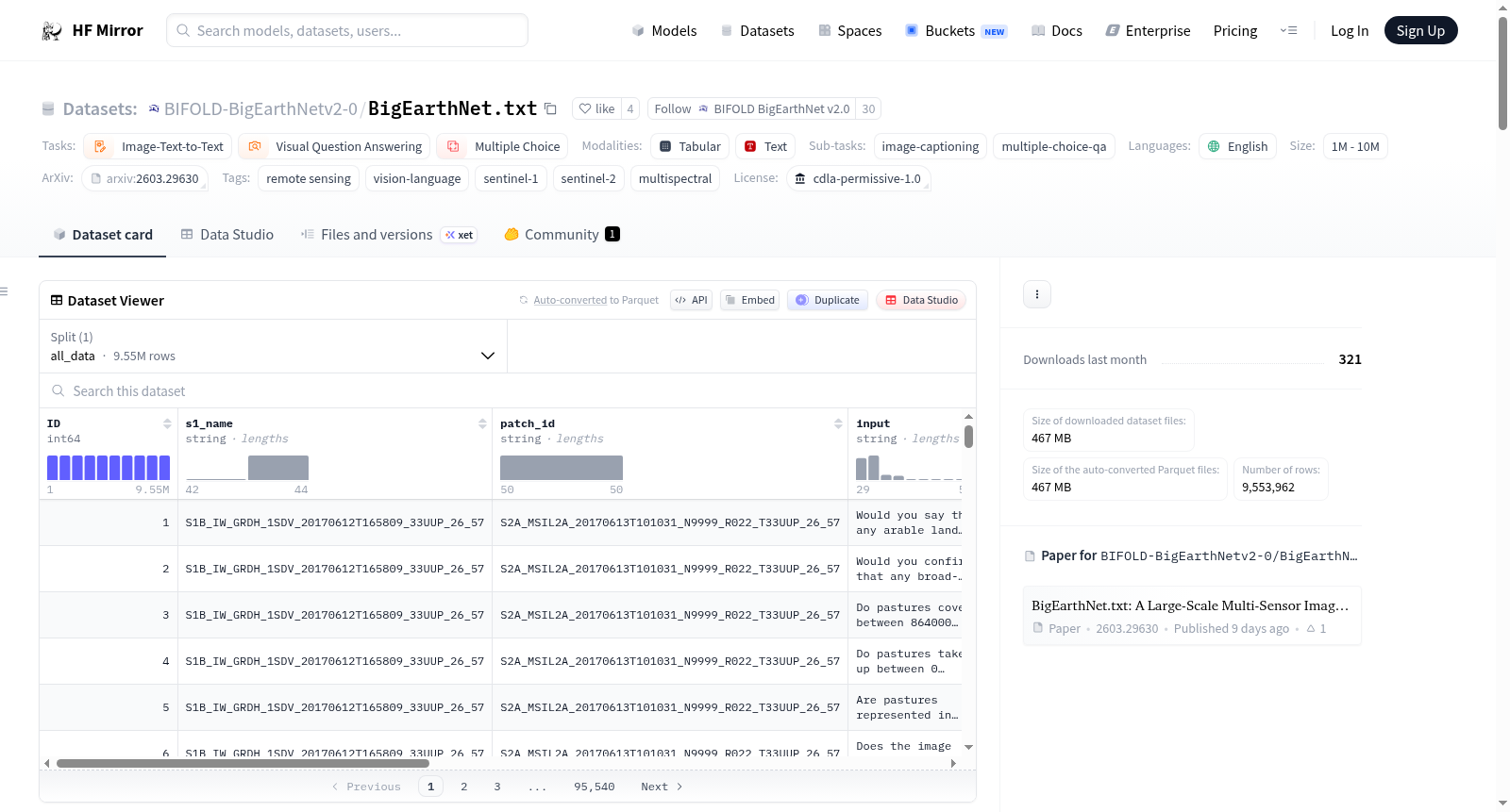
--- license: cdla-permissive-1.0 task_categories: - image-text-to-text - visual-question-answering - multiple-choice task_ids: - image-captioning - multiple-choice-qa language: - en pretty_name: BigEarthNet.txt size_categories: - 1M<n<10M tags: - remote sensing - vision-language - sentinel-1 - sentinel-2 - multispectral configs: - config_name: default data_files: - split: all_data path: BigEarthNet.txt.parquet default: true --- <!-- CSS styling --> <style> .logo { height: 50px; } table, td { border: 1px solid black; } </style> <!-- CSS styling End --> <center> <p style="display: flex; justify-content: space-between; width: 100%;"> <span style="display: flex; align-items: center; gap: 20px; margin-left: 20px"> <a href="https://bifold.berlin/"> <img src="./static/images/logos/BIFOLD_Logo_farbig.svg" alt="BIFOLD logo" class="logo"> </a> <a href="https://www.tu.berlin/"> <img src="./static/images/logos/tu-berlin-logo-long-red.svg" alt="TU Berlin Logo" class="logo"> </a> <a href="https://www.rsim.berlin/"> <img src="./static/images/logos/RSiM_Logo.png" alt="Remote Sensing Image Analysis Group Logo" class="logo"> </a> </span> <span style="display: flex; align-items: top; gap: 10px;"> <a href="https://txt.bigearth.net"> <img alt="Paper Website Badge" src="https://img.shields.io/badge/Paper-Website-%237FCCE0"> </a> <a href="https://arxiv.org/abs/2603.29630"> <img alt="Paper arXiv Badge" src="https://img.shields.io/badge/Paper-arXiv-%23b31b1b"> </a> <a href="https://cdla.dev/permissive-1-0/"> <img alt="Community Data License Agreement - Permissive - Version 1.0 License Badge" src="https://img.shields.io/badge/License-CDLA%201.0-blue.svg"> </a> </span> </p> </center> # BigEarthNet.txt: A Large-Scale Multi-Sensor Image-Text Dataset and Benchmark for Earth Observation `BigEarthNet.txt` is a large-scale multi-sensor image–text dataset for Earth observation, designed to advance vision–language learning on remote sensing data. It comprises <b>464,044 co-registered Sentinel-1 (SAR) and Sentinel-2 (multispectral) image pairs</b> collected over Europe, paired with approximately <b>9.6 million textual annotations</b>. The textual annotations include geographically anchored captions describing land-use/land-cover (LULC) classes and their spatial relationships, diverse visual question answering (VQA) pairs (binary and multiple-choice), and referring expression instructions for LULC localization. In addition, the dataset provides a <b>manually verified benchmark split consisting of 1,082 image pairs with 15,029 textual annotations</b>, specifically designed for reliable evaluation of vision–language models on complex multi-sensor remote sensing tasks. For more details on the dataset, please see our [paper website](https://txt.bigearth.net). <center> <img src="./static/images/dataset.svg" width="80%" style="margin-bottom: 0"> <div style="font-size: 0.8em; color: gray; width: 80%; margin-top: 0"> The dataset supports 15 tasks (Presence, Area, Counting, Adjacency, Relative Position Country, Season, and Climate Zone, denoted as Pr, A, Cnt, Adj, RP, Loc, S, and Clt, respectively) across 4 broad categories. </div> </center> <hr> ## Parquet File Structure The `BigEarthNet.txt.parquet` file contains multiple attributes: - `ID`: A unique identifier for each sample in the dataset. - `s1_name`: The name of the Sentinel-1 patch from `BigEarthNet v2.0`. - `patch_id`: The name of the Sentinel-2 patch from `BigEarthNet v2.0`. - `input`: The instruction or question for the VLM. - `output`: The reference answer. - `type`: The broader task-type of the sample, i.e., `binary`, `mcq`, `captioning`, or `bounding box`. - `category`: The more fine-grained task-type. See [here](https://huggingface.co/datasets/BIFOLD-BigEarthNetv2-0/BigEarthNet.txt/sql-console/KzrmYgF) for all type-category combinations. - `split`: The associated split of the sample, i.e., `train`, `validation`, `test`, or `bench`. - `latitude`: The latitude coordinates of the center of the image patch. - `longitude`: The longitude coordinates of the center of the image patch. - `country`: The acquisition country of the image patch. See [here](https://huggingface.co/datasets/BIFOLD-BigEarthNetv2-0/BigEarthNet.txt/sql-console/yn1wpPS) for all available values. - `season`: The acquisition season of the image patch. See [here](https://huggingface.co/datasets/BIFOLD-BigEarthNetv2-0/BigEarthNet.txt/sql-console/m59YuRc) for all available values. - `climate_zone`: The associated [Köppen-Geiger](https://www.nature.com/articles/s41597-023-02549-6) climate zone. See [here](https://huggingface.co/datasets/BIFOLD-BigEarthNetv2-0/BigEarthNet.txt/sql-console/SUU1DwA) for all available values. <hr> ## How to use We show the recommended way to prepare the image and text data to be jointly used in the form of a custom [PyTorch Dataset](https://docs.pytorch.org/tutorials/beginner/basics/data_tutorial.html) `BENTxTDataset` or [DataLoader](https://docs.pytorch.org/tutorials/beginner/basics/data_tutorial.html) `BENTxTDataModule` provided in [ben_txt_datamodule.py](ben_txt_datamodule.py). #### 1. Download `BigEarthNet.txt.parquet` Download using Git. ```bash git clone https://huggingface.co/datasets/BIFOLD-BigEarthNetv2-0/BigEarthNet.txt ``` #### 2. Download the Image Data Download the Sentinel-1 and Sentinel-2 image data from the [BigEarthNet v2.0 website](https://bigearth.net/). #### 3. Preprocess the Image Data Convert the Sentinel-1 and Sentinel-2 image data to `safetensors` stored in an `LMDB` database for higher throughput using [rico-hdl](https://github.com/rsim-tu-berlin/rico-hdl). Follow the installation instructions on [GitHub](https://github.com/rsim-tu-berlin/rico-hdl), then execute the following command to convert the Sentinel-1 and Sentinel-2 image data downloaded to `<S1_ROOT_DIR>` and `<S2_ROOT_DIR>`. ```bash rico-hdl bigearthnet --bigearthnet-s1-dir <S1_ROOT_DIR> --bigearthnet-s2-dir <S2_ROOT_DIR> --target-dir Encoded-BigEarthNet ``` #### 4. Load the Data Install [uv](https://docs.astral.sh/uv/getting-started/installation/). Install the required packages via uv using the command below. You can specify if you want to use the PyTorch CPU version or PyTorch with CUDA 12.6 by choosing `cpu` or `cu126` as the `<option>`. ```bash uv sync --extra <option> ``` <hr> The following examples show how to jointly load text samples from `BigEarthNet.txt` with the respective image data from `BigEarthNet v2.0`. After executing the suggested steps above, you should be able to run the following [file from this repository](https://huggingface.co/datasets/BIFOLD-BigEarthNetv2-0/BigEarthNet.txt/blob/main/example_data_loading.py): ```bash uv run example_data_loading.py ``` or load the data manually using the [provided datamodule](https://huggingface.co/datasets/BIFOLD-BigEarthNetv2-0/BigEarthNet.txt/blob/main/ben_txt_datamodule.py) as shown in the following two examples: This example shows how to load the Red (B04), Green (B03), and Blue (B02) band from the Sentinel-2 image data using the `BENTxTDataset` Datasets class. More details about the custom Dataset are provided in [ben_txt_datamodule.py](ben_txt_datamodule.py). ```python from ben_txt_datamodule import BENTxTDataset ds_rgb = BENTxTDataset( lmdb_file = "Encoded-BigEarthNet/", metadata_file = "BigEarthNet.txt.parquet", bands = ("B04", "B03", "B02"), img_size = 120 ) sample = ds_rgb[0] print(f"RGB input image: {sample['image_input'].shape}") print(f"Text input: {sample['text_input']}") print(f"Reference output: {sample['reference_output']}") ``` This example shows how to load the 10m and 20m spatial resolution bands from Sentinel-1 and Sentinel-2 using the `BENTxTDataModule` Lightning DataModule class. In this example we apply multiple metadata filters on `BigEarthNet.txt`, more details about the custom DataModule are provided in [ben_txt_datamodule.py](ben_txt_datamodule.py). ```python from ben_txt_datamodule import BENTxTDataModule # Lightning DataModule example using the 10m and 20m spatial resolution bands from Sentinel-1 and Sentinel-2 and multiple metadata filters. # The datamodule will create 4 dataloaders: train, val, test, and bench. dm = BENTxTDataModule( image_lmdb_file = "Encoded-BigEarthNet/", metadata_file = "BigEarthNet.txt.parquet", bands = 'S1S2-10m20m', img_size = 120, batch_size = 1, num_workers_dataloader = 0, types = ['mcq'], categories = ['climate zone'], countries = ['Portugal', 'Finland'], seasons = ['Summer'], climate_zones = None, point_token = ['<point>', '</point>'], ref_token = ['<ref>', '</ref>'] ) dm.setup() train_dl = dm.train_dataloader() for batch in train_dl: print(f"Batch image input shape: {batch['image_input'].shape}") print(f"First batch sample text input: {batch['text_input'][0]}") print(f"First batch sample text reference output: {batch['reference_output']}") break ``` <hr> ### Citation If you use the `BigEarthNet.txt` dataset, please cite: ``` J. Herzog, M. Adler, L. Hackel, Y. Shu, A. Zavras, I. Papoutsis, P. Rota, B. Demir, "BigEarthNet.txt: A Large-Scale Multi-Sensor Image-Text Dataset and Benchmark for Earth Observation", Arxiv Preprint arXiv:2603.29630, 2026. ``` ```bibtex @article{Herzog2026BigEarthNetTXT, title={BigEarthNet.txt: A Large-Scale Multi-Sensor Image-Text Dataset and Benchmark for Earth Observation}, author={Johann-Ludwig Herzog and Mathis Jürgen Adler and Leonard Hackel and Yan Shu and Angelos Zavras and Ioannis Papoutsis and Paolo Rota and Begüm Demir}, journal={Arxiv Preprint arXiv:2603.29630}, year={2026}, } ```
--- license: CDLA宽松许可1.0版(Community Data License Agreement - Permissive - 1.0) task_categories: - 图像-文本转文本 - 视觉问答 - 多项选择 task_ids: - 图像字幕 - 多项选择问答 language: - en pretty_name: BigEarthNet.txt size_categories: - 1M<n<10M tags: - 遥感 - 视觉语言 - 哨兵1号(Sentinel-1) - 哨兵2号(Sentinel-2) - 多光谱 configs: - config_name: default data_files: - split: all_data path: BigEarthNet.txt.parquet default: true --- <!-- CSS样式 --> <style> .logo { height: 50px; } table, td { border: 1px solid black; } </style> <!-- CSS样式结束 --> <center> <p style="display: flex; justify-content: space-between; width: 100%;"> <span style="display: flex; align-items: center; gap: 20px; margin-left: 20px"> <a href="https://bifold.berlin/"> <img src="./static/images/logos/BIFOLD_Logo_farbig.svg" alt="BIFOLD标志" class="logo"> </a> <a href="https://www.tu.berlin/"> <img src="./static/images/logos/tu-berlin-logo-long-red.svg" alt="柏林工业大学标志" class="logo"> </a> <a href="https://www.rsim.berlin/"> <img src="./static/images/logos/RSiM_Logo.png" alt="遥感图像分析研究组标志" class="logo"> </a> </span> <span style="display: flex; align-items: top; gap: 10px;"> <a href="https://txt.bigearth.net"> <img alt="论文官网徽章" src="https://img.shields.io/badge/Paper-Website-%237FCCE0"> </a> <a href="https://arxiv.org/abs/2603.29630"> <img alt="论文arXiv徽章" src="https://img.shields.io/badge/Paper-arXiv-%23b31b1b"> </a> <a href="https://cdla.dev/permissive-1-0/"> <img alt="社区数据许可协议-宽松版-1.0版许可徽章" src="https://img.shields.io/badge/License-CDLA%201.0-blue.svg"> </a> </span> </p> </center> # BigEarthNet.txt:用于地球观测的大规模多传感器图像-文本数据集与基准测试集 `BigEarthNet.txt`是面向地球观测的大规模多传感器图像-文本数据集,旨在推动遥感数据上的视觉语言(Vision-Language)学习研究。其包含**464044对经配准的哨兵1号(Sentinel-1,合成孔径雷达)与哨兵2号(Sentinel-2,多光谱)图像对**,采集范围覆盖欧洲,同时配有约**960万条文本标注**。文本标注涵盖了带有地理锚点的、描述土地利用/土地覆盖(Land Use/Land Cover,LULC)类别及其空间关系的字幕描述,多样的视觉问答(Visual Question Answering,VQA)对(包含二元分类与多项选择类型),以及用于土地利用/土地覆盖定位的指代表达式指令。此外,本数据集还提供了经过人工验证的基准拆分集,包含1082对图像与15029条文本标注,专为复杂多传感器遥感任务下的视觉语言模型可靠评估而设计。如需了解数据集的更多细节,请访问我们的[论文官网](https://txt.bigearth.net)。 <center> <img src="./static/images/dataset.svg" width="80%" style="margin-bottom: 0"> <div style="font-size: 0.8em; color: gray; width: 80%; margin-top: 0"> 本数据集支持15项任务(存在性、面积、计数、邻接性、国家相对位置、季节与气候区,分别记为Pr、A、Cnt、Adj、RP、Loc、S与Clt),涵盖4大类别。 </div> </center> <hr> ## Parquet 文件结构 `BigEarthNet.txt.parquet`文件包含多个属性: - `ID`:数据集中每个样本的唯一标识符。 - `s1_name`:来自`BigEarthNet v2.0`的哨兵1号影像块名称。 - `patch_id`:来自`BigEarthNet v2.0`的哨兵2号影像块名称。 - `input`:提供给视觉语言模型(Vision-Language Model,VLM)的指令或问题。 - `output`:参考答案。 - `type`:样本的广义任务类型,即`binary`(二元分类)、`mcq`(多项选择)、`captioning`(图像字幕)或`bounding box`(边界框)。 - `category`:更细粒度的任务类型。所有类型-类别组合详见[此处](https://huggingface.co/datasets/BIFOLD-BigEarthNetv2-0/BigEarthNet.txt/sql-console/KzrmYgF)。 - `split`:样本对应的拆分集,即`train`(训练集)、`validation`(验证集)、`test`(测试集)或`bench`(基准集)。 - `latitude`:影像块中心的纬度坐标。 - `longitude`:影像块中心的经度坐标。 - `country`:影像块的获取国家。所有可用国家详见[此处](https://huggingface.co/datasets/BIFOLD-BigEarthNetv2-0/BigEarthNet.txt/sql-console/yn1wpPS)。 - `season`:影像块的获取季节。所有可用季节详见[此处](https://huggingface.co/datasets/BIFOLD-BigEarthNetv2-0/BigEarthNet.txt/sql-console/m59YuRc)。 - `climate_zone`:对应的[柯本-盖格(Köppen-Geiger)](https://www.nature.com/articles/s41597-023-02549-6)气候区。所有可用气候区详见[此处](https://huggingface.co/datasets/BIFOLD-BigEarthNetv2-0/BigEarthNet.txt/sql-console/SUU1DwA)。 <hr> ## 使用方法 我们推荐通过自定义的PyTorch(PyTorch)数据集`BENTxTDataset`或数据加载器(DataLoader)`BENTxTDataModule`来联合准备图像与文本数据,相关实现可参见`ben_txt_datamodule.py`。 #### 1. 下载`BigEarthNet.txt.parquet` 使用Git下载: bash git clone https://huggingface.co/datasets/BIFOLD-BigEarthNetv2-0/BigEarthNet.txt #### 2. 下载影像数据 从[BigEarthNet v2.0官网](https://bigearth.net/)下载哨兵1号与哨兵2号影像数据。 #### 3. 预处理影像数据 使用`rico-hdl`将哨兵1号与哨兵2号影像数据转换为存储在LMDB数据库中的`safetensors`(安全张量格式)以提升吞吐量。请先按照GitHub上的安装说明完成`rico-hdl`的安装,随后执行以下命令,将下载至`<S1_ROOT_DIR>`与`<S2_ROOT_DIR>`的影像数据进行转换: bash rico-hdl bigearthnet --bigearthnet-s1-dir <S1_ROOT_DIR> --bigearthnet-s2-dir <S2_ROOT_DIR> --target-dir Encoded-BigEarthNet #### 4. 加载数据 安装[uv](https://docs.astral.sh/uv/getting-started/installation/)。通过以下命令安装所需依赖包,可通过指定`<option>`为`cpu`或`cu126`来选择使用PyTorch CPU版本或支持CUDA 12.6的PyTorch版本: bash uv sync --extra <option> <hr> 以下示例展示了如何将`BigEarthNet.txt`中的文本样本与来自`BigEarthNet v2.0`的对应影像数据联合加载。完成上述推荐步骤后,即可运行本仓库中的`example_data_loading.py`文件: bash uv run example_data_loading.py 或通过提供的`ben_txt_datamodule.py`中的数据模块手动加载数据,如下两个示例所示: 本示例展示了如何使用`BENTxTDataset`数据集类加载哨兵2号影像数据中的红(B04)、绿(B03)与蓝(B02)波段。关于自定义数据集的更多细节可参见`ben_txt_datamodule.py`。 python from ben_txt_datamodule import BENTxTDataset ds_rgb = BENTxTDataset( lmdb_file = "Encoded-BigEarthNet/", metadata_file = "BigEarthNet.txt.parquet", bands = ("B04", "B03", "B02"), img_size = 120 ) sample = ds_rgb[0] print(f"RGB input image: {sample['image_input'].shape}") print(f"Text input: {sample['text_input']}") print(f"Reference output: {sample['reference_output']}") 本示例展示了如何使用`BENTxTDataModule` Lightning数据模块类加载哨兵1号与哨兵2号的10m和20m空间分辨率波段。本示例中我们对`BigEarthNet.txt`应用了多个元数据过滤条件,关于自定义数据模块的更多细节可参见`ben_txt_datamodule.py`。 python from ben_txt_datamodule import BENTxTDataModule # Lightning DataModule example using the 10m and 20m spatial resolution bands from Sentinel-1 and Sentinel-2 and multiple metadata filters. # The datamodule will create 4 dataloaders: train, val, test, and bench. dm = BENTxTDataModule( image_lmdb_file = "Encoded-BigEarthNet/", metadata_file = "BigEarthNet.txt.parquet", bands = 'S1S2-10m20m', img_size = 120, batch_size = 1, num_workers_dataloader = 0, types = ['mcq'], categories = ['climate zone'], countries = ['Portugal', 'Finland'], seasons = ['Summer'], climate_zones = None, point_token = ['<point>', '</point>'], ref_token = ['<ref>', '</ref>'] ) dm.setup() train_dl = dm.train_dataloader() for batch in train_dl: print(f"Batch image input shape: {batch['image_input'].shape}") print(f"First batch sample text input: {batch['text_input'][0]}") print(f"First batch sample text reference output: {batch['reference_output']}") break <hr> ### 引用声明 如果使用本数据集,请引用以下内容: J. Herzog, M. Adler, L. Hackel, Y. Shu, A. Zavras, I. Papoutsis, P. Rota, B. Demir, "BigEarthNet.txt: A Large-Scale Multi-Sensor Image-Text Dataset and Benchmark for Earth Observation", Arxiv Preprint arXiv:2603.29630, 2026. bibtex @article{Herzog2026BigEarthNetTXT, title={BigEarthNet.txt: A Large-Scale Multi-Sensor Image-Text Dataset and Benchmark for Earth Observation}, author={Johann-Ludwig Herzog and Mathis Jürgen Adler and Leonard Hackel and Yan Shu and Angelos Zavras and Ioannis Papoutsis and Paolo Rota and Begüm Demir}, journal={Arxiv Preprint arXiv:2603.29630}, year={2026}, }