南师大仙林北区DEM数据(20220118)
收藏国家地球系统科学数据中心2025-01-15 更新2024-09-14 收录
下载链接:
https://www.geodata.cn/data/datadetails.html?dataguid=118274444701545&docId=1813
下载链接
链接失效反馈官方服务:
资源简介:
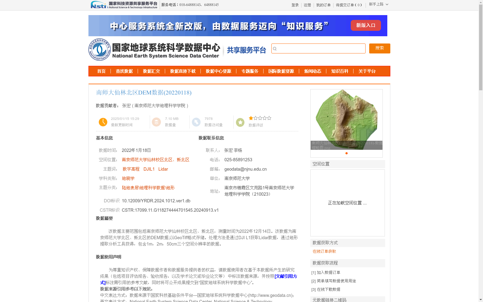
该数据主要范围包括南京师范大学仙林校区北区、新北区,测量时间为2022年12月14日。该数据为南京师范大学北区、新北区的DEM数据,以GeoTiff格式存储。处理方法是通过DJI L1获取Lidar数据,通过地形提取分析工具获得,包含1m,2m,50cm三个空间分辨率的数据。
The primary coverage of this dataset includes the North Campus and New North Campus of Xianlin Campus, Nanjing Normal University, with the survey conducted on December 14, 2022. This dataset consists of DEM (Digital Elevation Model) data for the aforementioned campuses, stored in GeoTiff format. It was generated by processing Lidar data collected via DJI L1 using topographic extraction and analysis tools, and contains three datasets with spatial resolutions of 1m, 2m, and 50cm respectively.
提供机构:
南京师范大学地理科学学院
创建时间:
2024-09-13
搜集汇总
数据集介绍
背景与挑战
背景概述
该数据集为南京师范大学仙林校区北区、新北区的数字高程模型(DEM)数据,采用DJI L1获取Lidar数据并通过地形提取分析工具处理,包含1m、2m、50cm三个空间分辨率的数据,以GeoTiff格式存储。数据测量时间为2022年12月14日,空间投影为WGS_1984_UTM_Zone_50N,精度可靠,适用于地貌学研究和地理科学数据分析。
以上内容由遇见数据集搜集并总结生成


