RoadTracer 道路数据集
收藏超神经2022-09-06 更新2024-05-15 收录
下载链接:
https://hyper.ai/cn/datasets/16871
下载链接
链接失效反馈官方服务:
资源简介:
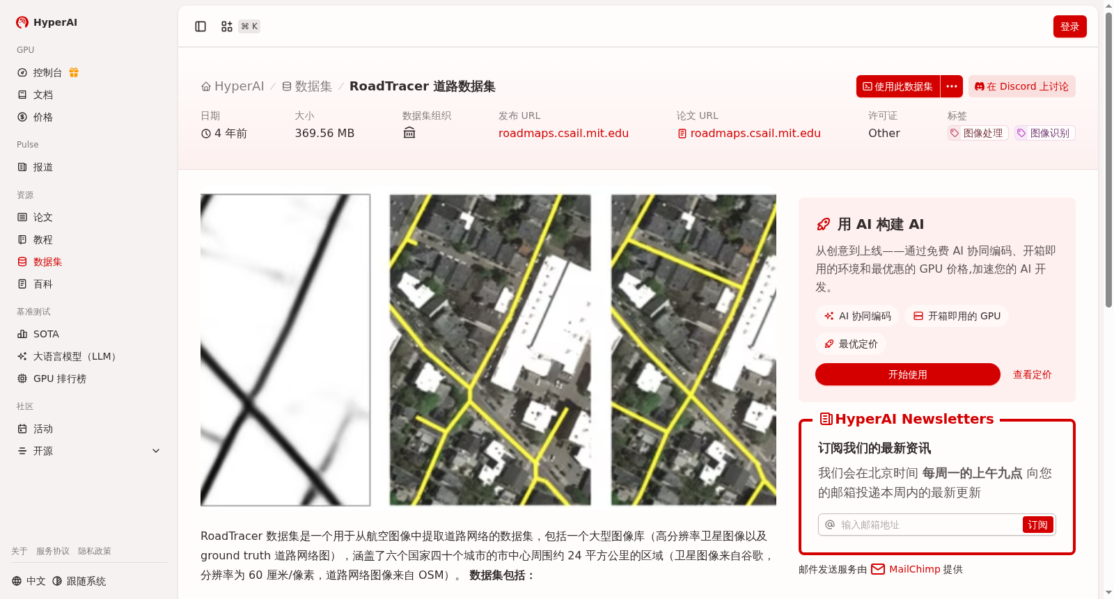
RoadTracer 数据集是一个用于从航空图像中提取道路网络的数据集,包括一个大型图像库(高分辨率卫星图像以及 ground truth 道路网络图),涵盖了六个国家四十个城市的市中心周围约 24 平方公里的区域(卫星图像来自谷歌,分辨率为 60 厘米/像素,道路网络图像来自 OSM)。
The RoadTracer dataset is a specialized dataset for road network extraction from aerial images. It includes a large-scale image repository containing high-resolution satellite imagery and ground truth road network maps. The dataset covers an area of approximately 24 square kilometers around the downtown districts of 40 cities across six countries. The satellite imagery is sourced from Google with a resolution of 60 centimeters per pixel, and the ground truth road network maps are derived from OpenStreetMap (OSM).
创建时间:
2022-09-01
搜集汇总
数据集介绍
背景与挑战
背景概述
RoadTracer道路数据集是一个用于从航空图像中提取道路网络的数据集,包含高分辨率卫星图像和地面真实道路网络图,覆盖六个国家四十个城市的市中心区域。数据集分为25个城市的训练集和15个城市的测试集,总大小为369.56 MB。
以上内容由遇见数据集搜集并总结生成


