内蒙古自治区30米分辨率土壤可蚀性因子数据集
收藏资源简介:
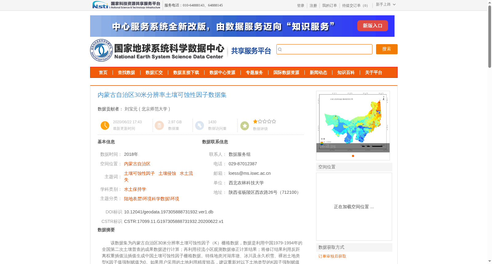
该数据集为内蒙古自治区30米分辨率土壤可蚀性因子(K)栅格数据,数据是利用中国1979-1994年的全国第二次土壤普查的成果数据进行计算;再利用径流小区观测数据修正计算结果;将修订结果利用反距离权重插值法插值生成中国土壤可蚀性因子栅格数据。特殊地类河湖库塘、冰川及永久积雪、裸岩土地类型K因子值强制赋值为0。如果用户采用的土地利用精度较高,建议重新对以下土地类型的K因子强制赋值为0:河湖库塘、冰川及永久积雪、裸岩。如果有K值为0,但不属于上述类型的,K因子可按如下原则:取邻近相同土地类型图斑的K值,或取与该图斑邻近且不等于0的所有图斑K值的平均值。内蒙古自治区土壤可蚀性因子(K)栅格数据的利用内蒙古自治区边界在中国土壤可蚀性因子栅格数据中裁切出内蒙古自治区土壤可蚀性因子数据。由于数据时大,数据分内蒙古自治区西部土壤可蚀性因子和内蒙古自治区东部土壤可蚀性因子两部分存放。
This dataset is a 30-meter resolution soil erodibility factor (K) raster dataset for the Inner Mongolia Autonomous Region. The calculation was conducted based on the results of the Second National Soil Survey of China conducted from 1979 to 1994. The preliminary calculation results were revised using runoff plot observation data, and then the revised results were interpolated via the Inverse Distance Weighting (IDW) method to generate the national soil erodibility factor raster dataset. Specifically, the K factor values for special land types including rivers, lakes, reservoirs, ponds, glaciers and permanent snow cover, and bare rock are forcibly assigned as 0. If users adopt higher-precision land use data, it is recommended to forcibly set the K factor of the following land types to 0: rivers, lakes, reservoirs, ponds, glaciers and permanent snow cover, and bare rock. For pixels with a K value of 0 but not belonging to the aforementioned land types, the K factor can be determined following these principles: take the K value of adjacent patches with the same land type, or calculate the average of the K values of all adjacent patches with non-zero K values. The soil erodibility factor (K) raster dataset for the Inner Mongolia Autonomous Region was extracted by clipping the national soil erodibility factor raster dataset using the boundary of the Inner Mongolia Autonomous Region. Due to the large data volume, the dataset is stored in two parts: the soil erodibility factor data for the western Inner Mongolia Autonomous Region and that for the eastern Inner Mongolia Autonomous Region.