慕士塔格扩扩色勒冰芯黑碳浓度数据集(1986-2006)
收藏国家青藏高原科学数据中心2025-04-14 更新2025-04-19 收录
下载链接:
https://data.tpdc.ac.cn/zh-hans/data/61c3a03d-adef-457a-8345-a921cbcadf17
下载链接
链接失效反馈官方服务:
资源简介:
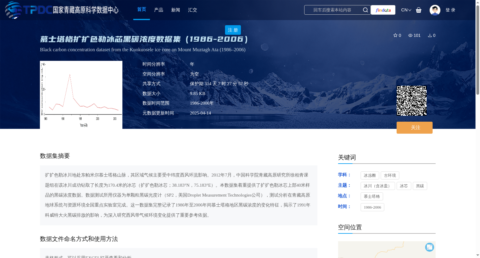
扩扩色勒冰川地处东帕米尔慕士塔格山脉,其区域气候主要受中纬度西风环流影响。2012年7月,中国科学院青藏高原研究所徐柏青课题组在该冰川成功钻取了长度为170.4米的冰芯(扩扩色勒冰芯;38.183°N,75.183°E)。本数据集着重提供了扩扩色勒冰芯上部40米样品的黑碳浓度数据。数据测试所用仪器为单颗粒黑碳光度计(SP2,美国Droplet Measurement Technologies公司),测试分析在青藏高原地球系统与资源环境全国重点实验室完成。这一数据集完整记录了1986年至2006年间慕士塔格地区黑碳浓度的变化特征,揭示了1991年科威特大火黑碳排放的影响,为深入研究西风带气候环境变化提供了重要参考依据。
The Kuokuosele Glacier is located in the Muztagh Mountains of the Eastern Pamirs, where the regional climate is mainly affected by the mid-latitude westerly circulation. In July 2012, the research group led by Professor Baiqing Xu from the Institute of Tibetan Plateau Research, Chinese Academy of Sciences successfully drilled a 170.4-meter-long ice core (Kuokuosele Ice Core; 38.183°N, 75.183°E) on this glacier. This dataset primarily provides black carbon concentration data of the upper 40-meter samples from the Kuokuosele Ice Core. The instrument used for data testing is the Single-Particle Soot Photometer (SP2, Droplet Measurement Technologies, USA), and the test and analysis were conducted at the State Key Laboratory of Tibetan Plateau Earth System, Resources and Environment. This dataset comprehensively records the temporal variations of black carbon concentrations in the Muztagh region from 1986 to 2006, revealing the impact of black carbon emissions from the 1991 Kuwait oil fires, and providing important reference for in-depth research on climatic and environmental changes driven by the westerlies.
提供机构:
徐柏青,王茉
创建时间:
2025-04-11
搜集汇总
数据集介绍
背景与挑战
背景概述
该数据集提供了1986年至2006年慕士塔格扩扩色勒冰芯的黑碳浓度数据,基于2012年钻取的冰芯上部40米样品,使用单颗粒黑碳光度计分析完成。数据揭示了1991年科威特大火黑碳排放的影响,为研究西风带气候环境变化提供了关键参考。
以上内容由遇见数据集搜集并总结生成


