鄱阳湖近年来1:25万空间分布变化数据集(2008-2016年)
收藏国家地球系统科学数据中心2024-09-04 更新2024-03-04 收录
下载链接:
https://www.geodata.cn/data/datadetails.html?dataguid=153231846497159&docId=2716
下载链接
链接失效反馈官方服务:
资源简介:
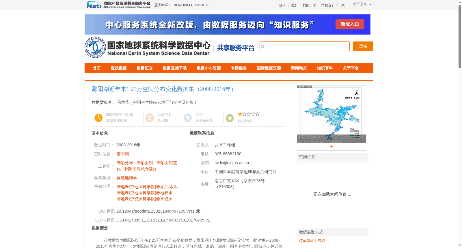
该数据集为鄱阳湖近年来1:25万空间分布变化数据,鄱阳湖丰水期枯水期差异较大,此次挑选2008-2016年典型水情年,对鄱阳湖边界进行人工解译,区分水域、岛屿、洲滩、围垦各类型,附编码,并计算其对应的面积,得到鄱阳湖不同期的矢量边界数据。数据集按照时间存放,每个文件夹均包含了1个shp矢量文件,共计6个矢量文件,20090111.shp,20110423.shp,20131106.shp,20141008.shp,20160725.shp,20161216.shp。
This dataset contains 1:250,000-scale spatial distribution change data of Poyang Lake in recent years. Given the notable disparities between the flood and dry seasons of Poyang Lake, typical hydrological years spanning 2008 to 2016 were selected. Manual interpretation was performed on the boundary of Poyang Lake to categorize and distinguish different features including water bodies, islands, lake mudflats, and reclaimed lands, with each category assigned a unique code. The corresponding areas of each feature type were calculated, yielding vector boundary datasets of Poyang Lake across different periods. The dataset is organized by time, with each folder containing one shapefile (shp). A total of 6 vector files are included: 20090111.shp, 20110423.shp, 20131106.shp, 20141008.shp, 20160725.shp, and 20161216.shp.
提供机构:
中国科学院南京地理与湖泊研究所
创建时间:
2017-07-05
搜集汇总
数据集介绍
背景与挑战
背景概述
该数据集提供了鄱阳湖2008-2016年间典型水情年的空间分布变化数据,包含6个矢量文件,区分了水域、岛屿、洲滩和围垦等类型,并计算了面积。数据基于Landsat TM/8遥感影像处理,质量可靠,适用于湖泊变化研究。
以上内容由遇见数据集搜集并总结生成


