2021年中国长三角地区GF1-2m土地利用分类数据集
收藏地球大数据科学工程2024-04-26 收录
下载链接:
https://data.casearth.cn/sdo/detail/653890fd819aec0f2602815f
下载链接
链接失效反馈官方服务:
资源简介:
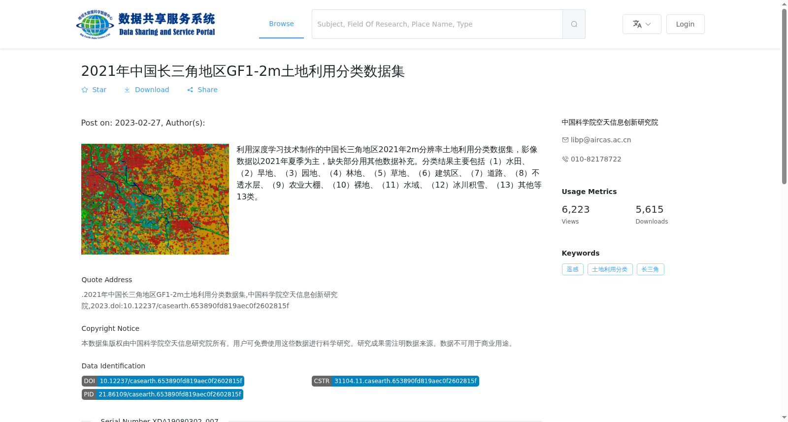
利用深度学习技术制作的中国长三角地区2021年2m分辨率土地利用分类数据集,影像数据以2021年夏季为主,缺失部分用其他数据补充。分类结果主要包括(1)水田、(2)旱地、(3)园地、(4)林地、(5)草地、(6)建筑区、(7)道路、(8)不透水层、(9)农业大棚、(10)裸地、(11)水域、(12)冰川积雪、(13)其他等13类。
This is a 2-meter-resolution land use classification dataset for the Yangtze River Delta region of China in 2021, developed using deep learning techniques. The imagery data is primarily sourced from summer 2021, with missing segments supplemented by other auxiliary data. The classification results primarily include 13 categories: (1) paddy fields, (2) dry farmland, (3) garden plots, (4) forest land, (5) grassland, (6) built-up areas, (7) roads, (8) impervious surfaces, (9) agricultural greenhouses, (10) bare land, (11) water bodies, (12) glacial snow and ice, (13) others.
提供机构:
中国科学院空天信息创新研究院
搜集汇总
数据集介绍
背景与挑战
背景概述
该数据集是2021年中国长三角地区的2米分辨率土地利用分类数据,利用深度学习技术生成,覆盖水田、旱地、建筑区等13个类别,适用于科学研究。数据以栅格格式提供,存储容量为20.71 GB,由中国科学院空天信息创新研究院发布,需注明来源且不可用于商业用途。
以上内容由遇见数据集搜集并总结生成


