2017–2025年中国10米/20米分辨率水稻种植分布数据集
收藏国家生态科学数据中心2025-05-03 收录
下载链接:
http://www.nesdc.org.cn/sdo/detail?id=681089cb7e28174acd118300
下载链接
链接失效反馈官方服务:
资源简介:
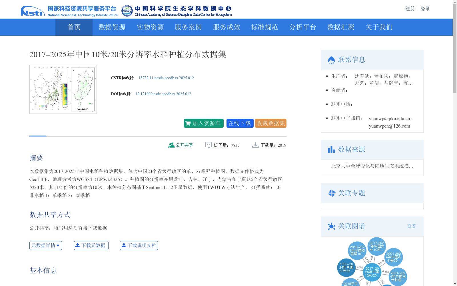
本数据集为2017-2025年中国水稻种植数据集,包含中国23个省级行政区的单、双季稻种植图。数据文件格式为GeoTIFF,地理参考为WGS84(EPSG:4326)。种植图的分辨率在黑龙江、吉林、辽宁、内蒙古和宁夏这5个省级行政区为20米,其余省份的分辨率为10米。本种植分布图基于Sentinel-1、2卫星数据,使用TWDTW方法生产。
分类系统:
0:非水稻
1:单季稻
2:双季稻
This dataset is a rice cultivation dataset in China covering the period from 2017 to 2025. It contains single-season and double-season rice cultivation maps for 23 provincial-level administrative regions across China. The data files are in GeoTIFF format, with the geographic reference system being WGS84 (EPSG:4326). The spatial resolution of the cultivation maps is 20 meters for the five provincial-level regions including Heilongjiang, Jilin, Liaoning, Inner Mongolia Autonomous Region, and Ningxia Hui Autonomous Region, while it is 10 meters for the remaining provinces. These cultivation maps are produced using Sentinel-1 and Sentinel-2 satellite data via the TWDTW method. Classification system: 0: Non-rice; 1: Single-season rice; 2: Double-season rice
提供机构:
团队
创建时间:
2024-04-28
搜集汇总
数据集介绍
背景与挑战
背景概述
该数据集涵盖2017-2025年中国23个省级行政区的水稻种植分布,包含单季稻和双季稻分类,分辨率为10米/20米,基于Sentinel卫星数据生成,适用于农业和生态研究。
以上内容由遇见数据集搜集并总结生成


