1980年以来青藏高原草地合理载畜量和超载程度
收藏地球大数据科学工程2024-05-01 收录
下载链接:
https://data.casearth.cn/sdo/detail/5feae826819aec33049b7c52
下载链接
链接失效反馈官方服务:
资源简介:
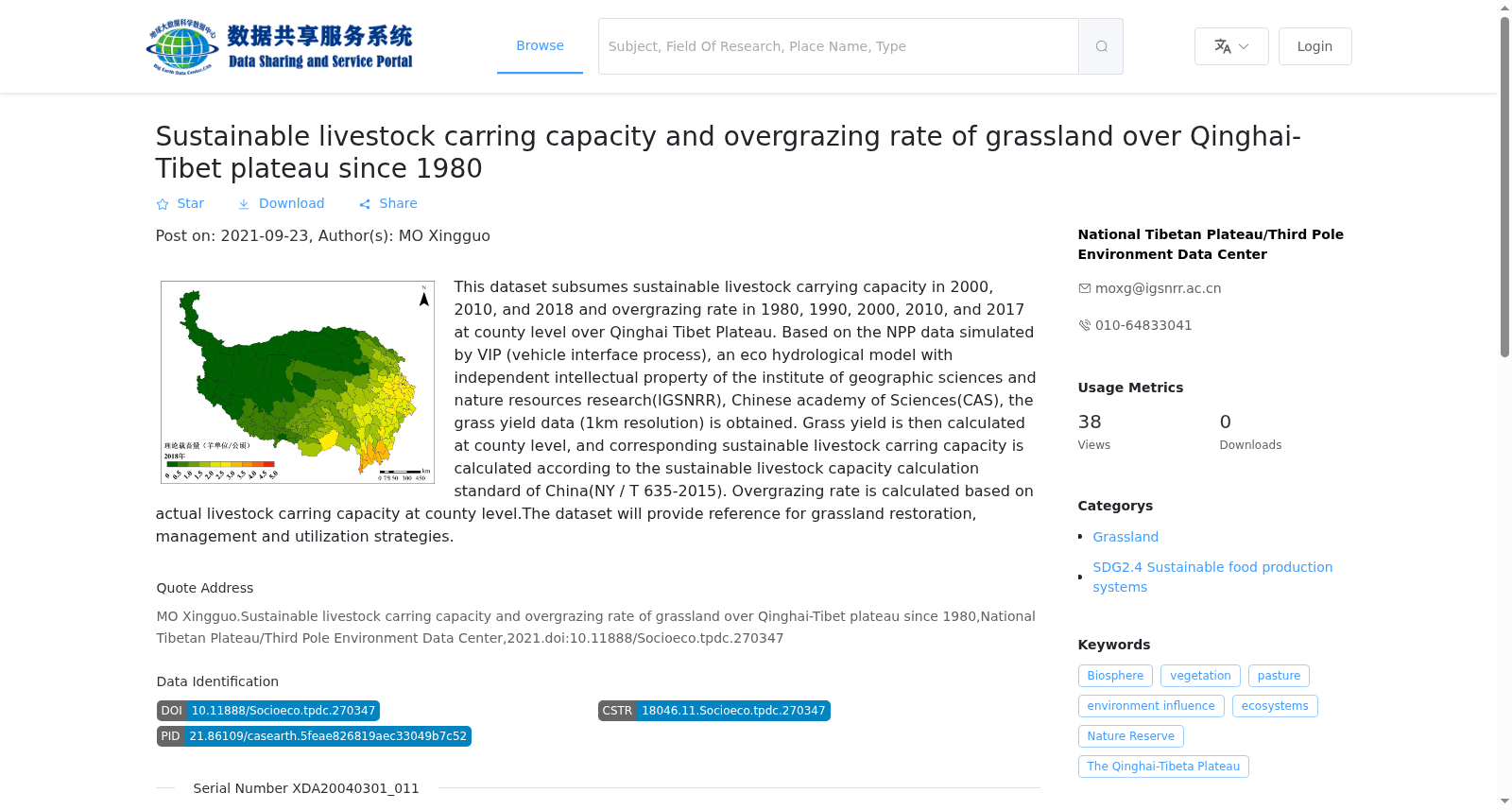
数据集包含2000年,2010年,2018年青藏高原县级理论载畜量数据和1980年, 1990年, 2000年, 2010年, 2017年县级超载程度。基于地理科学与资源研究所具有自主知识产权的生态水文动力学模型VIP(Vegetation interface process) 模拟的NPP数据计算了产草量数据(1km分辨率),按照县行政区域尺度,计算县域产草量,并根据载畜量计算标准(NY/T 635-2015)计算得到县域范围内的理论载畜量。基于县级实际载畜量数据,计算了超载程度。数据将为草地恢复、管理和利用策略的制定提供借鉴。
This dataset contains county-level theoretical livestock carrying capacity data of the Qinghai-Tibet Plateau in 2000, 2010 and 2018, as well as county-level overgrazing degree data from 1980, 1990, 2000, 2010 and 2017. The grass yield data at 1 km resolution were calculated using Net Primary Productivity (NPP) data simulated by the VIP (Vegetation Interface Process) eco-hydrological dynamic model with independent intellectual property rights developed by the Institute of Geographic Sciences and Natural Resources Research. County-level grass yield was aggregated based on county administrative divisions, and the county-level theoretical livestock carrying capacity was further calculated in accordance with the livestock carrying capacity calculation standard (NY/T 635-2015). The overgrazing degree was computed using county-level actual livestock carrying capacity data. This dataset can provide valuable references for formulating grassland restoration, management and utilization strategies.
提供机构:
国家青藏高原科学数据中心
搜集汇总
数据集介绍
背景与挑战
背景概述
该数据集提供了1980年以来青藏高原县级尺度的草地可持续载畜量和超载率数据,包括2000、2010、2018年的载畜量以及1980、1990、2000、2010、2017年的超载率。数据基于VIP生态水文模型模拟的NPP计算草产量,并依据中国国家标准计算可持续载畜量,超载率则基于实际载畜量得出。该数据集旨在支持草地恢复、管理和可持续利用策略的制定。
以上内容由遇见数据集搜集并总结生成


