典型长城无人机倾斜摄影数据集(榆林-嘉峪关)
收藏地球大数据科学工程2024-03-04 收录
下载链接:
https://data.casearth.cn/sdo/detail/6538abb2819aec0f2616b727
下载链接
链接失效反馈官方服务:
资源简介:
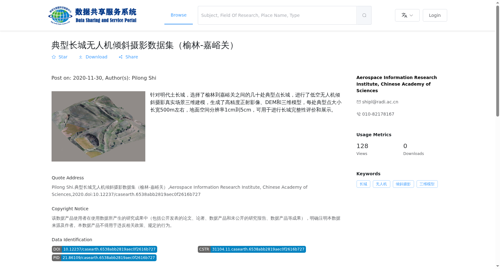
针对明代土长城,选择了榆林到嘉峪关之间的几十处典型点长城,进行了低空无人机倾斜摄影真实场景三维建模,生成了高精度正射影像、DEM和三维模型,每处典型点大小长宽500m左右,地面空间分辨率1cm到5cm,可用于进行长城完整性评价和展示。
This dataset targets the earthen Great Wall of the Ming Dynasty. Dozens of typical sections of the Great Wall between Yulin and Jiayuguan were selected as research sites. Low-altitude UAV oblique photography was employed to conduct 3D modeling of real-world scenes, and high-precision orthophotos, Digital Elevation Models (DEMs) and 3D models were generated. Each typical site covers an area of approximately 500m × 500m, with a Ground Sampling Distance (GSD) ranging from 1 cm to 5 cm. This dataset can be utilized for Great Wall integrity assessment and display.
提供机构:
Aerospace Information Research Institute, Chinese Academy of Sciences
搜集汇总
数据集介绍
背景与挑战
背景概述
该数据集为明代土长城榆林到嘉峪关段的无人机倾斜摄影数据,包含高精度正射影像、DEM和三维模型,地面分辨率1-5cm,适用于长城完整性评价和展示。
以上内容由遇见数据集搜集并总结生成


