青藏高原高寒草地地上生物量数据(2000-2020)
收藏国家青藏高原科学数据中心2022-12-21 更新2024-03-06 收录
下载链接:
https://data.tpdc.ac.cn/zh-hans/data/7b9065f6-87a9-4f8a-92a0-167650e7794a
下载链接
链接失效反馈官方服务:
资源简介:
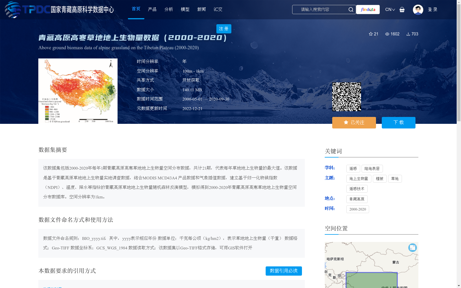
该数据集包括2000-2020年每年1期青藏高原高寒草地地上生物量空间分布数据,共计21期,代表每年草地地上生物量的最大值。该数据是基于青藏高原草地地上生物量实地调查数据,结合MODIS MCD43A4 产品数据和气象插值数据,建立基于归一化物候指数(NDPI)、温度、降水等指标的青藏高原草地地上生物量随机森林反演模型,模拟得到2000-2020年青藏高原高寒草地地上生物量空间分布数据库。空间分辨率为1km。
This dataset contains spatial distribution data of aboveground biomass of alpine grasslands on the Qinghai-Tibet Plateau, with one annual scene from 2000 to 2020, totaling 21 scenes, which represent the maximum aboveground biomass of grasslands in each corresponding year. Based on field survey data of grassland aboveground biomass on the Qinghai-Tibet Plateau, combined with MODIS MCD43A4 product data and interpolated meteorological data, a random forest inversion model for grassland aboveground biomass on the Qinghai-Tibet Plateau was developed using indicators including Normalized Difference Phenology Index (NDPI), air temperature, and precipitation. This model was employed to simulate and establish the spatial distribution database of aboveground biomass of alpine grasslands on the Qinghai-Tibet Plateau spanning 2000 to 2020. The spatial resolution of this dataset is 1 km.
提供机构:
金哲人,冯琦胜
创建时间:
2022-12-10
搜集汇总
数据集介绍
背景与挑战
背景概述
该数据集包含2000-2020年青藏高原高寒草地每年1期的地上生物量空间分布数据,共计21期,空间分辨率为1km。数据基于实地调查、MODIS产品和气象数据,通过随机森林模型反演得到,以Geo-TIFF格式存储,适用于GIS软件分析。
以上内容由遇见数据集搜集并总结生成


