水土资源匹配分区数据集(V1.0)(1995-2015)
收藏地球大数据科学工程2024-04-26 收录
下载链接:
https://data.casearth.cn/sdo/detail/5feae826819aec33049b7c55
下载链接
链接失效反馈官方服务:
资源简介:
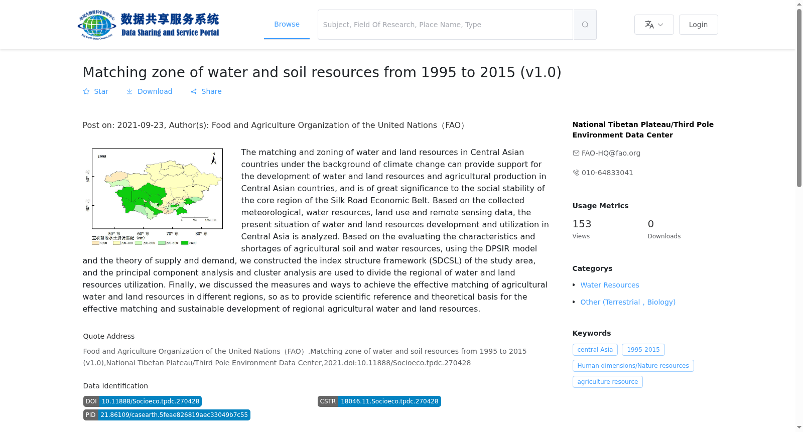
气候变化背景下中亚各国水土资源的匹配和分区,可以为中亚国家水土资源开发和农业生产提供支撑,对于“丝绸之路经济带”核心区域的社会稳定具有重要意义。利用收集的气象、水资源、土地利用和遥感数据,对中亚地区水土资源开发利用现状进行了分析。在对农业水土资源匹配特征及短缺程度进行评估基础上,依据DPSIR模型和供需理论构建的分区指标结构框架(SDCSL),运用主成分分析和聚类分析法对区域水土资源利用状况进行分区,最后提出实现不同分区农业水土资源有效匹配的措施和途径。
Against the backdrop of climate change, the matching and zoning of water and soil resources across Central Asian countries can provide support for water and soil resources development and agricultural production in these countries, and is of great significance to social stability in the core area of the "Silk Road Economic Belt". Using collected meteorological, water resources, land use and remote sensing data, this study analyzed the current status of water and soil resources development and utilization in Central Asia. Based on the assessment of the matching characteristics and shortage degree of agricultural water and soil resources, and adopting the zoning index structural framework (SDCSL) constructed based on the DPSIR model and supply-demand theory, this study conducted zoning of regional water and soil resources utilization status via principal component analysis (PCA) and cluster analysis, and finally proposed measures and approaches to achieve effective matching of agricultural water and soil resources in different zoning regions.
提供机构:
国家青藏高原科学数据中心
搜集汇总
数据集介绍
背景与挑战
背景概述
该数据集提供了1995-2015年中亚国家水土资源匹配分区的详细信息,旨在支持中亚地区水土资源开发和农业生产,为丝绸之路经济带核心区域的社会稳定提供科学参考。数据集包含气象、水资源、土地利用等多源数据,并通过主成分分析和聚类分析实现了区域划分,适用于农业资源管理和可持续发展研究。
以上内容由遇见数据集搜集并总结生成


