2017年吉林省通榆县30m 分辨率土地沙漠化时空动态数据集
收藏国家地球系统科学数据中心2024-06-12 更新2024-04-26 收录
下载链接:
https://www.geodata.cn/data/datadetails.html?dataguid=98470968081423&docId=3067
下载链接
链接失效反馈官方服务:
资源简介:
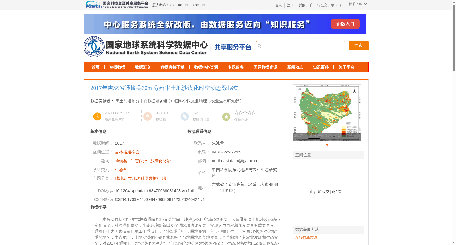
本数据包括2017年吉林省通榆县30m 分辨率土地沙漠化时空动态数据集,反应通榆县土地沙漠化动态变化情况,对沙漠化防治,生态环境改善以及促进区域协调发展、实现人与自然和谐发展具有重要意义。通榆县作为国家扶贫开发工作重点县,产业结构单一,耕地资源丰富,但榆县位于吉林西部沙漠化较为严重的地区,生态脆弱,土地沙漠化问题直接影响了当地耕地及草地质量,严重制约了其农业发展和生态安全,对2017年通榆县土地沙漠化过程进行了详细深入地分析对沙漠化防治,生态环境改善以及促进区域协调发展有重要意义。可广泛服务于生态保护、沙漠化防治等相关学科的科学研究工作者。
This dataset is the 30-meter resolution spatiotemporal dynamic dataset of land desertification in Tongyu County, Jilin Province in 2017, which depicts the dynamic changes of land desertification in Tongyu County. It holds significant importance for desertification control, ecological environment improvement, promotion of coordinated regional development, and realization of harmonious coexistence between humans and nature. As a key county for national poverty alleviation and development work, Tongyu County features a single industrial structure and abundant arable land resources. However, located in the western part of Jilin Province, a region severely affected by desertification, Tongyu County has a fragile ecosystem. The land desertification issue directly impairs the quality of local arable land and grassland, severely restricting its agricultural development and ecological security. Therefore, conducting a detailed and in-depth analysis of the land desertification process in Tongyu County in 2017 is of great significance for desertification control, ecological environment improvement, and coordinated regional development. This dataset can be widely applied to scientific researchers in related disciplines such as ecological conservation and desertification control.
提供机构:
中国科学院东北地理与农业生态研究所
创建时间:
2024-04-24
搜集汇总
数据集介绍
背景与挑战
背景概述
该数据集是2017年吉林省通榆县30米分辨率的土地沙漠化时空动态数据,通过Landsat遥感影像处理生成,反映了当地沙漠化动态变化情况。通榆县位于吉林西部沙漠化较严重地区,生态脆弱,该数据对沙漠化防治、生态环境改善及区域协调发展具有重要科学意义,可服务于生态保护和相关研究。
以上内容由遇见数据集搜集并总结生成


