青藏高原荒漠生态系统类型分布数据集(1990-2020)
收藏国家青藏高原科学数据中心2025-06-19 更新2025-04-12 收录
下载链接:
https://data.tpdc.ac.cn/zh-hans/data/2896a372-f928-4d64-98ba-8afc71ed08f7
下载链接
链接失效反馈官方服务:
资源简介:
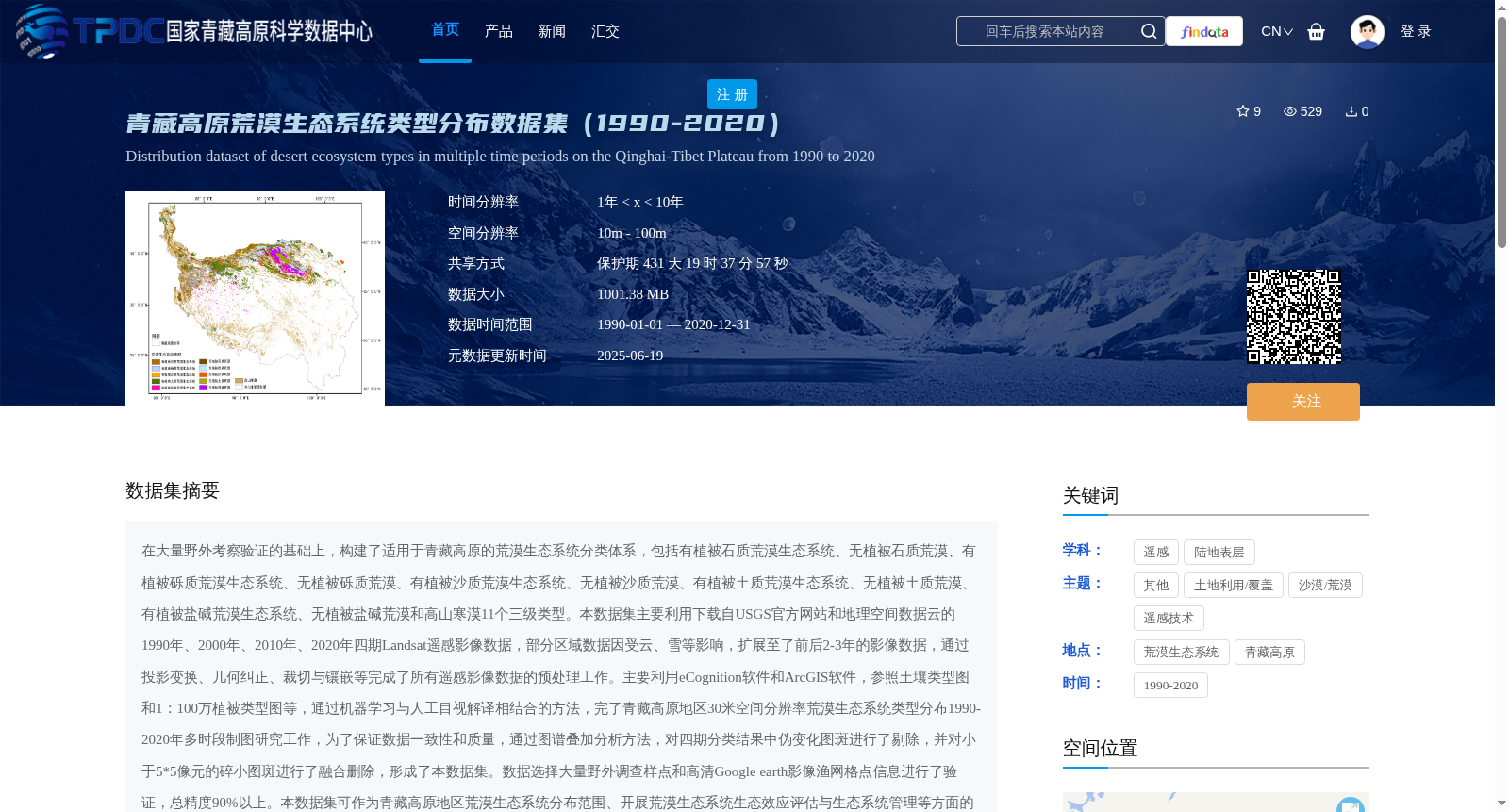
在大量野外考察验证的基础上,构建了适用于青藏高原的荒漠生态系统分类体系,包括有植被石质荒漠生态系统、无植被石质荒漠、有植被砾质荒漠生态系统、无植被砾质荒漠、有植被沙质荒漠生态系统、无植被沙质荒漠、有植被土质荒漠生态系统、无植被土质荒漠、有植被盐碱荒漠生态系统、无植被盐碱荒漠和高山寒漠11个三级类型。本数据集主要利用下载自USGS官方网站和地理空间数据云的1990年、2000年、2010年、2020年四期Landsat遥感影像数据,部分区域数据因受云、雪等影响,扩展至了前后2-3年的影像数据,通过投影变换、几何纠正、裁切与镶嵌等完成了所有遥感影像数据的预处理工作。主要利用eCognition软件和ArcGIS软件,参照土壤类型图和1:100万植被类型图等,通过机器学习与人工目视解译相结合的方法,完了青藏高原地区30米空间分辨率荒漠生态系统类型分布1990-2020年多时段制图研究工作,为了保证数据一致性和质量,通过图谱叠加分析方法,对四期分类结果中伪变化图斑进行了剔除,并对小于5*5像元的碎小图斑进行了融合删除,形成了本数据集。数据选择大量野外调查样点和高清Google earth影像渔网格点信息进行了验证,总精度90%以上。本数据集可作为青藏高原地区荒漠生态系统分布范围、开展荒漠生态系统生态效应评估与生态系统管理等方面的重要基础数据。
Based on extensive field surveys and validation, a desert ecosystem classification system tailored for the Qinghai-Tibet Plateau was established, including 11 third-level categories: vegetated stony desert ecosystem, unvegetated stony desert, vegetated gravel desert ecosystem, unvegetated gravel desert, vegetated sandy desert ecosystem, unvegetated sandy desert, vegetated loamy desert ecosystem, unvegetated loamy desert, vegetated saline-alkali desert ecosystem, unvegetated saline-alkali desert, and alpine cold desert. This dataset primarily uses four-phase Landsat remote sensing image data from 1990, 2000, 2010 and 2020 downloaded from the official USGS website and Geospatial Data Cloud. For some regions affected by clouds, snow and other interferences, image data from 2 to 3 years before and after the target years were supplemented. Preprocessing of all remote sensing image data was completed via projection transformation, geometric correction, clipping and mosaicking. Using eCognition and ArcGIS software, and referencing soil type maps, 1:1,000,000 vegetation type maps and other auxiliary data, we conducted multi-temporal mapping of desert ecosystem type distribution in the Qinghai-Tibet Plateau at 30-meter spatial resolution for the period 1990–2020 through a combination of machine learning and manual visual interpretation. To ensure data consistency and quality, pseudo-change patches in the four-phase classification results were removed, and tiny patches smaller than 5×5 pixels were merged and deleted, thus forming this dataset. A large number of field survey sampling points and grid point information from high-definition Google Earth imagery were selected to validate the dataset, with an overall accuracy exceeding 90%. This dataset can serve as a critical foundational data resource for studies on the distribution range of desert ecosystems in the Qinghai-Tibet Plateau, ecological effect assessment of desert ecosystems, and ecosystem management.
提供机构:
刘树林,段翰晨,康文平,支莹,芦瑞杰
创建时间:
2025-03-22
搜集汇总
数据集介绍
背景与挑战
背景概述
该数据集提供了1990-2020年青藏高原荒漠生态系统类型分布的多时段制图数据,空间分辨率为30米,包含11种荒漠生态系统类型,总精度超过90%。数据基于Landsat遥感影像,通过机器学习和人工目视解译方法生成,适用于荒漠生态系统分布范围研究和生态效应评估。
以上内容由遇见数据集搜集并总结生成


