雅鲁藏布江流域冰川地貌图
收藏国家青藏高原科学数据中心2025-01-09 更新2025-01-25 收录
下载链接:
https://data.tpdc.ac.cn/zh-hans/data/83ac6972-a1e4-42ea-ae27-f0973ba7d447
下载链接
链接失效反馈官方服务:
资源简介:
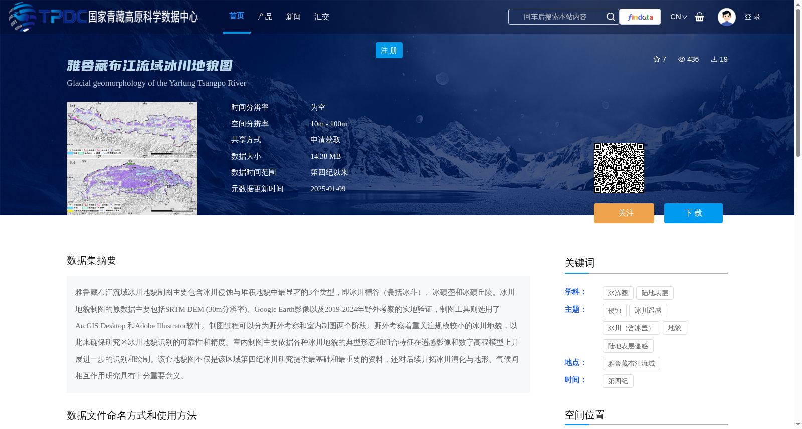
雅鲁藏布江流域冰川地貌制图主要包含冰川侵蚀与堆积地貌中最显著的3个类型,即冰川槽谷(囊括冰斗)、冰碛垄和冰碛丘陵。冰川地貌制图的原数据主要包括SRTM DEM (30m分辨率)、Google Earth影像以及2019-2024年野外考察的实地验证,制图工具则选用了ArcGIS Desktop 和Adobe Illustrator软件。制图过程可以分为野外考察和室内制图两个阶段。野外考察着重关注规模较小的冰川地貌,以此来确保研究区冰川地貌识别的可靠性和精度。室内制图主要依据各种冰川地貌的典型形态和组合特征在遥感影像和数字高程模型上开展进一步的识别和绘制。该套地貌图不仅是该区域第四纪冰川研究提供最基础和最重要的资料,还对后续开拓冰川演化与地形、气候间相互作用研究具有十分重要意义。
Glacial landform mapping in the Yarlung Zangbo River Basin focuses on the three most prominent types of glacial erosional and depositional landforms: glacial troughs (including cirques), moraine ridges, and hummocky moraines. The raw data for this glacial landform mapping mainly includes SRTM DEM (30 m resolution), Google Earth imagery, and field validation data obtained from field expeditions conducted between 2019 and 2024. The mapping tools adopted are ArcGIS Desktop and Adobe Illustrator. The entire mapping process is divided into two stages: field surveys and indoor cartography. Field surveys prioritize small-scale glacial landforms to ensure the reliability and accuracy of glacial landform identification in the study area. Indoor cartography conducts further identification and mapping based on the typical morphologies and associative characteristics of various glacial landforms using remote sensing imagery and digital elevation models. This set of geomorphic maps not only provides the most fundamental and crucial data for Quaternary glacial research in this region, but also has great significance for subsequent studies on the interactions among glacial evolution, topography and climate.
提供机构:
王杰
创建时间:
2025-01-06
搜集汇总
数据集介绍
背景与挑战
背景概述
该数据集是雅鲁藏布江流域的冰川地貌图,聚焦于冰川槽谷、冰碛垄和冰碛丘陵三种主要地貌类型,基于遥感影像、数字高程模型和野外考察制图。它具有10m-100m的空间分辨率,覆盖第四纪以来时间范围,作为区域冰川研究的基础资料,对理解冰川演化与气候、地形相互作用至关重要。
以上内容由遇见数据集搜集并总结生成


