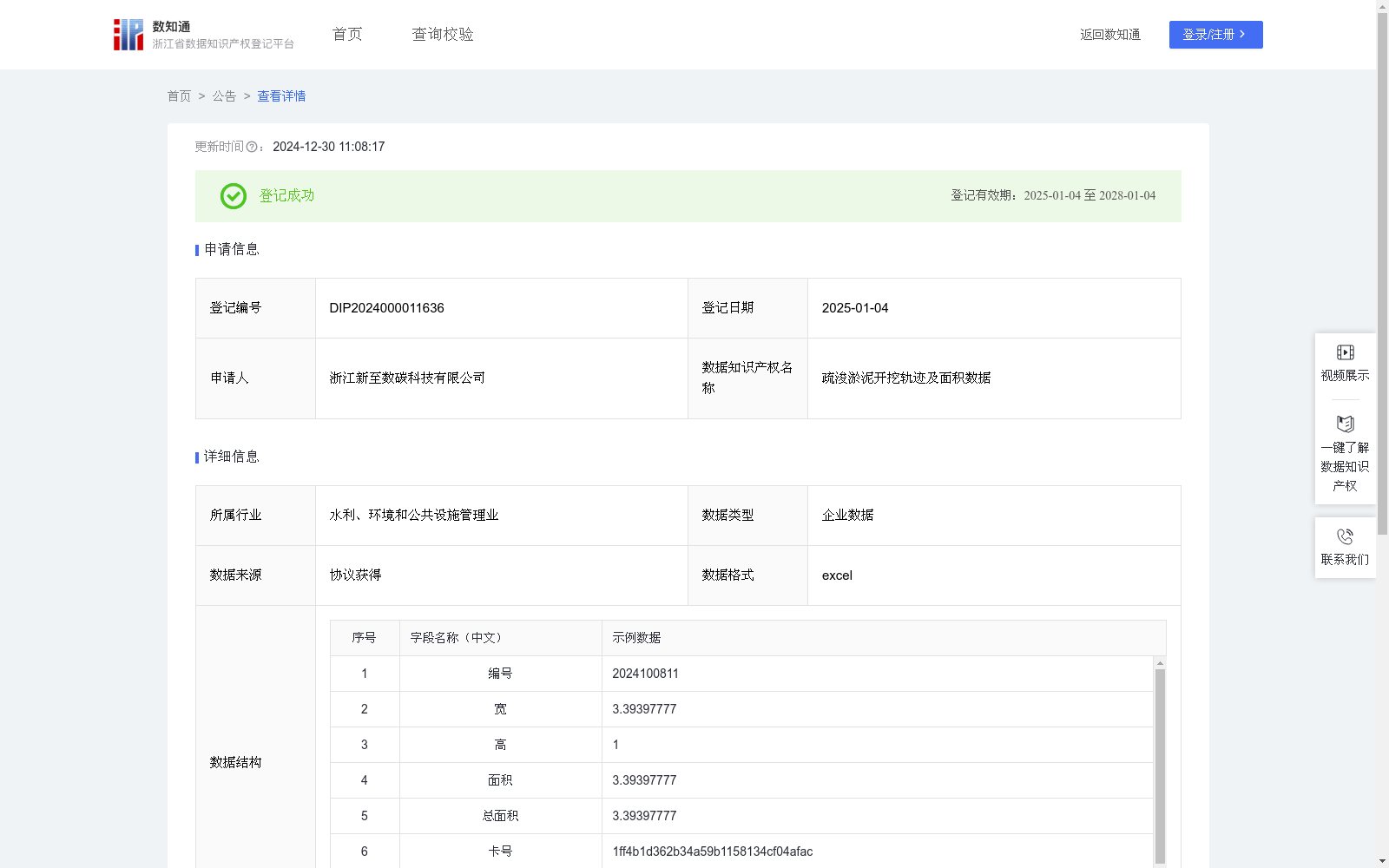
疏浚淤泥开挖轨迹及面积数据
收藏浙江省数据知识产权登记平台2024-12-30 更新2024-12-31 收录
下载链接:
https://www.zjip.org.cn/home/announce/trends/109169
下载链接
链接失效反馈官方服务:
资源简介:
1.施工检测:上传施工CAD图纸,通过读取GPS(卡号)信息,能够实时反应施工船位置,实时查看位置信息来施工,对于整体施工进行监控。提高了施工精确度和施工效率。施工面积计算:通过施工数据,进行数据分析,通过算法计算出施工面积。避免了人工估算的误差,提高了施工面积精确度1、数据采集 :计算机通过端口读取GPS(卡号)设备数据,采集编号、宽、高、卡号及开始时间及结束时间;
2、数据处理:对采集到数据进行去重、得到淤泥开挖轨迹及面积数据;
3、算法加工:将施工采集的数据根据计算出施工长度及宽度,因施工平面可能是不规则图形,将原有图形进行切割,通过面积公式 面积=长()*宽,来计算每个切割面积,切割宽度越小计算的面积越精确。施工总面积=切割长(高)1*切割宽1+切割长(高)2*切割宽2....+切割长(高)n*切割宽n
1. Construction Detection: By uploading construction CAD drawings and reading GPS (card number) information, the real-time position of construction vessels can be tracked. Users can carry out construction operations by checking real-time position data and monitor the overall construction process, which improves construction accuracy and efficiency. Construction Area Calculation: Analyze the collected construction data and calculate the construction area via algorithms, which eliminates manual estimation errors and improves the accuracy of construction area measurement.
1. Data Collection: The computer reads GPS (card number) device data through ports, collecting parameters including device ID, width, height, card number, start time and end time;
2. Data Processing: Deduplicate the collected data to obtain dredging excavation trajectory and area data;
3. Algorithm Processing: Calculate the construction length and width based on the collected construction data. Since the construction plane may be an irregular shape, the original graphic is segmented. The area of each segment is calculated using the area formula: Area = Length × Width. The smaller the segment width, the more accurate the calculated area. The total construction area = (Segment Length/Height 1 × Segment Width 1) + (Segment Length/Height 2 × Segment Width 2) + ... + (Segment Length/Height n × Segment Width n)
提供机构:
浙江新至数碳科技有限公司
创建时间:
2024-10-16
搜集汇总
数据集介绍
以上内容由遇见数据集搜集并总结生成


