祁连山地区冰川边界(v3.0, 2019)
收藏国家青藏高原科学数据中心2022-07-06 更新2024-03-06 收录
下载链接:
https://data.tpdc.ac.cn/zh-hans/data/27f65f1f-27b7-4f30-a27a-e1ba35f75ebb
下载链接
链接失效反馈官方服务:
资源简介:
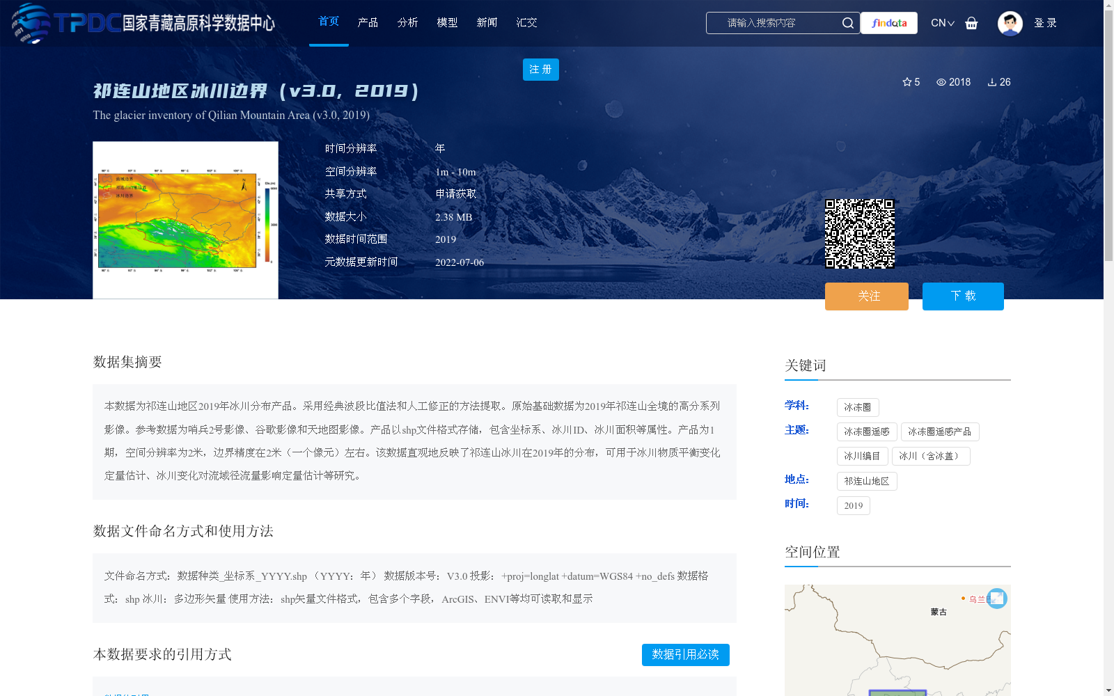
本数据为祁连山地区2019年冰川分布产品。采用经典波段比值法和人工修正的方法提取。原始基础数据为2019年祁连山全境的高分系列影像。参考数据为哨兵2号影像、谷歌影像和天地图影像。产品以shp文件格式存储,包含坐标系、冰川ID、冰川面积等属性。产品为1期,空间分辨率为2米,边界精度在2米(一个像元)左右。该数据直观地反映了祁连山冰川在2019年的分布,可用于冰川物质平衡变化定量估计、冰川变化对流域径流量影响定量估计等研究。
This dataset is the 2019 glacier distribution product for the Qilian Mountains region. It was extracted using the classic band ratio method combined with manual correction. The original basic data are the Gaofen (GF) series images covering the entire Qilian Mountains in 2019. The reference data include Sentinel-2 images, Google Earth imagery and Tianditu imagery. The product is stored in SHP file format, with attributes including coordinate system, glacier ID, glacier area and other related information. This is a single-temporal product with a spatial resolution of 2 meters, and the boundary accuracy is approximately 2 meters, equivalent to one pixel. This dataset intuitively reflects the distribution of glaciers in the Qilian Mountains in 2019, and can be used for researches such as quantitative estimation of glacier mass balance changes and quantitative assessment of the impact of glacier changes on basin runoff.
提供机构:
李佳
创建时间:
2022-05-31
搜集汇总
数据集介绍
背景与挑战
背景概述
该数据集是祁连山地区2019年的冰川边界分布产品,采用经典波段比值法和人工修正方法从高分系列影像中提取,以shp格式存储,空间分辨率为2米,边界精度约2米。它直观反映了2019年冰川分布,适用于冰川物质平衡变化和流域径流量影响等定量研究。
以上内容由遇见数据集搜集并总结生成


