青藏高原土壤风蚀强度图(2020)
收藏国家青藏高原科学数据中心2024-05-16 更新2024-06-15 收录
下载链接:
https://data.tpdc.ac.cn/zh-hans/data/5900198a-e6c6-4ff9-8bbc-07dc7af58d2e
下载链接
链接失效反馈官方服务:
资源简介:
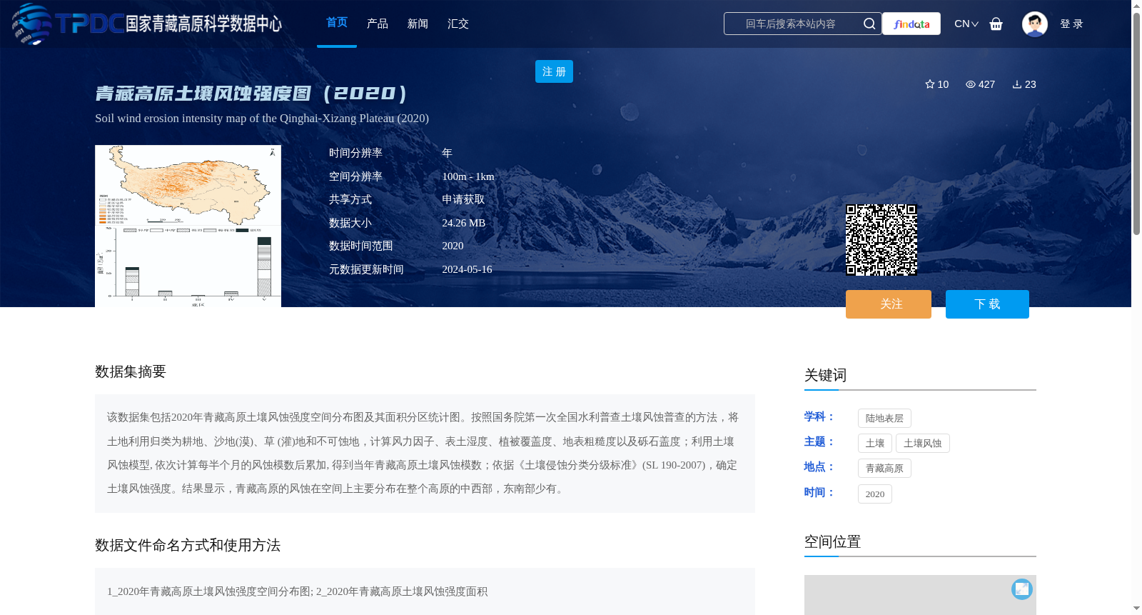
该数据集包括2020年青藏高原土壤风蚀强度空间分布图及其面积分区统计图。按照国务院第一次全国水利普查土壤风蚀普查的方法,将土地利用归类为耕地、沙地(漠)、草 (灌)地和不可蚀地,计算风力因子、表土湿度、植被覆盖度、地表粗糙度以及砾石盖度;利用土壤风蚀模型, 依次计算每半个月的风蚀模数后累加, 得到当年青藏高原土壤风蚀模数;依据《土壤侵蚀分类分级标准》(SL 190-2007),确定土壤风蚀强度。结果显示,青藏高原的风蚀在空间上主要分布在整个高原的中西部,东南部少有。
This dataset includes the 2020 spatial distribution map of soil wind erosion intensity and the area partition statistical map over the Qinghai-Tibet Plateau. Adopting the soil wind erosion survey method from the First National Water Conservancy Census of the State Council, land use was classified into cultivated land, sandy land (desert), grass (shrub) land and non-erodible land, and wind force factor, topsoil moisture, vegetation coverage, surface roughness and gravel coverage were calculated. Using the soil wind erosion model, the wind erosion modulus for each half-month period was calculated sequentially and summed to derive the annual soil wind erosion modulus of the Qinghai-Tibet Plateau. The soil wind erosion intensity was determined in accordance with the Standard for Classification and Grading of Soil Erosion (SL 190-2007). The results indicate that wind erosion over the Qinghai-Tibet Plateau is mainly spatially distributed in the central and western parts of the entire plateau, with rare occurrences in the southeast.
提供机构:
伍永秋
创建时间:
2024-01-29
搜集汇总
数据集介绍
背景与挑战
背景概述
该数据集为2020年青藏高原土壤风蚀强度空间分布图及其面积分区统计图,空间分辨率为100m - 1km,采用土壤风蚀模型计算风蚀模数,结果显示风蚀主要分布在高原中西部。数据共享方式为申请获取,需按照特定规范引用数据来源。
以上内容由遇见数据集搜集并总结生成


