祁连山区域30m土地覆盖分类产品数据集(V3.0,2021)
收藏国家青藏高原科学数据中心2022-07-11 更新2024-03-01 收录
下载链接:
https://data.tpdc.ac.cn/zh-hans/data/8c041cfb-f297-481b-b4fa-cbdf1e27dc84
下载链接
链接失效反馈官方服务:
资源简介:
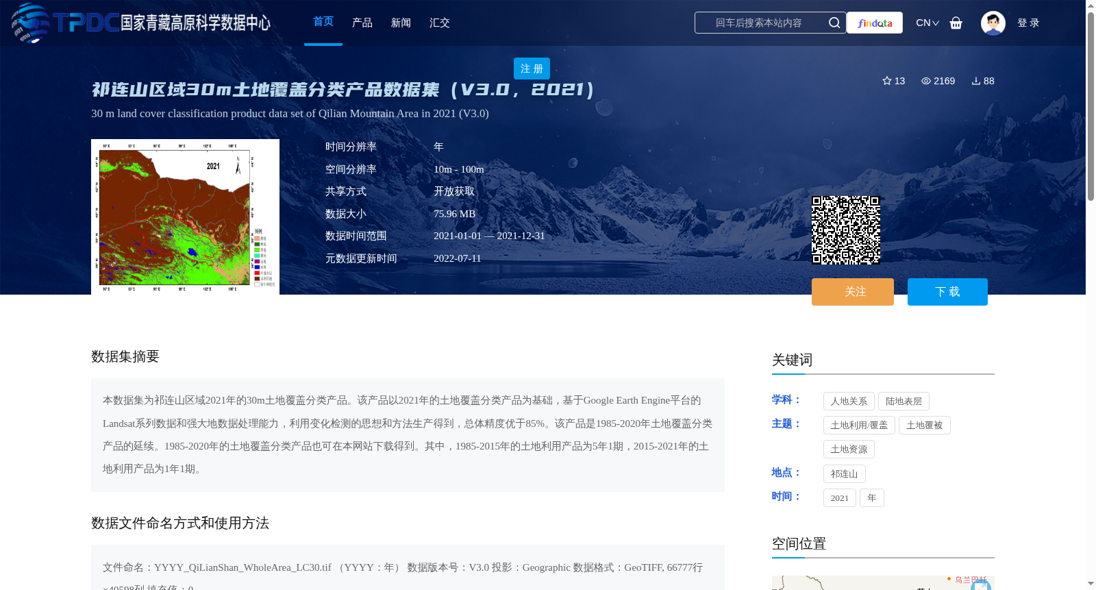
本数据集为祁连山区域2021年的30m土地覆盖分类产品。该产品以2021年的土地覆盖分类产品为基础,基于Google Earth Engine平台的Landsat系列数据和强大地数据处理能力,利用变化检测的思想和方法生产得到,总体精度优于85%。该产品是1985-2020年土地覆盖分类产品的延续。1985-2020年的土地覆盖分类产品也可在本网站下载得到。其中,1985-2015年的土地利用产品为5年1期,2015-2021年的土地利用产品为1年1期。
This dataset is a 30-meter land cover classification product for the Qilian Mountains region in 2021. It is developed using Landsat series data from the Google Earth Engine (GEE) platform and its powerful data processing capabilities, adopting the concepts and methodologies of change detection, and built upon the 2021 land cover classification product. The overall accuracy of this product exceeds 85%. This product is a continuation of the land cover classification products spanning from 1985 to 2020. The land cover classification products from 1985 to 2020 are also available for download on this website. Specifically, the land use products from 1985 to 2015 are released at 5-year intervals, while those from 2015 to 2021 are updated on an annual basis.
提供机构:
杨爱霞, 仲波,角坤升,吴俊君
创建时间:
2022-05-11
搜集汇总
数据集介绍
背景与挑战
背景概述
该数据集是2021年祁连山区域的30米分辨率土地覆盖分类产品,基于Google Earth Engine平台和Landsat数据生产,总体精度超过85%。它是1985-2020年系列产品的一部分,2015年后每年更新一期,数据开放获取。
以上内容由遇见数据集搜集并总结生成


