青藏高原遥感干旱指数SPI和SPEI数据集(1983-2021)
收藏国家青藏高原科学数据中心2024-10-30 更新2024-12-14 收录
下载链接:
https://data.tpdc.ac.cn/zh-hans/data/85b0c24a-b628-4d03-96ef-76b3fddcfd14
下载链接
链接失效反馈官方服务:
资源简介:
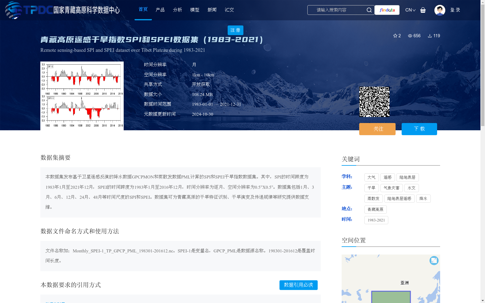
本数据集发布基于卫星遥感反演的降水数据GPCPMON和蒸散发数据PML计算的SPI和SPEI干旱指数数据集。其中,SPI的时间跨度为1983年1月至2021年12月,SPEI的时间跨度为1983年1月至2016年12月,时间分辨率为逐月、空间分辨率为0.5°X0.5°。数据集包括1月、3月、6月、12月、24月、48月等时间尺度的SPI和SPEI。数据集可为青藏高原的干旱特征识别、干旱演变及传递规律等研究提供数据支撑。
This dataset comprises SPI and SPEI drought indices calculated using satellite remote sensing-retrieved precipitation data GPCPMON and evapotranspiration data PML. Specifically, the temporal coverage of SPI spans from January 1983 to December 2021, while that of SPEI ranges from January 1983 to December 2016. The dataset has a monthly temporal resolution and a spatial resolution of 0.5° × 0.5°. It includes SPI and SPEI products with temporal scales of 1, 3, 6, 12, 24, and 48 months. This dataset can provide data support for studies on drought characteristic identification, drought evolution and transmission regularity over the Qinghai-Tibet Plateau.
提供机构:
张选泽
创建时间:
2024-10-29
搜集汇总
数据集介绍
背景与挑战
背景概述
该数据集提供了青藏高原地区基于卫星遥感反演的降水数据GPCPMON和蒸散发数据PML计算的SPI和SPEI干旱指数,时间跨度为1983年至2021年(SPI)和1983年至2016年(SPEI),时间分辨率为逐月,空间分辨率为0.5°X0.5°,并包含多个时间尺度(如1月、3月、6月等)。数据集旨在支持青藏高原的干旱特征识别、演变及传递规律研究,数据格式为NetCDF,可通过开放获取方式使用,需遵循引用规范。
以上内容由遇见数据集搜集并总结生成


