2000年中国乡镇(街道)级人口密度数据集
收藏地球大数据科学工程2024-03-04 收录
下载链接:
https://data.casearth.cn/sdo/detail/60e55fc9819aec59a2af7017
下载链接
链接失效反馈资源简介:
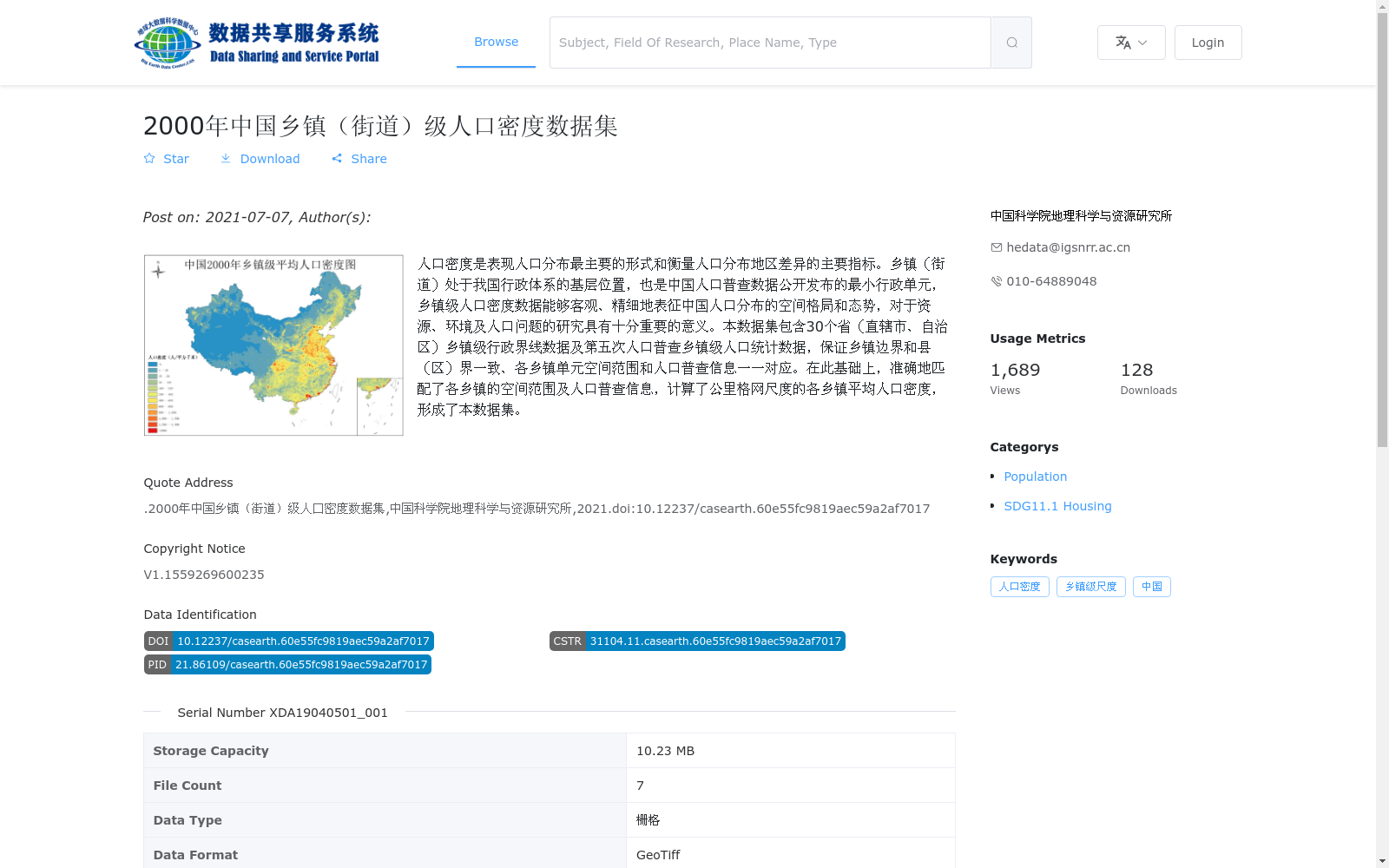
人口密度是表现人口分布最主要的形式和衡量人口分布地区差异的主要指标。乡镇(街道)处于我国行政体系的基层位置,也是中国人口普查数据公开发布的最小行政单元,乡镇级人口密度数据能够客观、精细地表征中国人口分布的空间格局和态势,对于资源、环境及人口问题的研究具有十分重要的意义。本数据集包含30个省(直辖市、自治区)乡镇级行政界线数据及第五次人口普查乡镇级人口统计数据,保证乡镇边界和县(区)界一致、各乡镇单元空间范围和人口普查信息一一对应。在此基础上,准确地匹配了各乡镇的空间范围及人口普查信息,计算了公里格网尺度的各乡镇平均人口密度,形成了本数据集。
Population density is the primary form of depicting population distribution and a core indicator for measuring regional disparities in population distribution. Townships (sub-districts) serve as the grassroots tier of China's administrative system and the smallest administrative unit for which publicly released census population data is available in China. Township-level population density data can objectively and precisely characterize the spatial pattern and trend of China's population distribution, which is of great significance for research on resources, environmental and population issues. This dataset includes township-level administrative boundary data for 30 provinces (municipalities directly under the Central Government, autonomous regions) and township-level population statistics from the Fifth National Population Census, ensuring that township boundaries are consistent with county (district) boundaries and that the spatial scope of each township unit is in one-to-one correspondence with its census population information. On this basis, the spatial scope and census population information of each township were accurately matched, and the average population density of each township at the kilometer grid scale was calculated, thereby forming this dataset.
提供机构:
中国科学院地理科学与资源研究所
AI搜集汇总
数据集介绍
背景与挑战
背景概述
该数据集是基于2000年第五次人口普查的中国乡镇(街道)级人口密度数据,覆盖30个省(直辖市、自治区),整合了乡镇级行政界线和人口统计信息,并计算了公里格网尺度的平均人口密度,以精细表征人口分布空间格局。数据格式为GeoTiff栅格,由中国科学院地理科学与资源研究所于2021年发布,适用于资源、环境及人口相关研究。
以上内容由AI搜集并总结生成


