黑河流域中上游SWAT情景模拟数据(2011-2030)
收藏国家青藏高原科学数据中心2021-04-19 更新2024-02-29 收录
下载链接:
https://data.tpdc.ac.cn/zh-hans/data/675981ec-0593-4795-afcc-2610151e907e
下载链接
链接失效反馈官方服务:
资源简介:
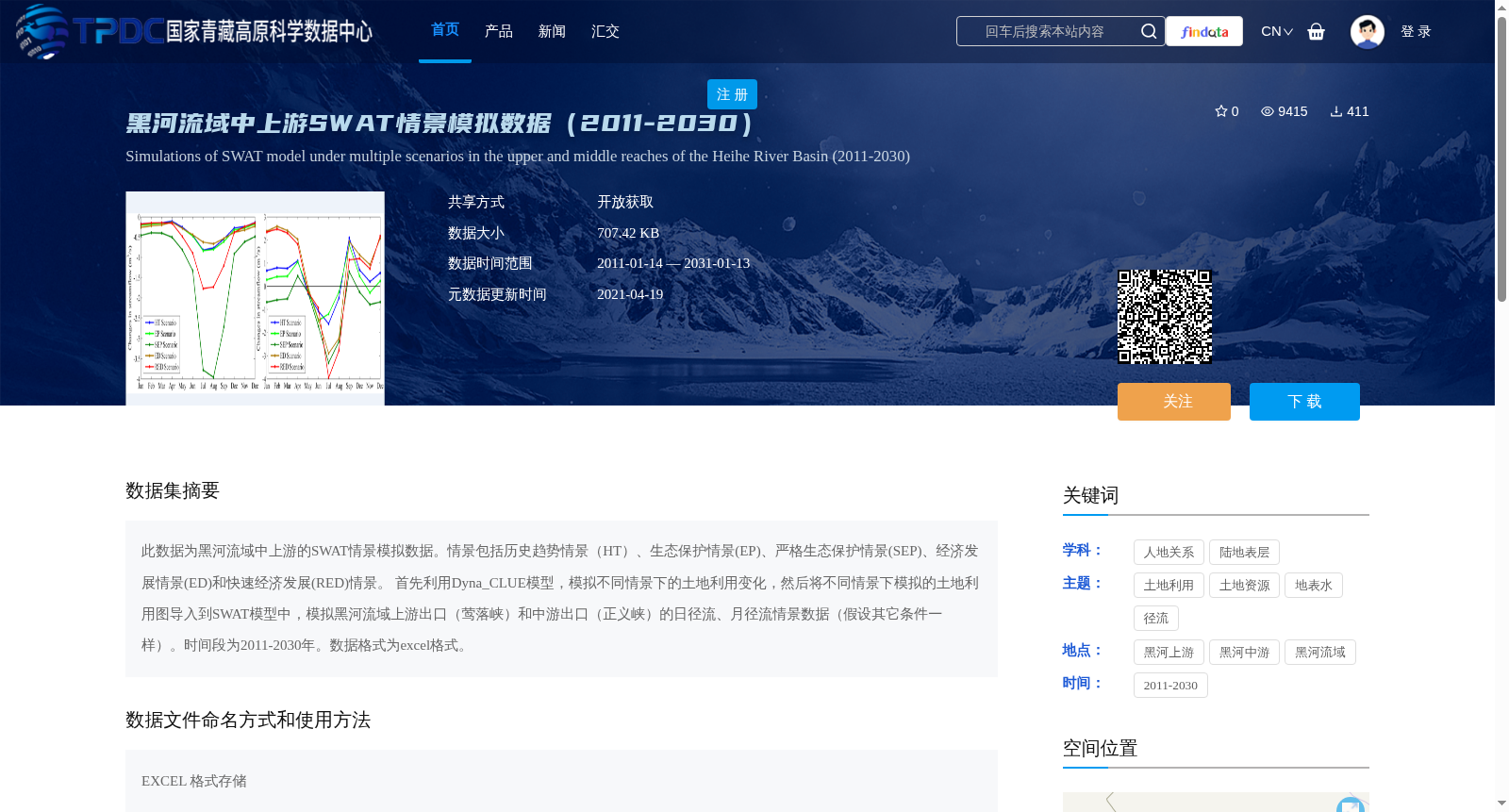
此数据为黑河流域中上游的SWAT情景模拟数据。情景包括历史趋势情景(HT)、生态保护情景(EP)、严格生态保护情景(SEP)、经济发展情景(ED)和快速经济发展(RED)情景。 首先利用Dyna_CLUE模型,模拟不同情景下的土地利用变化,然后将不同情景下模拟的土地利用图导入到SWAT模型中,模拟黑河流域上游出口(莺落峡)和中游出口(正义峡)的日径流、月径流情景数据(假设其它条件一样)。时间段为2011-2030年。数据格式为excel格式。
This dataset comprises SWAT scenario simulation data for the middle and upper reaches of the Heihe River Basin. The included scenarios are as follows: historical trend scenario (HT), ecological protection scenario (EP), strict ecological protection scenario (SEP), economic development scenario (ED), and rapid economic development scenario (RED). First, the Dyna_CLUE model was employed to simulate land use changes under each scenario. Subsequently, the simulated land use maps corresponding to different scenarios were imported into the SWAT model to produce scenario-based daily and monthly runoff data at two key outlets: the upper reach outlet (Yingluoxia) and the middle reach outlet (Zhengyixia) of the Heihe River Basin, with all other conditions held constant. The simulation period ranges from 2011 to 2030, and the data is stored in Excel format.
提供机构:
南卓铜,张凌
创建时间:
2015-01-13
搜集汇总
数据集介绍
背景与挑战
背景概述
该数据集为黑河流域中上游的SWAT情景模拟数据,涵盖2011-2030年,包括历史趋势、生态保护和经济发展等多种情景下的土地利用变化模拟,并基于此模拟了上游和中游出口的日径流与月径流数据。数据以Excel格式提供,适用于水文响应和土地利用变化分析研究。
以上内容由遇见数据集搜集并总结生成


