中国大陆地区均一化及格点化的多层逐日土壤温度数据集(1960-2017)
收藏国家青藏高原科学数据中心2023-04-26 更新2024-03-01 收录
下载链接:
https://data.tpdc.ac.cn/zh-hans/data/f3df77b7-bd0d-4ad2-a0c2-8b93b5cf77b0
下载链接
链接失效反馈官方服务:
资源简介:
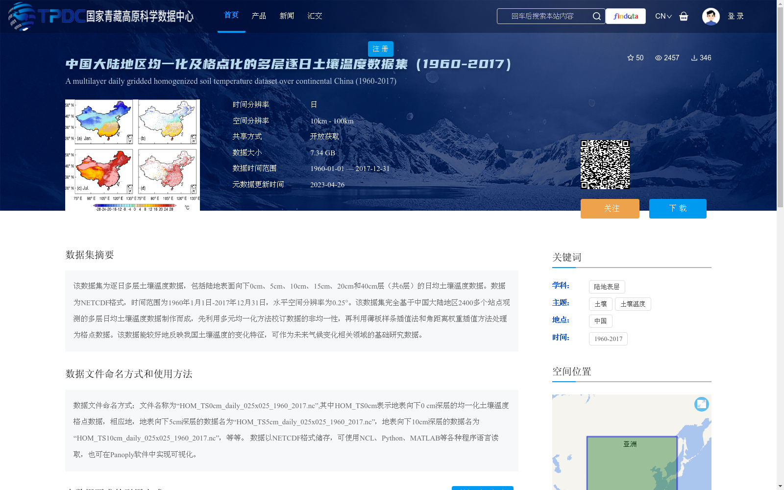
该数据集为逐日多层土壤温度数据,包括陆地表面向下0cm、5cm、10cm、15cm、20cm和40cm层(共6层)的日均土壤温度数据。数据为NETCDF格式,时间范围为1960年1月1日-2017年12月31日,水平空间分辨率为0.25°。该数据集完全基于中国大陆地区2400多个站点观测的多层日均土壤温度数据制作而成,先利用多元均一化方法校订数据的非均一性,再利用薄板样条插值法和角距离权重插值方法处理为格点数据。该数据能较好地反映我国土壤温度的变化特征,可作为未来气候变化相关领域的基础研究数据。
This dataset contains daily multi-layer soil temperature data, including daily average soil temperature at six layers: 0cm, 5cm, 10cm, 15cm, 20cm, and 40cm below the land surface. The data is stored in NETCDF format, with a temporal coverage from January 1, 1960 to December 31, 2017, and a horizontal spatial resolution of 0.25°. This dataset is entirely developed based on multi-layer daily average soil temperature observations from more than 2,400 stations across mainland China. First, the inhomogeneities of the original observational data were corrected using the multiple homogenization method, then the corrected data were interpolated into gridded data via the thin plate spline interpolation and angular distance weighted interpolation methods. This dataset can effectively reflect the spatiotemporal variation characteristics of soil temperature in China, and can serve as fundamental research data for future studies related to climate change.
提供机构:
王爱慧,王丹
创建时间:
2023-04-18
搜集汇总
数据集介绍
背景与挑战
背景概述
该数据集为中国大陆地区1960-2017年的多层逐日土壤温度数据,包含0cm至40cm共6层的日均温度,空间分辨率为0.25°,数据格式为NETCDF。数据集基于2400多个站点观测数据,经过均一化和格点化处理,适用于气候变化研究。
以上内容由遇见数据集搜集并总结生成


