中国城市社会经济密度空间分布数据集(2012-2018年)
收藏国家地球系统科学数据中心2024-09-03 更新2024-03-04 收录
下载链接:
https://www.geodata.cn/data/datadetails.html?dataguid=30242668655895&docId=2720
下载链接
链接失效反馈官方服务:
资源简介:
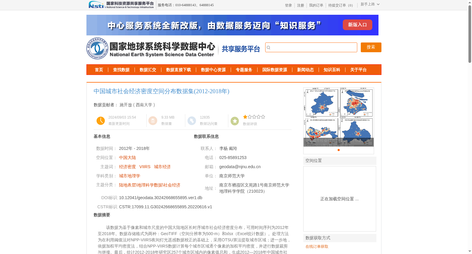
该数据为基于像素和城市尺度的中国大陆地区长时序城市社会经济密度分布,可用时间序列为2012年至2018年。数据存储格式为两种:GeoTIFF(空间分辨率为500-m)和xlsx(Excel统计数据)。处理方法为在利用阈值法对NPP-VIIRS夜间灯光遥感数据校正的基础上,采用OTSU算法提取城市区域;进一步地,依据加权平均密度法,结合NPP-VIIRS数据计算每个城市区域逐个像素的加权平均密度,并进行数据裁剪与拼接。最后,统计2012-2018年研究区257个城市区域内的像素值总和,生成2012—2018年中国城市社会经济密度分布数据集。
This dataset provides long-time-series urban socio-economic density distributions across mainland China at both pixel and urban scales, covering the 2012–2018 time period. The dataset is stored in two formats: GeoTIFF (with a spatial resolution of 500 meters) and XLSX (Excel statistical data). The processing workflow is as follows: first, the NPP-VIIRS nighttime light remote sensing data were corrected using the thresholding method, followed by urban area extraction via Otsu's algorithm; furthermore, the weighted average density of each pixel within every individual urban area was calculated with the NPP-VIIRS data based on the weighted average density method, and subsequent data cropping and mosaicking were conducted. Finally, the total pixel values within 257 urban areas of the study area from 2012 to 2018 were summed to generate the dataset of urban socio-economic density distributions across China for 2012–2018.
提供机构:
西南大学
创建时间:
2022-06-16
搜集汇总
数据集介绍
背景与挑战
背景概述
该数据集是2012-2018年中国大陆城市社会经济密度空间分布的长时序数据,基于NPP-VIIRS夜间灯光遥感数据,通过阈值法和OTSU算法提取城市区域,并采用加权平均密度法计算像素级密度,覆盖257个城市区域,以GeoTIFF(500米分辨率)和xlsx格式提供。数据精度可靠,但小城市区域可能存在极高值像素,需用户注意处理异常值。
以上内容由遇见数据集搜集并总结生成


