STPLS3D 点云数据集
收藏超神经2023-09-14 更新2024-05-15 收录
下载链接:
https://hyper.ai/cn/datasets/19941
下载链接
链接失效反馈官方服务:
资源简介:
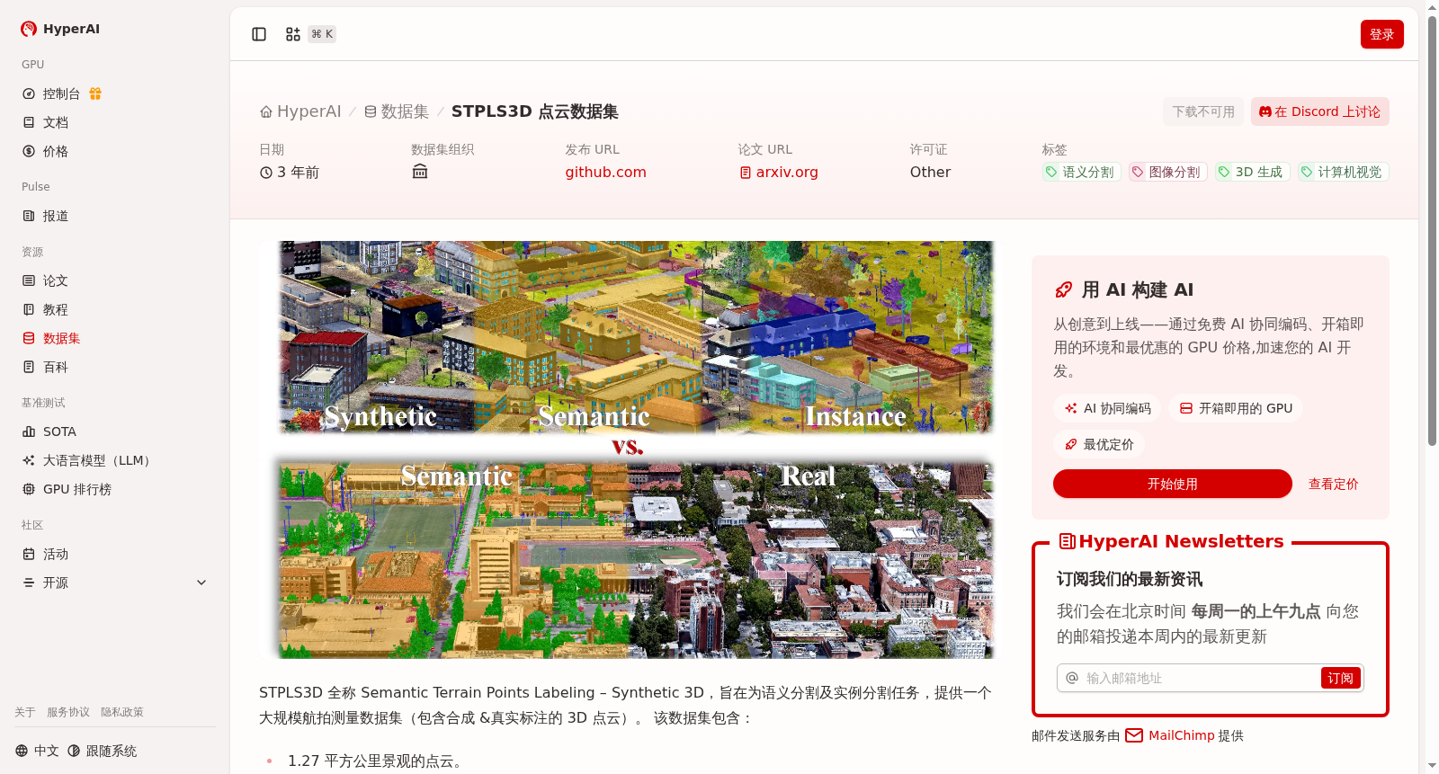
STPLS3D 全称 Semantic Terrain Points Labeling – Synthetic 3D,旨在为语义分割及实例分割任务,提供一个大规模航拍测量数据集(包含合成 &真实标注的 3D 点云)。
STPLS3D, whose full name is Semantic Terrain Points Labeling – Synthetic 3D, is a large-scale aerial survey dataset containing both synthetic and real-world annotated 3D point clouds, specifically developed for semantic segmentation and instance segmentation tasks.
创建时间:
2023-08-15
搜集汇总
数据集介绍
背景与挑战
背景概述
STPLS3D是一个大规模航拍测量点云数据集,包含1.27平方公里景观的点云和62个合成点云,覆盖约16平方公里的城市景观,具有18个细粒度语义类和14个实例类,由康奈尔大学发布,主要用于语义分割和实例分割任务。
以上内容由遇见数据集搜集并总结生成


