青藏高原草地生态系统生态功能重要性(2000-2020)
收藏国家青藏高原科学数据中心2025-06-25 更新2025-06-21 收录
下载链接:
https://data.tpdc.ac.cn/zh-hans/data/15eaa884-632e-4044-a9e8-281ede95bcc4
下载链接
链接失效反馈官方服务:
资源简介:
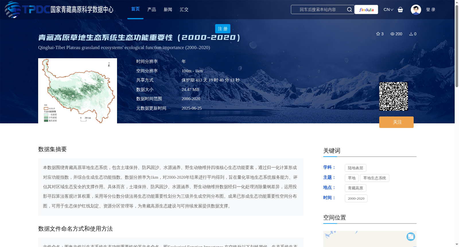
本数据围绕青藏高原草地生态系统,包含土壤保持、防风固沙、水源涵养、野生动物维持四项核心生态功能要素,通过归一化计算形成对应功能指数,并综合生成生态功能指数。数据分辨率为1km,对2000-2020年结果进行平均得到,旨在量化草地生态系统服务能力、评估其对区域生态安全的支撑作用。具体而言,土壤保持、防风固沙、水源涵养、野生动物维持数据经归一化处理消除量纲差异,运用投影寻踪算法客观计算权重,采用等分位数分级法将生态功能重要性划分为三级并生成空间分布图。成果已形成生态功能重要性空间分布图,可用于生态保护红线划定、资源分区管理等,为青藏高原生态建设与可持续发展提供数据支撑。
This dataset focuses on the grassland ecosystem of the Qinghai-Tibet Plateau, covering four core ecological function elements: soil conservation, windbreak and sand fixation, water conservation, and wildlife maintenance. Corresponding function indices are generated via normalization calculations, and a comprehensive ecological function index is further synthesized. With a spatial resolution of 1 km, the dataset is derived by averaging annual results from 2000 to 2020, aiming to quantify the grassland ecosystem service capacity and evaluate its supporting role for regional ecological security.
Specifically, the data of the four ecological functions are normalized to eliminate dimensional discrepancies, with weights objectively calculated using the projection pursuit algorithm. The ecological function importance is classified into three levels via the equal quantile classification method, and corresponding spatial distribution maps are generated.
The final outcomes include spatial distribution maps of ecological function importance, which can be applied to the delineation of ecological protection red lines, regional resource zoning management and other relevant tasks, providing data support for ecological construction and sustainable development of the Qinghai-Tibet Plateau.
提供机构:
王军邦, 欧阳熙煌,明茹,赵新全
创建时间:
2025-05-27
搜集汇总
数据集介绍
背景与挑战
背景概述
该数据集提供了青藏高原草地生态系统2000-2020年间的生态功能重要性评估,包含四项核心生态功能要素(土壤保持、防风固沙、水源涵养、野生动物维持),数据分辨率为1km,可用于生态保护红线划定和资源分区管理。
以上内容由遇见数据集搜集并总结生成


