
UAV3D
收藏资源简介:
UAV3D是由佐治亚州立大学和康涅狄格大学联合创建的一个大规模3D感知基准数据集,专为无人机应用设计。该数据集包含500,000张图像,覆盖1000个场景,每个场景有20帧,每帧都标注了3D边界框,支持四项3D感知任务。数据集通过CARLA和AirSim模拟器创建,模拟了复杂的交通情况和多无人机协作场景。UAV3D旨在推动无人机在3D环境中的物体检测和跟踪研究,解决现有2D数据集在3D感知能力上的不足。
UAV3D is a large-scale 3D perception benchmark dataset jointly created by Georgia State University and the University of Connecticut, specifically designed for unmanned aerial vehicle (UAV) applications. This dataset includes 500,000 images spanning 1000 unique scenes, with 20 frames per scene. Each frame is annotated with 3D bounding boxes, and the dataset supports four distinct 3D perception tasks. The dataset is generated using the CARLA and AirSim simulators, which simulate complex traffic scenarios and multi-UAV collaboration environments. UAV3D aims to promote research on object detection and tracking for UAVs in 3D environments, addressing the shortcomings of existing 2D datasets in terms of 3D perception capabilities.
UAV3D: A Large-scale 3D Perception Benchmark for Unmanned Aerial Vehicles
数据集概述
UAV3D是一个为无人机平台设计的公开大规模3D感知基准数据集。该数据集包含合成数据和3D感知算法,旨在促进单无人机和协作无人机3D感知任务的研究。
数据集组成
- 场景数量: 1,000个场景
- 训练集: 700个场景
- 验证集: 150个场景
- 测试集: 150个场景
- 图像数量: 500,000张RGB图像
- 3D框数量: 3,300,000个
场景规划
- 地点: 城市区域(Towns 3和10)和郊区区域(Towns 6和7)
- 飞行路线: 每个地图从左下到右上250条路线
- 场景分布: 700个训练场景,150个验证场景,150个测试场景
传感器设置
- RGB相机位置: 前、左、右、中心和后
- 旋转角度: 底部相机提供鸟瞰图,其他四个相机俯仰角为-45度
- 分辨率: 800x450像素
无人机编队
- 编队形状: 十字形编队,前、左、右、中心和后
- 距离: 每个无人机距离中心无人机20米
- 高度: 无人机编队在60米高度保持编队
数据格式
- 标注类型: 3D边界框和像素级语义标签
- 3D框定义: 中心位置(x, y, z坐标)、尺寸(宽度、长度、高度)和方向角度(偏航、俯仰、横滚)
- 车辆类别: 27个类别
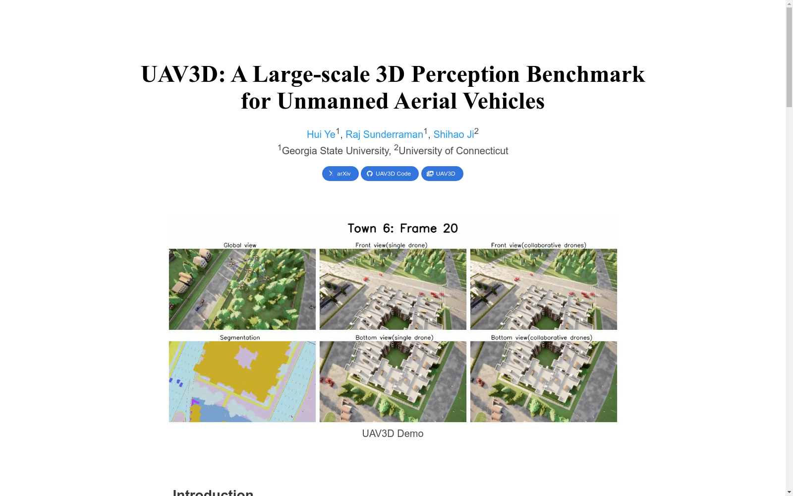
- 1UAV3D: A Large-scale 3D Perception Benchmark for Unmanned Aerial Vehicles佐治亚州立大学 · 2024年


