2021年南海北部漂流浮标观测数据集
收藏国家地球系统科学数据中心2025-01-03 更新2024-05-21 收录
下载链接:
https://www.geodata.cn/data/datadetails.html?dataguid=39099061696594&docId=1892
下载链接
链接失效反馈官方服务:
资源简介:
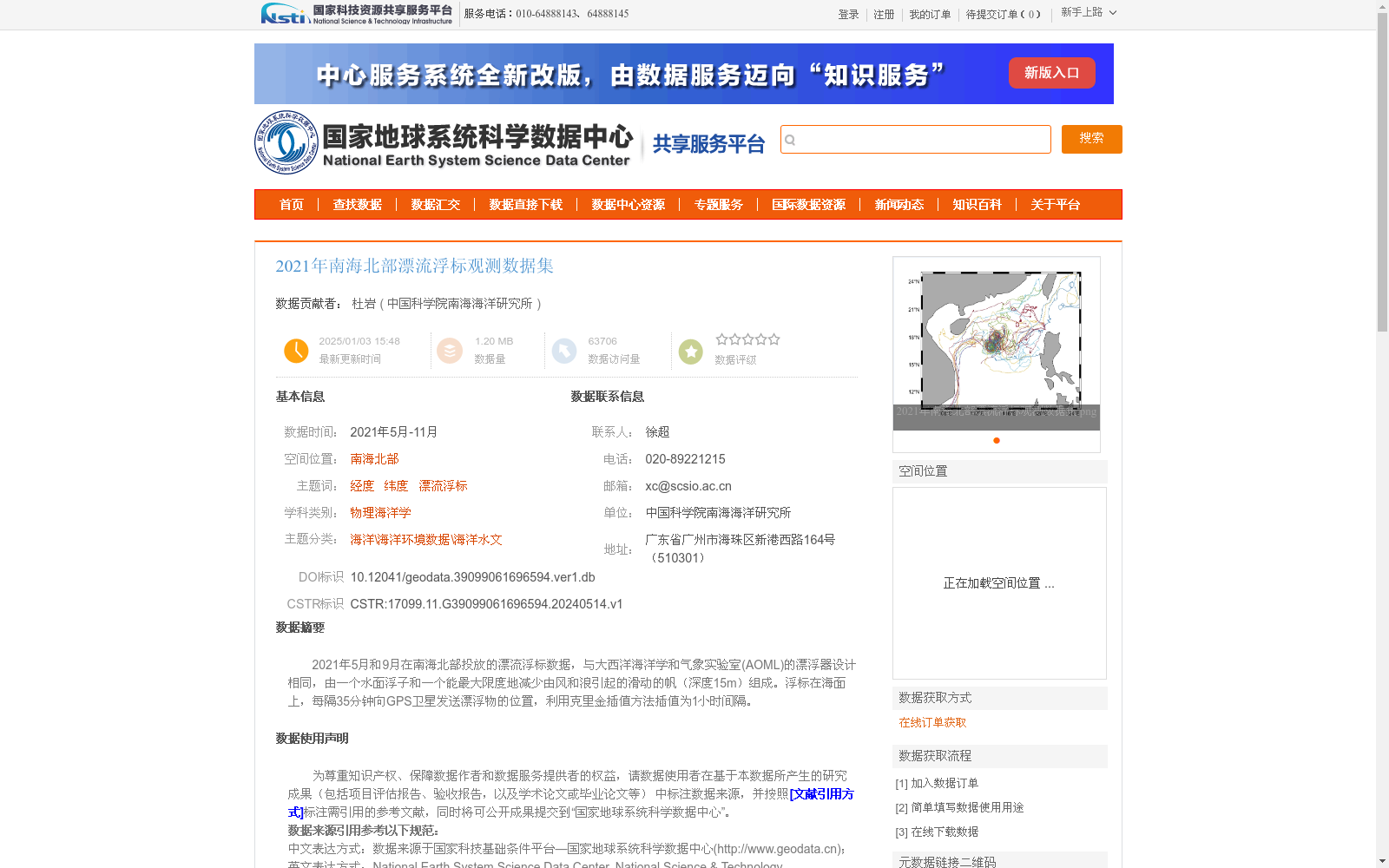
2021年5月和9月在南海北部投放的漂流浮标数据,与大西洋海洋学和气象实验室(AOML)的漂浮器设计相同,由一个水面浮子和一个能最大限度地减少由风和浪引起的滑动的帆(深度15m)组成。浮标在海面上,每隔35分钟向GPS卫星发送漂浮物的位置,利用克里金插值方法插值为1小时间隔。
The drifting buoy data was deployed in the northern South China Sea during May and September 2021. These buoys adopt the same design as the drifters developed by the Atlantic Oceanographic and Meteorological Laboratory (AOML), which consists of a surface float and a sail (set at a depth of 15 meters) that minimizes sliding caused by wind and wave actions. The buoys stay on the sea surface and transmit the drifter positions to GPS satellites every 35 minutes. The original observation data is interpolated to a 1-hour interval using the Kriging interpolation method.
提供机构:
中国科学院南海海洋研究所
创建时间:
2024-05-14
搜集汇总
数据集介绍
背景与挑战
背景概述
该数据集是2021年5月至11月在南海北部通过漂流浮标观测获取的海洋水文数据,浮标设计基于AOML标准,由水面浮子和深度15米的帆组成,以减少风浪影响。数据原始采集间隔为35分钟,经克里金插值方法处理为1小时间隔,适用于物理海洋学研究,重点关注经度、纬度等位置信息。
以上内容由遇见数据集搜集并总结生成


