青藏高原土壤可蚀性因子数据(2015-2024)
收藏国家青藏高原科学数据中心2024-02-29 更新2024-05-01 收录
下载链接:
https://data.tpdc.ac.cn/zh-hans/data/637949c5-e399-4218-945c-6bfbbaee65eb
下载链接
链接失效反馈官方服务:
资源简介:
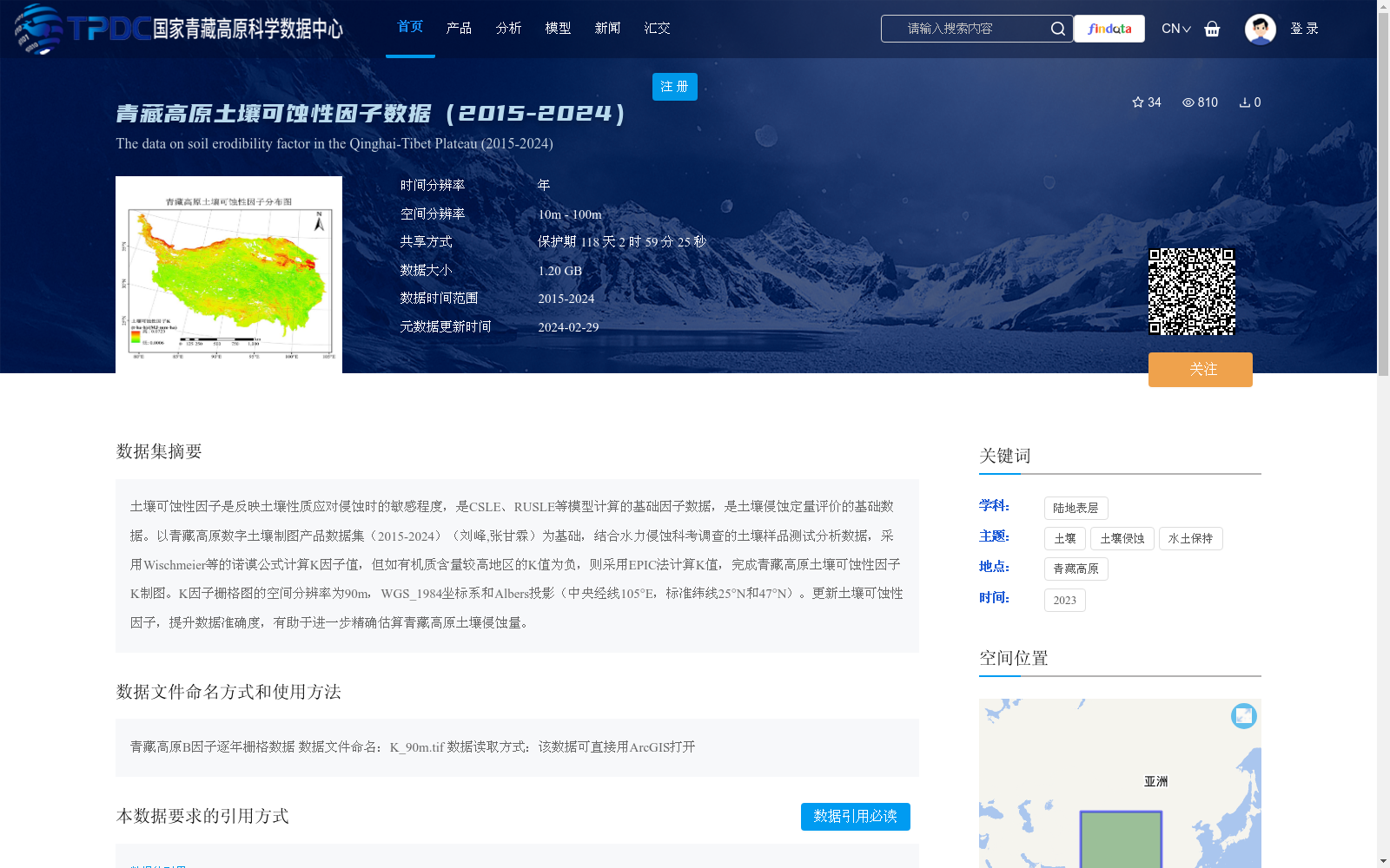
土壤可蚀性因子是反映土壤性质应对侵蚀时的敏感程度,是CSLE、RUSLE等模型计算的基础因子数据,是土壤侵蚀定量评价的基础数据。以青藏高原数字土壤制图产品数据集(2015-2024)(刘峰,张甘霖)为基础,结合水力侵蚀科考调查的土壤样品测试分析数据,采用Wischmeier等的诺谟公式计算K因子值,但如有机质含量较高地区的K值为负,则采用EPIC法计算K值,完成青藏高原土壤可蚀性因子K制图。K因子栅格图的空间分辨率为90m,WGS_1984坐标系和Albers投影(中央经线105°E,标准纬线25°N和47°N)。更新土壤可蚀性因子,提升数据准确度,有助于进一步精确估算青藏高原土壤侵蚀量。
Soil erodibility factor reflects the sensitivity of soil properties to erosion, serving as a fundamental computational factor for models including CSLE and RUSLE, as well as basic data for quantitative soil erosion assessment. Based on the 2015–2024 digital soil mapping product dataset of the Qinghai-Tibet Plateau (Liu Feng, Zhang Ganlin), combined with soil sample test and analysis data obtained from water erosion scientific investigations, the K factor values were first calculated using the nomogram formula proposed by Wischmeier et al. For regions with high organic matter content where the K value derived from this formula is negative, however, the EPIC method was employed to compute the K factor, ultimately completing the mapping of soil erodibility factor K across the Qinghai-Tibet Plateau. The resulting K factor raster map has a spatial resolution of 90 m, adopting the WGS_1984 coordinate system and Albers projection (central meridian: 105°E, standard parallels: 25°N and 47°N). Updating the soil erodibility factor and enhancing data accuracy will facilitate more accurate estimation of soil erosion volume on the Qinghai-Tibet Plateau.
提供机构:
章文波
创建时间:
2024-01-16
搜集汇总
数据集介绍
背景与挑战
背景概述
该数据集提供了2015年至2024年青藏高原土壤可蚀性因子(K因子)的栅格数据,空间分辨率为90米,采用WGS_1984坐标系和Albers投影。数据基于数字土壤制图和科考调查数据,通过诺谟公式和EPIC法计算生成,用于支持CSLE、RUSLE等土壤侵蚀模型的定量评价,有助于精确估算青藏高原土壤侵蚀量。数据集大小为1.20 GB,时间分辨率为年,共享方式为保护期共享。
以上内容由遇见数据集搜集并总结生成


