三极MODIS土地利用数据(2010年)
收藏地球大数据科学工程2024-03-04 收录
下载链接:
https://data.casearth.cn/sdo/detail/636e17ec819aec5df66b51f3
下载链接
链接失效反馈官方服务:
资源简介:
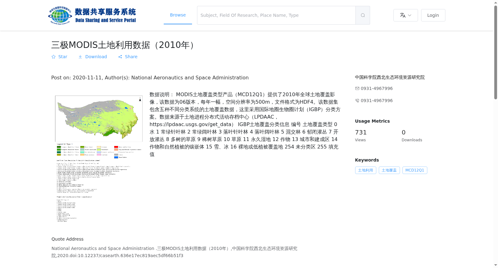
数据说明:
MODIS土地覆盖类型产品(MCD12Q1)提供了2010年全球土地覆盖影像,该数据为06版本,每年一幅,空间分辨率为500m,文件格式为HDF4。该数据集包含五种不同分类系统的土地覆盖数据,这里采用国际地圈生物圈计划(IGBP)分类方案。数据来源于土地进程分布式活动存档中心(LPDAAC,https://lpdaac.usgs.gov/get_data)
IGBP土地覆盖分类信息
编号 土地覆盖类型
0 水
1 常绿针叶林
2 常绿阔叶林
3 落叶针叶林
4 落叶阔叶林
5 混交林
6 郁闭灌丛
7 开放灌丛
8 多树的草原
9 稀树草原
10 草原
11 永久湿地
12 作物
13 城市和建成区
14 作物和自然植被的镶嵌体
15 雪、冰
16 裸地或低植被覆盖地
254 未分类区
255 填充值
Data Description: MODIS Land Cover Type Product (MCD12Q1) provides global land cover imagery for the year 2010. This is Version 06 of the dataset, with one image released annually, a spatial resolution of 500 meters, and the file format is HDF4. This dataset contains land cover data from five different classification systems, and the International Geosphere-Biosphere Programme (IGBP) classification scheme is adopted here. The data is sourced from the Land Processes Distributed Active Archive Center (LPDAAC, https://lpdaac.usgs.gov/get_data).
IGBP Land Cover Classification Information:
| ID | Land Cover Type |
|---|---|
| 0 | Water |
| 1 | Evergreen Needleleaf Forest |
| 2 | Evergreen Broadleaf Forest |
| 3 | Deciduous Needleleaf Forest |
| 4 | Deciduous Broadleaf Forest |
| 5 | Mixed Forests |
| 6 | Closed Shrublands |
| 7 | Open Shrublands |
| 8 | Woody Savannas |
| 9 | Savannas |
| 10 | Grasslands |
| 11 | Permanent Wetlands |
| 12 | Croplands |
| 13 | Urban and Built-Up |
| 14 | Cropland and Natural Vegetation Mosaics |
| 15 | Snow and Ice |
| 16 | Bare Ground or Low Vegetation Cover |
| 254 | Unclassified Areas |
| 255 | Fill Value
提供机构:
中国科学院西北生态环境资源研究院
搜集汇总
数据集介绍
背景与挑战
背景概述
该数据集是2010年全球土地覆盖影像,采用IGBP分类方案,空间分辨率为500m,覆盖南极、北极和青藏高原地区,文件格式为HDF4。
以上内容由遇见数据集搜集并总结生成


