人口密度空间分布数据集(2015)
收藏地球大数据科学工程2024-03-04 收录
下载链接:
https://data.casearth.cn/sdo/detail/5feae825819aec33049b7c0a
下载链接
链接失效反馈官方服务:
资源简介:
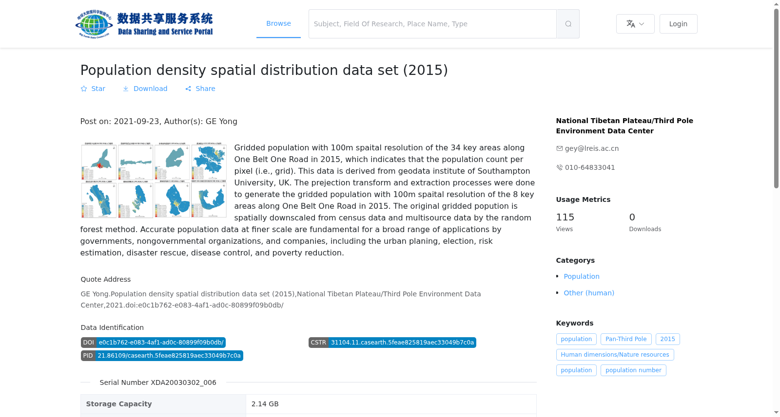
2015年百米尺度的人口格网数据,每个格网表达该范围内的人口总的数量。该数据来源于英国南安普顿大学地球数据研究所,对该数据进行投影转换、裁剪等处理加工得到“一带一路”沿线34个关键节点区域的百米尺度的人口格网数据。该数据是以行政单元的人口普查数据,通过空间尺度转换得到规则的百米尺度的人口格网数据,每个格网人口是按各行政单元人口和多源辅助数据利用随机森林方法计算得到。人口数据可用于诸多领域,包括城市规划、选举、风险评估、灾害救援、疾病防控、减贫扶贫等。注:该数据仅为初始数据,后续将结合人口普查、建筑物以及GIS遥感等数据进一步加工处理得到更加精确的人口格网数据。
The 2015 100-meter-scale population grid dataset, where each grid cell denotes the total population within its geographic coverage. This dataset originates from the GeoData Institute of the University of Southampton, United Kingdom. Following processing procedures including projection transformation and clipping, the 100-meter-scale population grid dataset for 34 key node regions along the Belt and Road Initiative is derived from the original data. This dataset is generated via spatial disaggregation of census population data of administrative units into regular 100-meter-scale grid cells. The population count of each grid cell is calculated using the random forest algorithm based on the population of each corresponding administrative unit and multi-source auxiliary data. This population dataset has broad applications in various fields, such as urban planning, electoral affairs, risk assessment, disaster relief, disease prevention and control, and poverty alleviation. Note: This is only the initial dataset. Further processing will be conducted in the future by integrating census data, building data, GIS remote sensing data and other relevant datasets to produce more accurate population grid data.
提供机构:
国家青藏高原科学数据中心
搜集汇总
数据集介绍
背景与挑战
背景概述
该数据集是2015年“一带一路”沿线34个关键区域的100米空间分辨率人口密度栅格数据,基于英国南安普顿大学的地理数据,通过随机森林方法从人口普查和多源数据降尺度生成。它提供每像素的人口数量,适用于城市规划、灾害救援和疾病控制等应用,数据格式为GeoTiff,覆盖广泛的地理范围。
以上内容由遇见数据集搜集并总结生成


