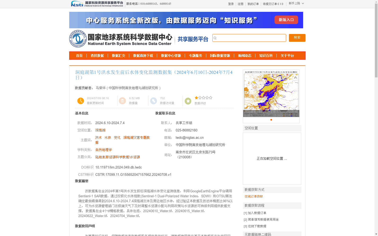
洞庭湖第1号洪水发生前后水体变化监测数据集(2024年6月10日-2024年7月4日)
收藏国家地球系统科学数据中心2024-07-09 更新2024-07-13 收录
下载链接:
https://www.geodata.cn/data/datadetails.html?dataguid=155652047157662&docId=2994
下载链接
链接失效反馈官方服务:
资源简介:
该数据集包含2024年第1号洪水发生前后洞庭湖水体变化监测信息,利用GoogleEarthEngine平台调用Sentienl-1 SAR数据,通过双极化水体指数(Sentinel-1 Dual-Polarized Water Index,SDWI)和OTSU算法确定最佳阈值得到2024.6.10-2024.7.4洞庭湖主体及周边地区水体,经过验证本数据及的总体精度达96%以上,可为水资源管理部门在极端天气下及时调整水资源分配与利用政策与水资源的可持续利用提供数据支撑。
数据集包含4个tif栅格数据。具体包括,20240610_Water.tif,20240615_Water.tif,
20240622_Water.tif,20240704_Water.tif。
This dataset contains monitoring information on water body changes in and around Dongting Lake before and after the 2024 No.1 Flood event. Sentinel-1 SAR data retrieved via the Google Earth Engine platform were used to extract water bodies in the main body and surrounding areas of Dongting Lake from June 10, 2024 to July 4, 2024, with the Sentinel-1 Dual-Polarized Water Index (SDWI) and Otsu's algorithm applied to determine the optimal threshold. After validation, the overall accuracy of this dataset exceeds 96%. This dataset can provide data support for water resource management authorities to timely adjust water resource allocation and utilization policies and facilitate the sustainable utilization of water resources under extreme weather conditions. The dataset includes 4 TIFF raster files, specifically 20240610_Water.tif, 20240615_Water.tif, 20240622_Water.tif, and 20240704_Water.tif.
提供机构:
中国科学院南京地理与湖泊研究所
创建时间:
2024-07-08
搜集汇总
数据集介绍
背景与挑战
背景概述
该数据集监测了2024年洞庭湖第1号洪水发生前后(6月10日至7月4日)的水体变化情况,利用Sentinel-1 SAR数据和双极化水体指数(SDWI)结合OTSU算法提取水体信息,总体精度超过96%,包含4个TIFF格式的栅格数据文件。数据集旨在为水资源管理部门在极端天气下调整水资源政策提供高精度数据支撑,属于自然地理学和水资源科学领域。
以上内容由遇见数据集搜集并总结生成


