沱沱河源区植被类型图
收藏国家青藏高原科学数据中心2022-04-15 更新2024-03-01 收录
下载链接:
https://data.tpdc.ac.cn/zh-hans/data/1f4b39b8-6e92-4f72-ba66-cfa8b5be379f
下载链接
链接失效反馈官方服务:
资源简介:
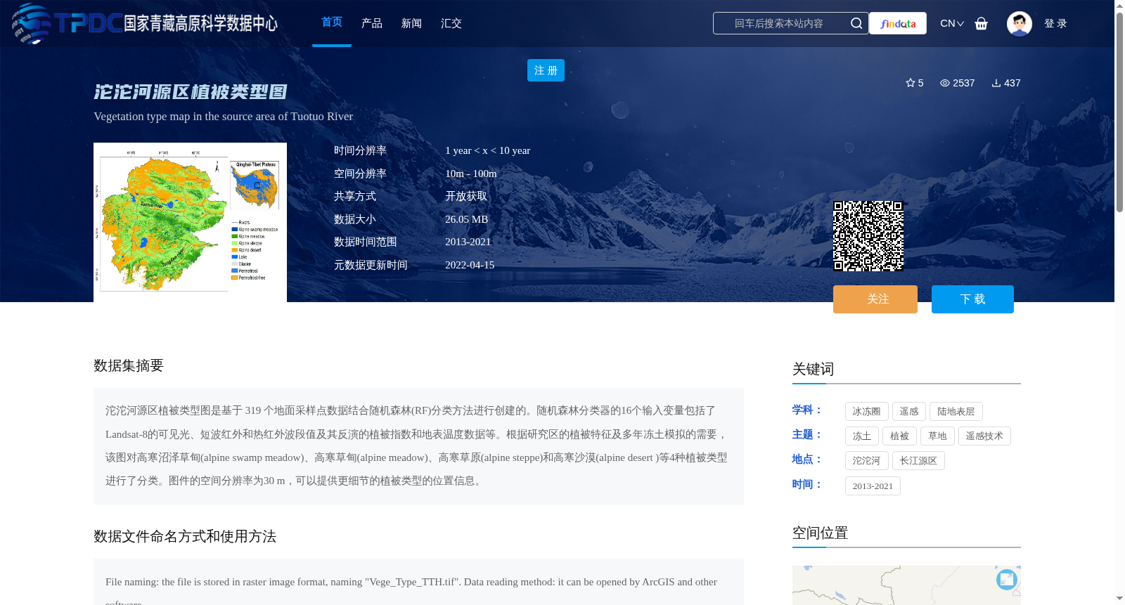
沱沱河源区植被类型图是基于 319 个地面采样点数据结合随机森林(RF)分类方法进行创建的。随机森林分类器的16个输入变量包括了Landsat-8的可见光、短波红外和热红外波段值及其反演的植被指数和地表温度数据等。根据研究区的植被特征及多年冻土模拟的需要,该图对高寒沼泽草甸(alpine swamp meadow)、高寒草甸(alpine meadow)、高寒草原(alpine steppe)和高寒沙漠(alpine desert )等4种植被类型进行了分类。图件的空间分辨率为30 m,可以提供更细节的植被类型的位置信息。
The vegetation type map of the Tuotuo River Source Region was developed using 319 ground sampling point datasets combined with the Random Forest (RF) classification method. The 16 input variables of the Random Forest classifier include the visible, shortwave infrared, and thermal infrared band values of Landsat-8, as well as retrieved vegetation indices and surface temperature data. Based on the vegetation characteristics of the study area and the requirements of permafrost simulation, this map classifies four vegetation types: alpine swamp meadow, alpine meadow, alpine steppe, and alpine desert. The spatial resolution of the map is 30 m, which can provide more detailed location information for each vegetation type.
提供机构:
邹德富,赵林,刘广岳,杜二计,胡国杰,李智斌,吴通华,吴晓东,陈杰
创建时间:
2022-01-05
搜集汇总
数据集介绍
背景与挑战
背景概述
沱沱河源区植被类型图是基于319个地面采样点和随机森林分类方法创建的30米分辨率植被分类图,包含高寒沼泽草甸、高寒草甸、高寒草原和高寒沙漠4种植被类型,数据时间跨度为2013-2021年。
以上内容由遇见数据集搜集并总结生成


