截止到2019年全球世界文化遗产自然病害风险评价专题图(灾害类型、影响强度)
收藏地球大数据科学工程2024-05-01 收录
下载链接:
https://data.casearth.cn/sdo/detail/6538ae93819aec0f261a7f1e
下载链接
链接失效反馈官方服务:
资源简介:
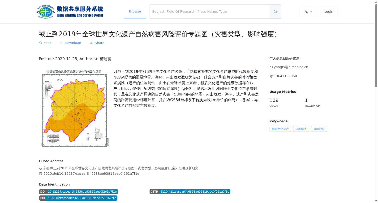
以截止到2019年7月的世界文化遗产名录,手动检索补充的文化遗产形成时代数据集和NOAA提供的重要地震、海啸、火山喷发数据为基础,结合遗产和自然灾害的时间和位置属性(遗产的位置属性,由于在全球尺度上来看,很多文化遗产的处级数据存在缺失,因此,仅使用项级数据的位置属性)做分析,筛选出发生时间晚于文化遗产形成时代,且在文化遗产周边的自然灾害(500km内的地震、火山喷发、海啸。遗产和灾害之间的距离使用经纬度计算,并在WGS84坐标系下转换为以km单位的距离),形成世界文化遗产自然灾害数据集。
Based on the World Cultural Heritage List as of July 2019, the manually curated dataset of formation periods for cultural heritage sites, and the dataset of significant earthquakes, tsunamis and volcanic eruptions provided by NOAA, this work develops the World Cultural Heritage Natural Disaster Dataset by first conducting analysis using the temporal and spatial attributes of both cultural heritage sites and natural disasters. Regarding the spatial attributes of cultural heritage sites: due to the lack of administrative-level location data for many cultural heritage sites at the global scale, only item-level spatial attributes are adopted. Subsequently, natural disasters including earthquakes, volcanic eruptions and tsunamis that occurred after the formation period of the corresponding cultural heritage site and are within a 500-kilometer radius of the site are screened out. The distance between a heritage site and a disaster event is calculated via longitude and latitude coordinates, and converted to kilometers under the WGS84 coordinate system.
提供机构:
空天信息创新研究院
搜集汇总
数据集介绍
背景与挑战
背景概述
该数据集提供了截止到2019年全球世界文化遗产的自然病害风险评价专题图,包括灾害类型和影响强度。数据来源于世界文化遗产名录和NOAA的自然灾害数据,通过分析遗产和灾害的时间和位置属性,筛选出500km范围内的自然灾害,为文化遗产保护提供科学依据。
以上内容由遇见数据集搜集并总结生成


