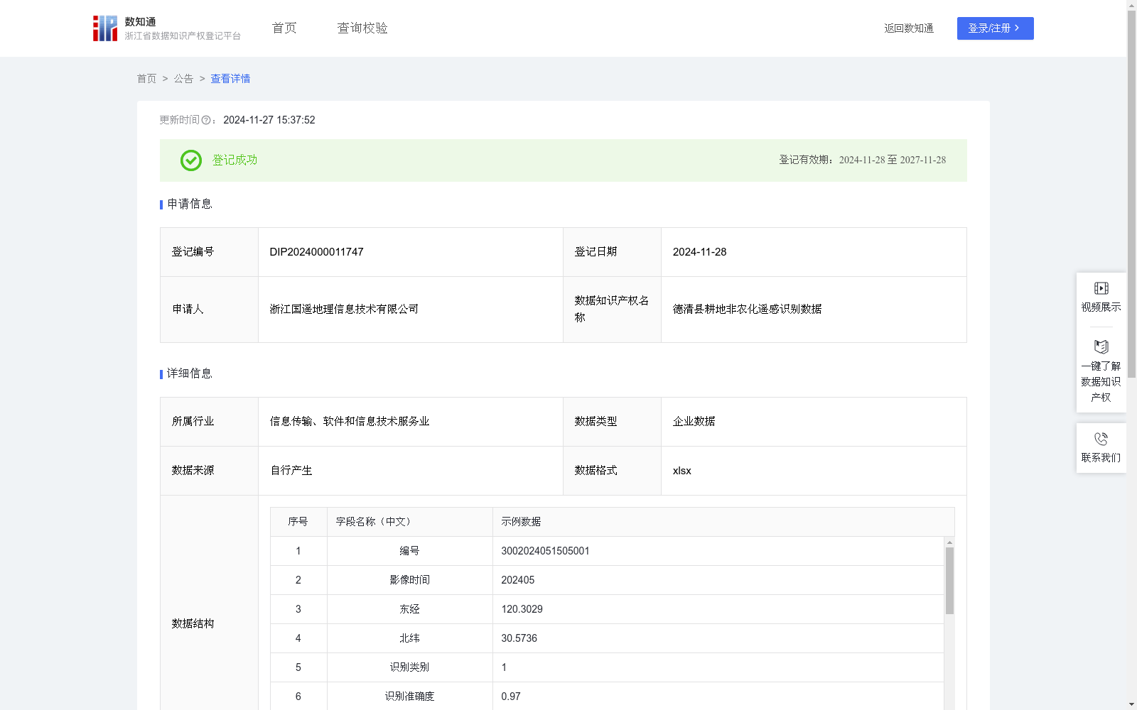
德清县耕地非农化遥感识别数据
收藏资源简介:
用于识别德清县耕地非农化区域,精准获取位置信息,并对非农食作物的种植情况进行分类。是分析管理和监控耕地土地利用类型变化的基础,为识别耕地转变为非农化地块的情况提供高效的发现手段与精准的识别途径。系统能够进行异常数据报警,结合历史监测数据对耕地非农化趋势进行预判,以便于精准掌握耕地的变化状况,有效预防和控制耕地资源的非法流失。利用无人机航拍技术采集的德清县耕地非农化遥感影像数据,通过YOLO算法实现实时目标检测。首先将神经网络应用于2024年5月整幅遥感影像,将其划分为固定大小的网格单元,每个单元神经网络负责预测K个类别。通过预测每个区域的概率,选取所有单元格中概率最大的类别,并将其分配给相应的网格单元。根据预测概率生成加权边界框,进行非极大值抑制(NMS)运算,以消除多余的锚点。算法会识别出概率次高的边界框,并重复相同的处理过程,直到所有不同的边界框均被筛选出来。对识别准确度进行验证,越接近1 说明越准确,算法输出识别结果大于0.6的要素并视为识别正确,并纳入到非农化识别地块中,若识别准确度小于0.6,则视为识别错误,排除到非农化识别地块之外。算法将识别正确的地块结合样本库一一对应至大棚或其他种类,得到非农化识别种类。系统将自动获取问题点位的坐标并展示,默认为东经、北纬。根据耕地非农化地块在当前识别框中的相对位置(x1,y1),(x2,y2),(x3,y3),(x4,y4),通过四个角标位置计算相对面积area,再结合遥感影像的分辨率和比例尺计算实际面积(平方米)。最后将影像中的特征区域及其坐标等信息上传至数字农田平台,从而实现对耕地非粮化遥感监测识别数据的获取。
This dataset is used to identify non-agriculturalization areas of cultivated land in Deqing County, accurately obtain location information, and classify the planting status of non-grain crops. It serves as the foundation for analyzing, managing, and monitoring changes in land use types of cultivated land, and provides efficient discovery methods and accurate identification approaches for detecting cultivated land converted into non-agricultural plots. The corresponding system can trigger abnormal data alarms, and predict the trend of cultivated land non-agriculturalization by combining historical monitoring data, so as to accurately grasp the changes of cultivated land and effectively prevent and control the illegal loss of cultivated land resources. Real-time object detection is implemented using the YOLO algorithm on remote sensing imagery data of cultivated land non-agriculturalization in Deqing County collected via unmanned aerial vehicle (UAV) aerial photography technology. First, the neural network is applied to the entire remote sensing image from May 2024, which is divided into grid cells of fixed size, and each cell is responsible for predicting K categories via the neural network. By predicting the probability of each region, the category with the highest probability among all grid cells is selected and assigned to the corresponding grid cell. Weighted bounding boxes are generated based on the predicted probabilities, and Non-Maximum Suppression (NMS) operation is performed to eliminate redundant anchor boxes. The algorithm will identify the bounding box with the second-highest probability, and repeat the same processing procedure until all distinct bounding boxes are screened out. Recognition accuracy is verified: the closer the value is to 1, the more accurate the recognition result is. Elements with recognition results greater than 0.6 output by the algorithm are considered correctly identified and included in the non-agriculturalization identified plots; if the recognition accuracy is less than 0.6, it is regarded as incorrect recognition and excluded from the non-agriculturalization identified plots. The algorithm maps the correctly identified plots to either greenhouses or other categories one-to-one in combination with the sample database, thus obtaining the non-agriculturalization identification categories. The system will automatically obtain and display the coordinates of the problematic points, which default to east longitude and north latitude. According to the relative positions (x1,y1), (x2,y2), (x3,y3), (x4,y4) of the cultivated land non-agriculturalization plots in the current recognition bounding box, the relative area is calculated based on the four corner positions, and then the actual area (in square meters) is calculated combined with the resolution and scale of the remote sensing image. Finally, information such as the feature regions in the image and their coordinates is uploaded to the Digital Farmland Platform, thereby realizing the acquisition of remote sensing monitoring and identification data for non-grain cultivation of cultivated land.