2009-2012年南海海洋科学断面考察CTD温盐观测图集
收藏南海海洋数据中心2024-03-01 收录
下载链接:
https://data.scsio.ac.cn/metaData-detail/1626127297729187840
下载链接
链接失效反馈官方服务:
资源简介:
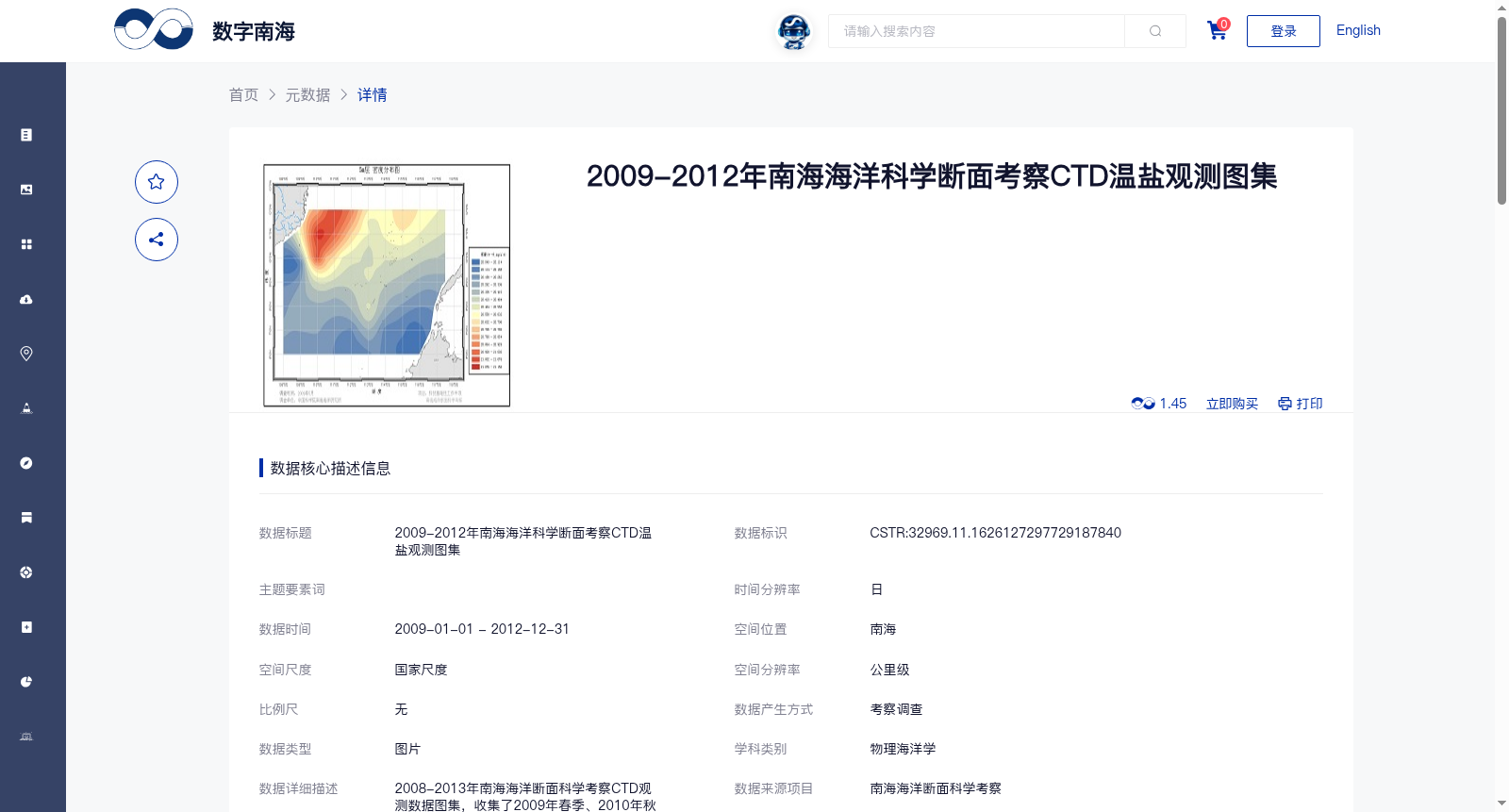
2008-2013年南海海洋断面科学考察CTD观测数据图集,收集了2009年春季、2010年秋季、2011年冬季和2012年夏季共四个调查航次的CTD在18°N、10°N、6°N及113°E子午向四条断面共75个站位的观测数据,1.按断面绘画温度、盐度、密度、声速等断面垂向分布图,图样有200m、1550m规格。2.在6~11°N,108.5~117.5°E范围,绘画不同深度的温度、盐度、密度、声速要素平面分布图。使用ArcGIS地理信息系统画图。
Atlas of CTD Observation Data from South China Sea Scientific Cruise Sections (2008–2013)
This dataset compiles CTD observation data collected at 75 stations across four meridional sections at 18°N, 10°N, 6°N and 113°E, from four survey cruises: spring 2009, autumn 2010, winter 2011 and summer 2012.
1. Generate vertical sectional distribution maps of hydrographic variables including temperature, salinity, density, sound velocity, etc., with two map specifications corresponding to 200 m and 1550 m water depth ranges per section.
2. Generate planar distribution maps of the aforementioned hydrographic variables at different water depths within the region of 6–11°N and 108.5–117.5°E.
All mapping work was completed using the ArcGIS geographic information system.
提供机构:
中国科学院南海海洋研究所
搜集汇总
数据集介绍
背景与挑战
背景概述
该数据集包含2009-2012年南海四条断面75个站位的CTD温盐观测数据,以断面垂向分布图和平面分布图形式展示温度、盐度、密度和声速等要素,数据经过质量控制并使用ArcGIS绘制。
以上内容由遇见数据集搜集并总结生成


