1979-1985年第二次全国县级土地利用概查数据西部地区土地利用现状概况(分县)统计表
收藏国家林业和草原科学数据中心2004-02-23 更新2024-03-06 收录
下载链接:
https://www.forestdata.cn/dataDetail.html?id=CSTR:17575.11.0120020909128.000002.V1
下载链接
链接失效反馈官方服务:
资源简介:
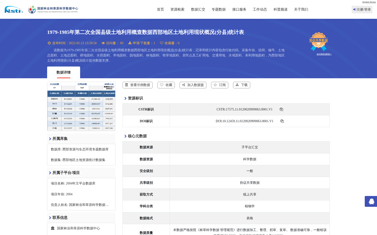
该数据为1979-1985年第二次全国县级土地利用概查数据西部地区土地利用现状概况(分县)统计表,记录和统计内容包含行政代码、采集年份、说明、编号、土地总面积、土地总面积、耕地面积、水田面积、旱地面积、园地面积、林地面积、牧草地面积、居民点及工矿用地、交通用地、水域面积、未利用地面积,为西部地区土地利用现状(分县)概况统计提供数据支撑。
This dataset comprises county-level statistical tables of general current land use status in the western regions of China, compiled from the Second National General County-level Land Use Survey conducted between 1979 and 1985. The recorded and statistically covered fields include administrative code, survey year, notes, serial number, total land area, total land area, arable land area, paddy field area, dry land area, garden plot area, forest land area, grassland area, residential and industrial land, transportation land, water area, and unused land area. This dataset provides data support for county-level general statistics of current land use status in the western regions of China.
提供机构:
国家林业和草原科学数据中心
创建时间:
2004-02-23
搜集汇总
数据集介绍
背景与挑战
背景概述
该数据集为1979-1985年第二次全国县级土地利用概查的统计表,聚焦西部地区,以分县为单位记录了土地利用现状概况,包括耕地、林地、水域等各类土地面积数据。这些数据旨在为西部地区土地利用现状的统计分析提供支撑,基于规范化录入和加工方法确保数据质量。
以上内容由遇见数据集搜集并总结生成


