青藏工程走廊地表温度数据(2010-2018)
收藏国家青藏高原科学数据中心2022-09-25 更新2024-03-06 收录
下载链接:
https://data.tpdc.ac.cn/zh-hans/data/c1113dbe-d5b3-43e9-8579-347a78c613e5
下载链接
链接失效反馈官方服务:
资源简介:
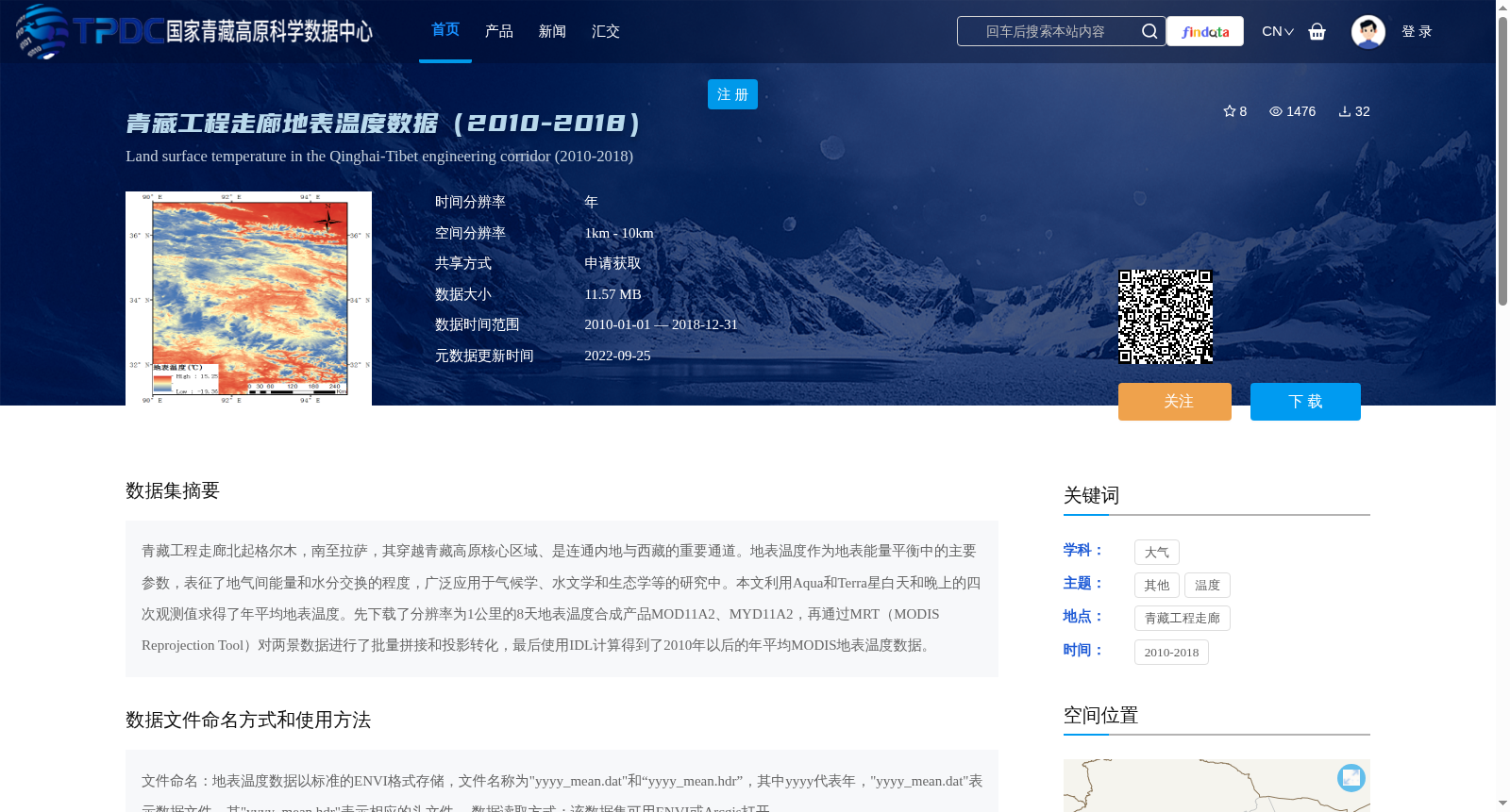
青藏工程走廊北起格尔木,南至拉萨,其穿越青藏高原核心区域、是连通内地与西藏的重要通道。地表温度作为地表能量平衡中的主要参数,表征了地气间能量和水分交换的程度,广泛应用于气候学、水文学和生态学等的研究中。本文利用Aqua和Terra星白天和晚上的四次观测值求得了年平均地表温度。先下载了分辨率为1公里的8天地表温度合成产品MOD11A2、MYD11A2,再通过MRT(MODIS Reprojection Tool)对两景数据进行了批量拼接和投影转化,最后使用IDL计算得到了2010年以后的年平均MODIS地表温度数据。
The Qinghai-Tibet Engineering Corridor stretches from Golmud in the north to Lhasa in the south, traversing the core area of the Qinghai-Tibet Plateau and serving as a critical passage connecting inland China and the Tibet Autonomous Region. Land surface temperature (LST), a key parameter in surface energy balance, characterizes the degree of energy and water exchange between the land surface and the atmosphere, and is widely utilized in research domains such as climatology, hydrology, and ecology. This study derived annual average land surface temperature using four sets of daytime and nighttime observations from the Aqua and Terra satellites. First, we downloaded the 8-day composite land surface temperature products MOD11A2 and MYD11A2 with a spatial resolution of 1 km. Then, we performed batch mosaicking and projection transformation on the two scenes of data using MRT (MODIS Reprojection Tool). Finally, we calculated the annual average MODIS land surface temperature data post-2010 using IDL.
提供机构:
牛富俊
创建时间:
2022-08-28
搜集汇总
数据集介绍
背景与挑战
背景概述
该数据集提供了2010年至2018年青藏工程走廊(北起格尔木,南至拉萨)的年平均地表温度数据,空间分辨率为1km至10km,基于Aqua和Terra卫星的MOD11A2和MYD11A2产品处理生成。数据以ENVI格式存储,适用于气候学、水文学和生态学等研究领域,共享方式需申请获取。
以上内容由遇见数据集搜集并总结生成


