塔吉克斯坦滑坡易发性数据集
收藏国家青藏高原科学数据中心2025-07-15 更新2025-07-26 收录
下载链接:
https://data.tpdc.ac.cn/zh-hans/data/3e7464a5-2aeb-4502-acd7-6fc0804051d9
下载链接
链接失效反馈官方服务:
资源简介:
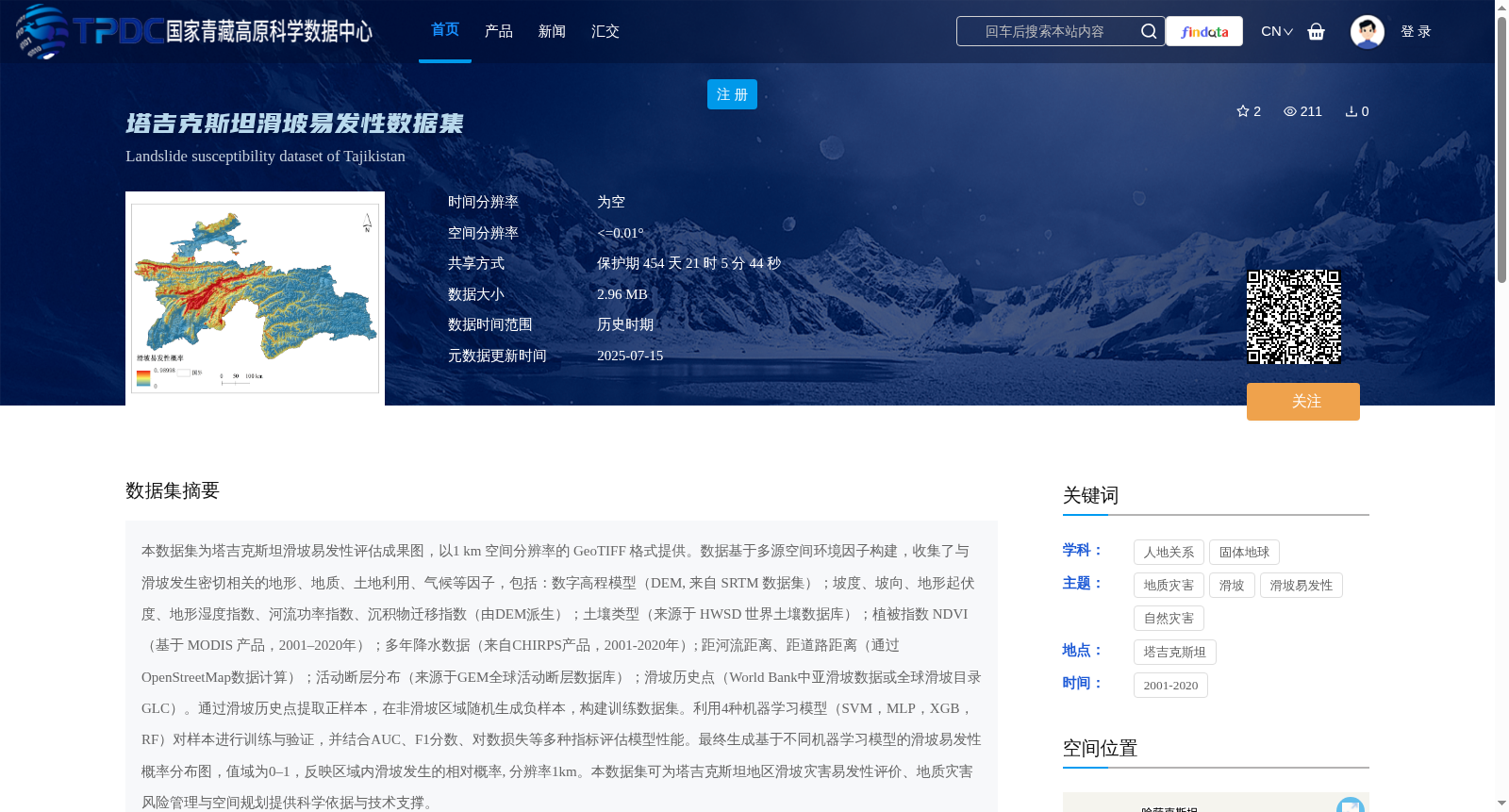
本数据集为塔吉克斯坦滑坡易发性评估成果图,以1 km 空间分辨率的 GeoTIFF 格式提供。数据基于多源空间环境因子构建,收集了与滑坡发生密切相关的地形、地质、土地利用、气候等因子,包括:数字高程模型(DEM, 来自 SRTM 数据集);坡度、坡向、地形起伏度、地形湿度指数、河流功率指数、沉积物迁移指数(由DEM派生);土壤类型(来源于 HWSD 世界土壤数据库);植被指数 NDVI(基于 MODIS 产品,2001–2020年);多年降水数据(来自CHIRPS产品,2001-2020年); 距河流距离、距道路距离(通过OpenStreetMap数据计算);活动断层分布(来源于GEM全球活动断层数据库);滑坡历史点(World Bank中亚滑坡数据或全球滑坡目录 GLC)。通过滑坡历史点提取正样本,在非滑坡区域随机生成负样本,构建训练数据集。利用4种机器学习模型(SVM,MLP,XGB,RF)对样本进行训练与验证,并结合AUC、F1分数、对数损失等多种指标评估模型性能。最终生成基于不同机器学习模型的滑坡易发性概率分布图,值域为0–1,反映区域内滑坡发生的相对概率, 分辨率1km。本数据集可为塔吉克斯坦地区滑坡灾害易发性评价、地质灾害风险管理与空间规划提供科学依据与技术支撑。
This dataset is the landslide susceptibility assessment result map for Tajikistan, provided in GeoTIFF format with a spatial resolution of 1 km. It is constructed based on multi-source spatial environmental factors, collecting factors closely related to landslide occurrence such as topography, geology, land use, and climate, including: Digital Elevation Model (DEM, sourced from the SRTM dataset); slope, aspect, topographic relief, topographic wetness index, stream power index, and sediment transport index (derived from DEM); soil type (derived from the HWSD World Soil Database); Normalized Difference Vegetation Index (NDVI, based on MODIS products, 2001–2020); multi-year precipitation data (from CHIRPS products, 2001–2020); distance to rivers and distance to roads (calculated using OpenStreetMap data); active fault distribution (from the GEM Global Active Fault Database); historical landslide points (from the World Bank Central Asia Landslide Dataset or the Global Landslide Catalog GLC). Positive samples were extracted from historical landslide points, while negative samples were randomly generated in non-landslide areas to construct the training dataset. Four machine learning models (SVM, MLP, XGB, RF) were used to train and validate the samples, and model performance was evaluated using multiple metrics including AUC, F1-score, and log loss. Finally, landslide susceptibility probability distribution maps based on different machine learning models were generated, with a value range of 0–1, reflecting the relative probability of landslide occurrence in the region, with a spatial resolution of 1 km. This dataset can provide scientific basis and technical support for landslide disaster susceptibility assessment, geological disaster risk management and spatial planning in Tajikistan.
提供机构:
程传美,郭浩,贾佳,伍永秋
创建时间:
2025-07-10
搜集汇总
数据集介绍
背景与挑战
背景概述
该数据集是塔吉克斯坦滑坡易发性评估成果图,以1 km空间分辨率的GeoTIFF格式提供,基于多源空间环境因子构建,并使用4种机器学习模型生成滑坡易发性概率分布图。数据集为塔吉克斯坦地区滑坡灾害易发性评价和风险管理提供科学依据。
以上内容由遇见数据集搜集并总结生成


