High-precision aerial imagery and interpretation dataset of landslide and debris flow disaster in Sichuan and surrounding areas
收藏Mendeley Data2022-11-10 更新2024-06-27 收录
下载链接:
https://www.doi.org/10.11922/sciencedb.j00001.00222
下载链接
链接失效反馈官方服务:
资源简介:
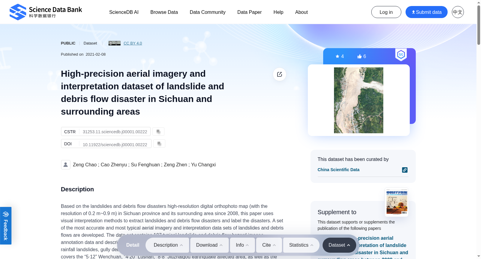
Based on the landslides and debris flow disasters high-resolution digital orthophoto map (with the resolution of 0.2 m~0.9 m) in Sichuan province and its surrounding area since 2008, this paper uses visual interpretation methods to extract landslides and debris flow disasters and label the disasters. A set of the most accurate and most typical aerial imagery and interpretation data sets of landslides and debris flows are developed. The data set contains 107 typical landslide and debris flow hazard images, annotation data and description files, involving four types of disasters, including earthquake landslides, rainfall landslides, gully debris flows and slope debris flows. The disasters selected for the data sets covers the “5·12” Wenchuan, “4·20” Lushan, “8·8” Jiuzhaigou earthquake affected area, as well as the areas along the Jinsha River and Dadu River. The quality of this data set is very good, because of high-precision image data sources, interpretation and annotations by geohazard experts, and detailed disaster information. Compared with previous relevant data sets, this data set is more valuable in terms of data source quality, data set completeness and potential applications. It can not only be used for automatic interpretation of landslides and debris flow disasters, but also for disaster distribution and risk assessment research.
本数据集以2008年以来四川省及周边区域的滑坡、泥石流灾害高分辨率数字正射影像图(Digital Orthophoto Map,分辨率0.2m~0.9m)为基础,采用目视解译方法提取滑坡与泥石流灾害体并完成标注。本研究构建了一套高精度且极具典型性的滑坡与泥石流航空影像解译数据集。该数据集包含107组典型滑坡与泥石流灾害影像、标注数据及说明文档,涵盖地震滑坡、降雨滑坡、沟谷泥石流、坡面泥石流四类灾害类型。数据集所收录的灾害覆盖“5·12”汶川地震灾区、“4·20”芦山地震灾区、“8·8”九寨沟地震灾区,以及金沙江、大渡河沿岸区域。本数据集质量优异,得益于高精度的影像数据源、地质灾害(Geohazard)领域专家完成的解译与标注工作,以及详实的灾害信息。相较于现有同类数据集,本数据集在数据源质量、数据集完整性与潜在应用价值上均更具优势。其不仅可用于滑坡与泥石流灾害的自动解译,还可支撑灾害分布与风险评估相关研究。
创建时间:
2022-02-10
搜集汇总
数据集介绍
背景与挑战
背景概述
该数据集提供了四川及周边地区2008-2020年间的高精度滑坡和泥石流灾害航空影像及解译数据,包含107个典型灾害案例,覆盖四种灾害类型,适用于灾害自动解译和风险评估研究。
以上内容由遇见数据集搜集并总结生成


