青藏高原新绘制冻土分布图(2017)
收藏国家青藏高原科学数据中心2021-04-20 更新2024-03-07 收录
下载链接:
https://data.tpdc.ac.cn/zh-hans/data/0231c972-8460-4691-a187-70e4cc356f60
下载链接
链接失效反馈官方服务:
资源简介:
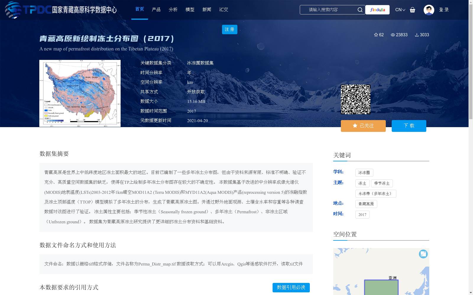
青藏高原是世界上中低纬度地区冻土面积最大的地区。目前已编制了一些多年冻土分布图,但由于资料来源有限、标准不明确、验证不充分、高质量空间数据集的缺乏,使得在TP上绘制多年冻土分布图存在较大的不确定性。
本数据集基于改进的中分辨率成像光谱仪(MODIS)地表温度(LSTs)2003-2012年1km晴空MOD11A2 (Terra MODIS)和MYD11A2(Aqua MODIS)产品(reprocessing version 5)的冻融指数及冻土顶部温度(TTOP)模型模拟了多年冻土的分布,生成了青藏高原冻土图。并通过野外地面观测、土壤含水率和容重等各种调查数据对该图进行了验证。
冻土属性主要包括:季节性冻土(Seasonally frozen ground)、多年冻土(Permafrost)、非冻土区域(Unfrozen ground)。
数据集为青藏高原冻土研究提供了更详细的冻土分布资料和基础资料。
The Tibetan Plateau (TP) boasts the largest permafrost area among all regions in the world's mid- to low-latitude zones. To date, several permafrost distribution maps have been compiled, but there remains considerable uncertainty in mapping permafrost distributions across the TP due to limited data sources, ambiguous standards, insufficient validation, and the scarcity of high-quality spatial datasets.
This dataset simulates permafrost distribution and generates a permafrost map of the Tibetan Plateau. It leverages freeze-thaw indices derived from 1 km-resolution cloud-free MOD11A2 (Terra MODIS) and MYD11A2 (Aqua MODIS) products (reprocessing version 5) of improved Moderate Resolution Imaging Spectroradiometer (MODIS) land surface temperatures (LSTs) spanning 2003 to 2012, in conjunction with the Top of Permafrost Temperature (TTOP) model. The resulting map was validated using multiple field ground observation datasets, including soil moisture content, bulk density and other survey data.
The main permafrost categories include: Seasonally frozen ground, Permafrost, and Unfrozen ground.
This dataset provides more detailed permafrost distribution data and foundational resources for permafrost research on the Tibetan Plateau.
提供机构:
赵林
创建时间:
2019-06-13
搜集汇总
数据集介绍
背景与挑战
背景概述
该数据集是2017年青藏高原的冻土分布图,基于改进的MODIS地表温度产品和冻土顶部温度模型模拟生成,并通过野外观测验证,提供了季节性冻土、多年冻土和非冻土区域的详细空间信息。数据以1km空间分辨率的栅格TIFF格式存储,适用于冰冻圈研究,支持开放获取,为青藏高原冻土研究提供了基础资料。
以上内容由遇见数据集搜集并总结生成


