青藏高原荒漠植物群落空间分布图(2018)
收藏国家青藏高原科学数据中心2025-03-13 更新2025-03-22 收录
下载链接:
https://data.tpdc.ac.cn/zh-hans/data/52453e21-3d33-4bd2-8d90-2bbff104a6b1
下载链接
链接失效反馈官方服务:
资源简介:
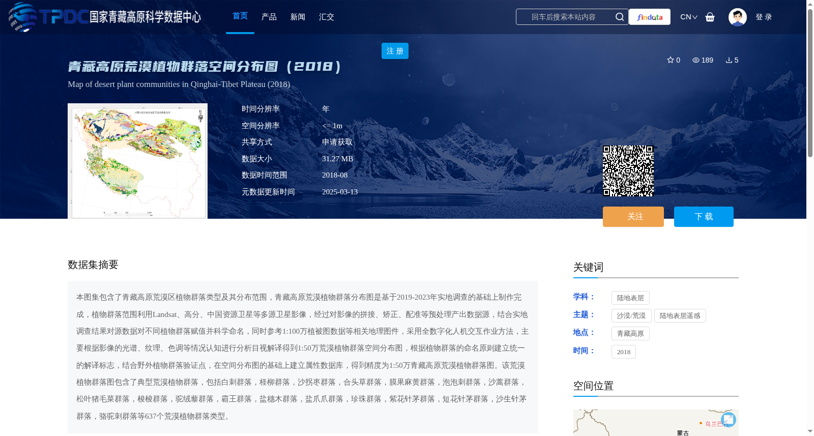
本图集包含了青藏高原荒漠区植物群落类型及其分布范围,青藏高原荒漠植物群落分布图是基于2019-2023年实地调查的基础上制作完成,植物群落范围利用Landsat、高分、中国资源卫星等多源卫星影像,经过对影像的拼接、矫正、配准等预处理产出数据源,结合实地调查结果对源数据对不同植物群落赋值并科学命名,同时参考1:100万植被图数据等相关地理图件,采用全数字化人机交互作业方法,主要根据影像的光谱、纹理、色调等情况认知进行分析目视解译得到1:50万荒漠植物群落空间分布图,根据植物群落的命名原则建立统一的解译标志,结合野外植物群落验证点,在空间分布图的基础上建立属性数据库,得到精度为1:50万青藏高原荒漠植物群落图。该荒漠植物群落图包含了典型荒漠植物群落,包括白刺群落,柽柳群落,沙拐枣群落,合头草群落,膜果麻黄群落,泡泡刺群落,沙蒿群落,松叶猪毛菜群落,梭梭群落,驼绒藜群落,霸王群落,盐穗木群落,盐爪爪群落,珍珠群落,紫花针茅群落,短花针茅群落,沙生针茅群落,骆驼刺群落等637个荒漠植物群落类型。
This atlas contains the plant community types and their distribution ranges in the desert regions of the Qinghai-Tibet Plateau. The distribution map of desert plant communities on the Qinghai-Tibet Plateau was compiled based on field surveys conducted between 2019 and 2023. The scope of plant communities was derived from multi-source satellite imagery including Landsat, Gaofen (GF) series, and China Resources Satellite series, with source data produced via preprocessing steps such as image mosaicking, correction, and registration. Combined with field survey results, the source data was used to assign values and scientifically name each plant community. Additionally, referring to relevant geographic datasets such as the 1:1,000,000-scale vegetation map, a fully digital human-computer interactive operation method was adopted. Visual interpretation was conducted primarily based on the spectral, texture, and tonal characteristics of the images, resulting in the 1:500,000-scale spatial distribution map of desert plant communities. Unified interpretation signs were established in accordance with the naming principles of plant communities. Combined with field plant community verification points, an attribute database was built on the basis of the spatial distribution map, yielding the 1:500,000-scale desert plant community map of the Qinghai-Tibet Plateau. This desert plant community map includes typical desert plant communities, including 637 desert plant community types such as Nitraria community, Tamarix community, Calligonum community, Sympegma regelii community, Ephedra przewalskii community, Nitraria sphaerocarpa community, Artemisia desertorum community, Salsola laricifolia community, Haloxylon ammodendron community, Ceratoides latens community, Zygophyllum xanthoxylum community, Halostachys caspica community, Kalidium foliatum community, Salsola passerina community, Stipa purpurea community, Stipa breviflora community, Stipa glareosa community, Alhagi sparsifolia community, and others.
提供机构:
王少昆
创建时间:
2025-02-24
搜集汇总
数据集介绍
背景与挑战
背景概述
该数据集是2018年青藏高原荒漠植物群落空间分布图,基于2019-2023年实地调查和多源卫星影像制作,采用全数字化人机交互目视解译方法,生成1:50万比例尺的图件,覆盖了包括白刺、柽柳、梭梭等在内的637个典型荒漠植物群落类型,为研究青藏高原荒漠生态系统提供高精度空间数据支持。
以上内容由遇见数据集搜集并总结生成


