中国森林地上生物量空间分布数据集(1km,2004年)
收藏国家地球系统科学数据中心2021-12-01 更新2024-03-04 收录
下载链接:
https://www.geodata.cn/data/datadetails.html?dataguid=102742076537869&docId=10594
下载链接
链接失效反馈官方服务:
资源简介:
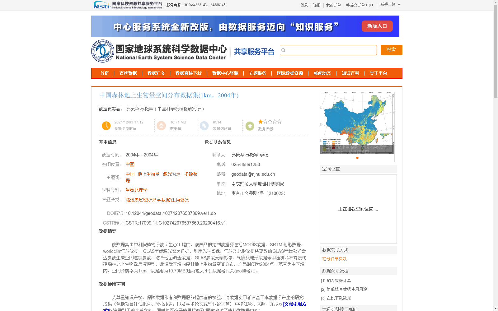
该数据集由中科院植物所数字生态组提供。该产品的绘制数据源包括MODIS数据、SRTM 地形数据、worldclim气候数据、GLAS星载激光雷达数据。利用光学影像,气候及地形数据将离散的GLAS星载激光雷达参数生成空间连续参数,结合地面调查数据,GLAS参数光学影像,气候及地形数据采用随机森林算法构建森林地上生物量反演模型,反演我国境内森林地上生物量空间分布。产品时间为2004年,范围为中国境内,空间分辨率为1km,数据集为10.70MB(压缩包大小), 数据格式为geotiff格式 。
This dataset is provided by the Digital Ecology Group of the Institute of Botany, Chinese Academy of Sciences. The data sources for generating this dataset include MODIS data, SRTM topographic data, WorldClim climatic data, and GLAS space-borne lidar data. Discrete GLAS space-borne lidar parameters were converted into spatially continuous parameters using optical imagery, climatic and topographic data. Combined with field survey data, a forest aboveground biomass inversion model was established using random forest algorithm with GLAS parameters, optical imagery, climatic and topographic data, and the spatial distribution of forest aboveground biomass within China was retrieved. The temporal coverage of this dataset is the year 2004, with a spatial coverage over the entire territory of China, a spatial resolution of 1 km, a compressed file size of 10.70 MB, and the data format is GeoTIFF.
提供机构:
中国科学院植物研究所
创建时间:
2020-04-16
搜集汇总
数据集介绍
背景与挑战
背景概述
该数据集提供了2004年中国森林地上生物量的空间分布信息,空间分辨率为1公里。它基于多源遥感数据(包括MODIS、SRTM地形、worldclim气候和GLAS星载激光雷达)和地面调查数据,采用随机森林算法反演生成,数据格式为GeoTIFF,精度较高(R²=0.75,RMSE=42.39 Mg/ha),适用于生物地理学和资源科学研究。
以上内容由遇见数据集搜集并总结生成


