中国冰冻圈资源与环境信息系统-青藏高原基础数据
收藏国家青藏高原科学数据中心2021-04-19 更新2024-03-01 收录
下载链接:
https://data.tpdc.ac.cn/zh-hans/data/2f48c20d-b9fa-4781-819b-8f004207684d
下载链接
链接失效反馈官方服务:
资源简介:
中国冰冻圈是指中国范围内,大气圈、水圈、生物圈、岩石圈的冻结部分。中国冰冻圈资源与环境信息系统是对中国冰冻圈资源与环境数据进行管理与分析的综合性信息系统。建立中国冰冻圈资源与环境信息系统一方面是满足地球系统科学的需要,为研制地理信息系统支持下的冻土、冰川以及雪盖对全球变化的响应与反馈模型提供参数与验证数据;另一方面系统整理和抢救宝贵的冰冻圈数据,为其提供一个科学、高效、安全的管理与分析工具。
中国冰冻圈资源与环境信息系统包含三个不同空间的基础数据库。其中青藏高原基础数据库主要以青藏高原为研究区域,范围在东经70—105°,北纬20—40°之间,主要包含以下类型的数据:
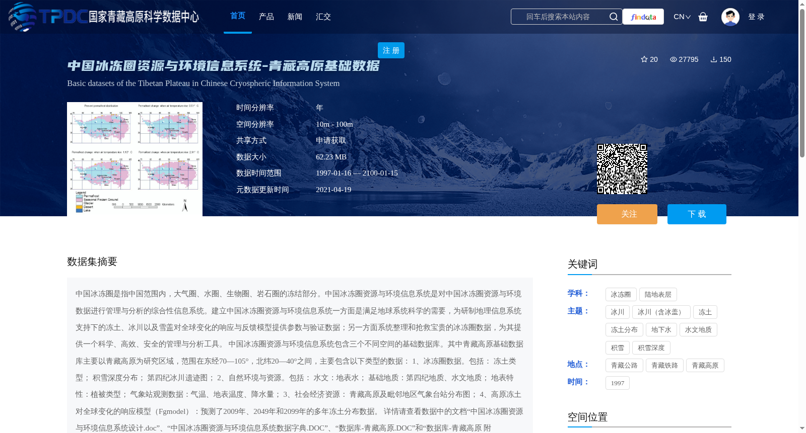
1、冰冻圈数据。包括:
冻土类型;
积雪深度分布;
第四纪冰川遗迹图;
2、自然环境与资源。包括:
水文:地表水;
基础地质:第四纪地质、水文地质;
地表特性:植被类型;
气象站观测数据:气温、地表温度、降水量;
3、社会经济资源: 青藏高原及毗邻地区气象台站分布图;
4、高原冻土对全球变化的响应模型(Fgmodel):预测了2009年、2049年和2099年的多年冻土分布数据。
详情请查看数据中的文档“中国冰冻圈资源与环境信息系统设计.doc”、“中国冰冻圈资源与环境信息系统数据字典.DOC”、“数据库-青藏高原.DOC”和“数据库-青藏高原 附表.DOC”。
The Cryosphere in China refers to the frozen components of the atmosphere, hydrosphere, biosphere, and lithosphere within the territory of China. The Cryosphere Resources and Environment Information System of China (CREISC) is a comprehensive information system for managing and analyzing cryosphere-related resources and environmental data in China. The establishment of CREISC serves two core purposes: on one hand, to support Earth System Science by providing parameters and validation data for developing response and feedback models of permafrost, glaciers, and snow cover to global change supported by Geographic Information System (GIS); on the other hand, to systematically organize and rescue valuable cryosphere data, and provide a scientific, efficient and secure management and analysis tool for such data. CREISC includes three basic spatial databases. Among them, the Qinghai-Tibet Plateau Basic Database takes the Qinghai-Tibet Plateau as its main research area, with a scope between 70°–105° east longitude and 20°–40° north latitude, and mainly includes the following types of data: 1. Cryosphere data: including permafrost type, snow depth distribution, and Quaternary glacial relics map; 2. Natural environment and resources: including hydrology: surface water; basic geology: Quaternary geology, hydrogeology; surface characteristics: vegetation types; meteorological station observation data: air temperature, surface temperature, and precipitation; 3. Socio-economic resources: distribution map of meteorological stations on the Qinghai-Tibet Plateau and its adjacent areas; 4. Plateau permafrost response model to global change (Fgmodel): permafrost distribution data predicted for the years 2009, 2049, and 2099. For more details, please refer to the following documents in the dataset: "Design of China Cryosphere Resources and Environment Information System.doc", "Data Dictionary of China Cryosphere Resources and Environment Information System.DOC", "Database - Qinghai-Tibet Plateau.DOC" and "Database - Qinghai-Tibet Plateau Appendix.DOC".
提供机构:
李新
创建时间:
2011-03-20
搜集汇总
数据集介绍
背景与挑战
背景概述
该数据集是中国冰冻圈资源与环境信息系统中的青藏高原基础数据库,覆盖东经70-105°、北纬20-40°的区域,时间范围为1997年至2100年,空间分辨率为10米至100米。它包含冰冻圈数据(如冻土类型、积雪深度)、自然环境与资源数据(如水文、地质、气象观测)以及社会经济资源数据,并集成高原冻土对全球变化的响应模型,用于预测未来多年冻土分布,是一个多学科、高分辨率的综合性基础数据集。
以上内容由遇见数据集搜集并总结生成


