横断山区1000m泥石流风险性评估图件(2024)
收藏国家青藏高原科学数据中心2025-04-15 更新2025-04-26 收录
下载链接:
https://data.tpdc.ac.cn/zh-hans/data/bfe2377d-db8c-4ef6-9265-00d89341ce94
下载链接
链接失效反馈官方服务:
资源简介:
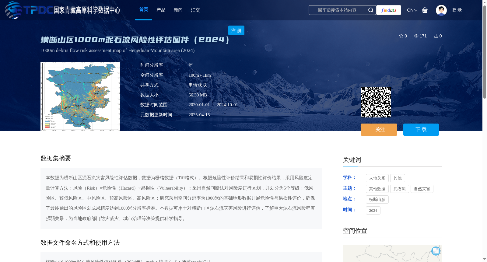
本数据为横断山区泥石流灾害风险性评估数据,数据为栅格数据(Tiff格式)。根据危险性评价结果和易损性评价结果,采用风险度定量计算方法:风险(Risk)=危险性(Hazard)×易损性(Vulnerability);采用自然间断法对风险度进行区划,并划分为5个等级:低风险区、较低风险区、中风险区、较高风险区、高风险区;研究采用空间分辨率为1000米的基础地形数据开展危险性与易损性评价,确保了最终输出的风险区划成果精度达到1000米分辨率标准。本数据可用于对横断山区泥石流灾害风险进行评估,了解重大泥石流风险程度强弱关系,为当地政府部门防灾减灾、城市治理等决策提供科学指导。
This dataset is a debris flow disaster risk assessment dataset for the Hengduan Mountains region, stored as raster data in TIFF format. Based on the results of hazard assessment and vulnerability assessment, the quantitative calculation method for risk degree is applied: Risk = Hazard × Vulnerability. The natural breaks classification method was used to zone the risk degree, which was divided into five levels: low-risk area, relatively low-risk area, medium-risk area, relatively high-risk area, and high-risk area. This study adopted basic topographic data with a spatial resolution of 1000 meters to conduct hazard and vulnerability assessments, ensuring that the accuracy of the final risk zoning product meets the 1000-meter resolution standard. This dataset can be used to assess debris flow disaster risks in the Hengduan Mountains, clarify the hierarchy of major debris flow risk degrees, and provide scientific guidance for decision-making such as disaster prevention and mitigation and urban governance by local government departments.
提供机构:
陈兴长
创建时间:
2025-01-07
搜集汇总
数据集介绍
背景与挑战
背景概述
该数据集为横断山区泥石流灾害风险性评估数据,采用栅格格式(Tiff),空间分辨率为1000米,基于危险性和易损性评价结果,通过风险度定量计算方法划分为5个风险等级。数据可用于评估泥石流灾害风险,为防灾减灾和城市治理提供科学依据。
以上内容由遇见数据集搜集并总结生成


